

Showers/Storms Forming Across Alabama
RADAR CHECK: Scattered showers and thunderstorms have formed across Alabama this afternoon… they are generally moving east/northeast.
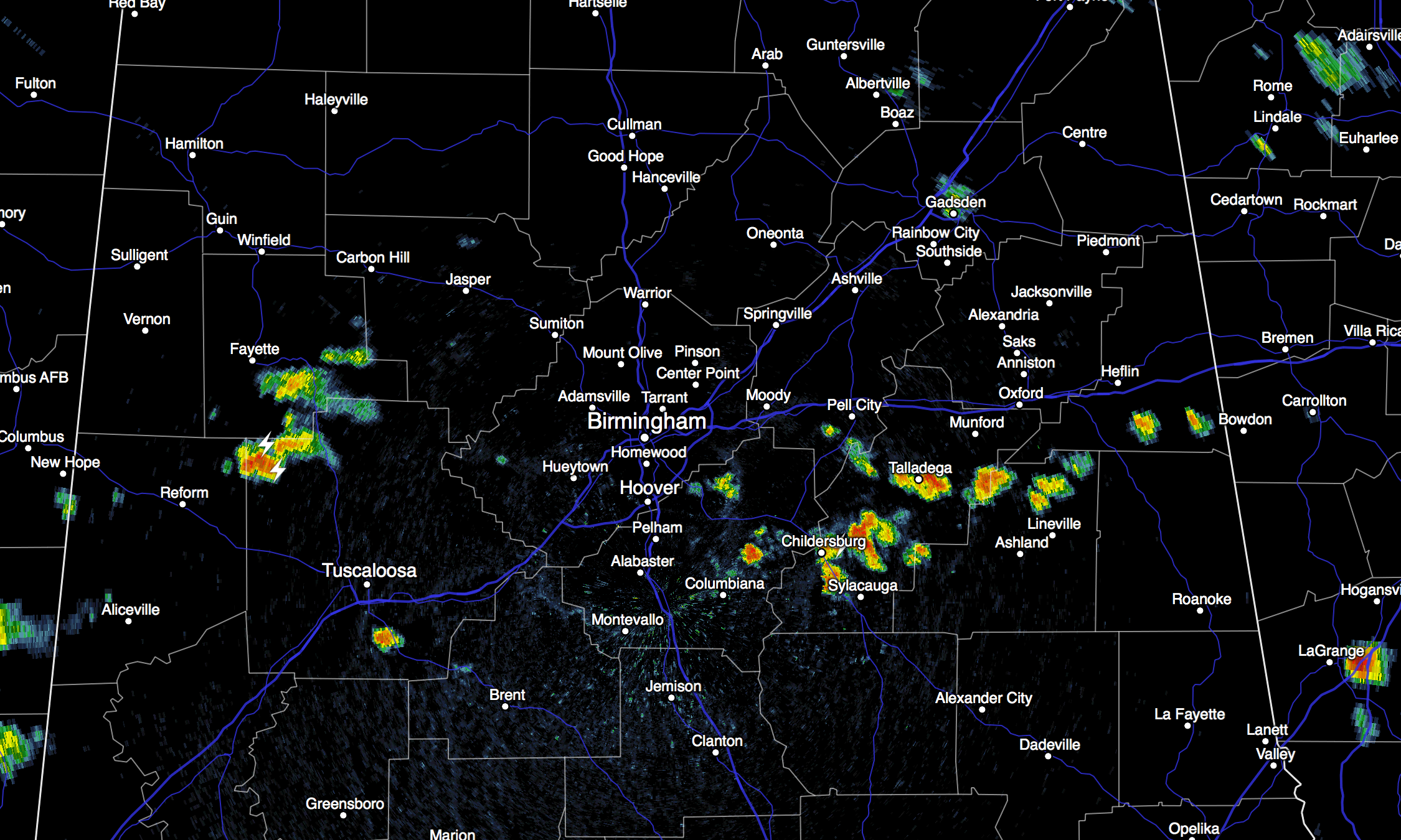
We note a band of strong to severe storms northwest of Alabama, over Arkansas, they are moving southeast. Some of these could reach Northwest Alabama tonight. With a short wave approaching, we will keep the chance of showers and storms in the forecast tonight, even into the late night hours.
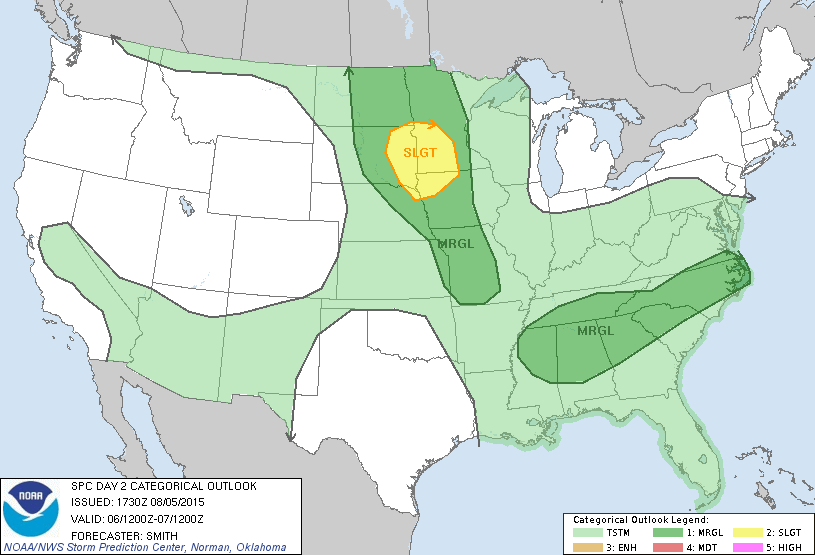
TOMORROW: This should be the wettest day of the week, with scattered to numerous showers and thunderstorms. Some of the storms could be strong, and SPC maintains a “marginal” severe weather risk for the northern half of Alabama.
The prime threat from the storms tomorrow will come from strong straight line winds. Of course, all summer storms pack loads of lightning. The good news is that most places will hold in the 80s all day tomorrow because of clouds and showers.
FRIDAY AND THE WEEKEND: The weather will trend hotter and drier on these three days. We will still mention some risk of thunderstorms, but they will be widely scattered Friday and Saturday, and very isolated Sunday. Look for partly sunny days, with a high around 90 Friday, followed by low 90s Saturday, and mid 90s Sunday.
NEXT WEEK: An approaching surface front will bring an increase in the number of showers and storms by mid-week on Wednesday… see the ABC 33/40 Weather Blog for a detailed briefing.
AT THE BEACH: About 6 to 8 hours of sunshine daily tomorrow through the weekend on the coast from Gulf Shores east to Panama City Beach, and of course, you will probably encounter a thunderstorm from time to time. Highs on the immediate coast will be in the upper 80s, with mid 90s just a few miles inland. Sea water temperatures remain mostly in the mid 80s.
See the complete Gulf Coast 7 Day Planner here. The Gulf Coast Beach Forecast is presented by Gulf Shores Plantation by Mandoki Hospitality Vacation Rentals. Escape to Gulf Shores Plantation where memories last a lifetime.
TROPICS: The Atlantic basin is very quiet; over in the western Pacific Typhoon Soudelor will move over the island of Taiwan Friday, perhaps with winds of 100 mph or higher. But, the system is slowly weakening after peaking in intensity yesterday.
WEATHER BRAINS: Don’t forget you can listen to our weekly 90 minute netcast anytime on the web, or on iTunes. This is the show all about weather featuring many familiar voices, including our meteorologists here at ABC 33/40.
CONNECT: You can find me on all of the major social networks…
Facebook
Twitter
Google Plus
Instagram
Look for the next Weather Xtreme video here by 7:00 a.m. tomorrow…
Category: Alabama's Weather
About the Author (Author Profile)
James Spann is one of the most recognized and trusted television meteorologists in the industry. He holds the AMS CCM designation and television seals from the AMS and NWA. He is a past winner of the Broadcast Meteorologist of the Year from both professional organizations.Subscribe
If you enjoyed this article, subscribe to receive more just like it.


