

Perfection!
Where were you on this date 36 years ago? I remember it well. Hurricane Frederic was moving northward across Alabama after hammering the Gulf Coast the night before. Rain and wind were buffeting our part of the state and Mobile was emerging after a sleepless night to find any of their beloved oak trees damaged or destroyed. Frederic will be an indelible hurricane memory for many Alabamians for generations.
COOL CHANGE: A gorgeous morning unfolded across North and Central Alabama this morning, with lows in the 50s and 40s across the region. 45F at Russellville, Valley Head and Cullman were the coolest readings observed. It was 52F at Birmingham, 50F in Tuscaloosa and 54F in Anniston.
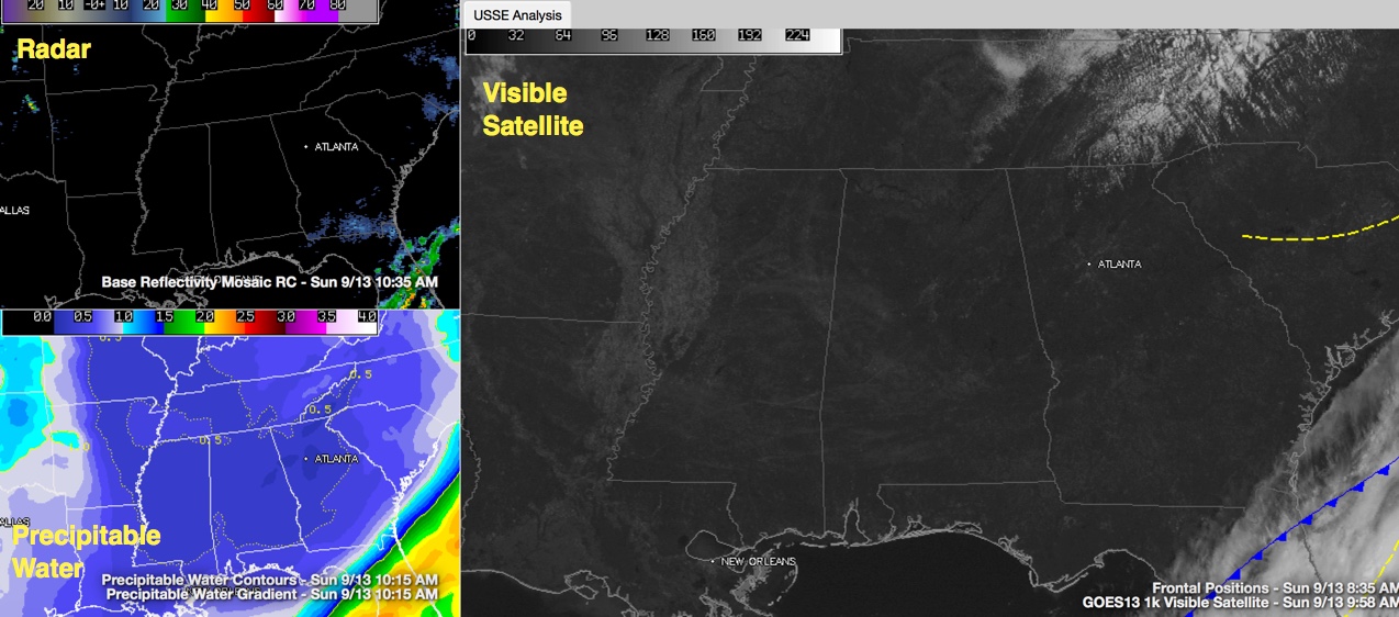
PERFECTION: High pressure centered near Little Rock this morning is shifting eastward on this mid-September Sunday. Dry air covers much of the state, with precipitable water values running around one half inch, on the low end of the scale for what we see this time of year. This will give us mostly sunny skies today, with highs in the middle and upper 70s. Dewpoints are around 50F and winds are light. All in all, a perfect day!
THE WEEK AHEAD: High pressure will remain in control of Alabama weather for the next several days. One subtle change will be that the high will continue shifting eastward until it is east of the Virginia Capes. When it gets there, easterly winds will start bringing in Atlantic moisture and allowing widely scattered showers and storms to return by Wednesday. Highs will be in the 80s and lows in the 60s. Humidities will return to uncomfortable levels by midweek.
WEEKEND OUTLOOK: Things look good for high school football games this week as well as for Saturday college games. An extension of the upper high over Texas will protect Alabama from an approaching front that will wash out before it can ever get here.
IN THE TROPICS: Here we are three days past the climatological peak of the Atlantic Hurricane Season and we don’t even have a named storm in progress across the basin. The remnants of Grace are over the Antilles but have almost no chance of redevelopment. There is another disturbance southeast of Bermuda with nearly no chance of developing. The tropical wave west of the Cape Verde Islands will likely become Tropical Storm Ida this week, but it will turn to the north well east of the islands.
Category: Alabama's Weather
About the Author (Author Profile)
Bill Murray is the President of The Weather Factory. He is the site's official weather historian and a weekend forecaster. He also anchors the site's severe weather coverage. Bill Murray is the proud holder of National Weather Association Digital Seal #0001 @wxhistorianSubscribe
If you enjoyed this article, subscribe to receive more just like it.


