

Increasing Rain Chances; Update on Gulf Low
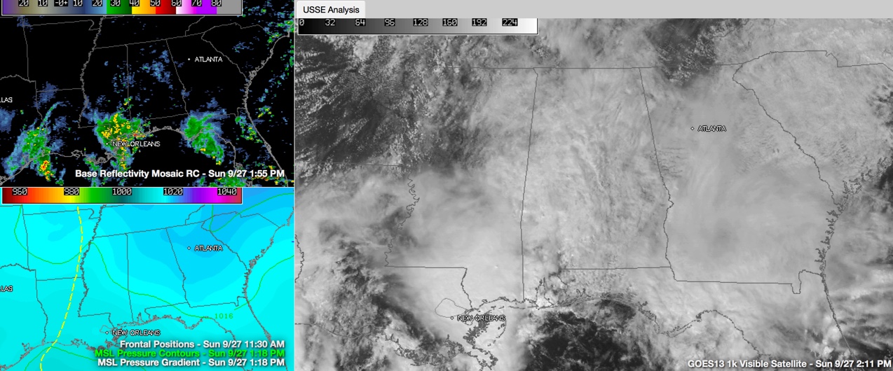
Moisture levels are high across Alabama on this late September Sunday afternoon. Clouds are thick across the area and light showers are increasing across the Central part of the state.
Temperatures are edging toward the 80F mark, but many spots will hang in the 70s this afternoon. Skies will remain mostly cloudy and scattered showers will be possible.
Expect the rain to expand this evening and most spots will see 30-45 minutes of rain late between this afternoon and tonight. Rainfall amounts will be light, around one tenth of an inch.
SUPERMOON ECLIPSE: I am afraid the only way that you will see the big lunar event tonight is by traveling far away or watching it on SpaceWeather.com. The moon will be eclipsed by the Earth’s shadow this evening in a total eclipse, even as the Moon is at perigee, its closest point in its orbit around the Earth. All for naught I am afraid for us here in Alabama.
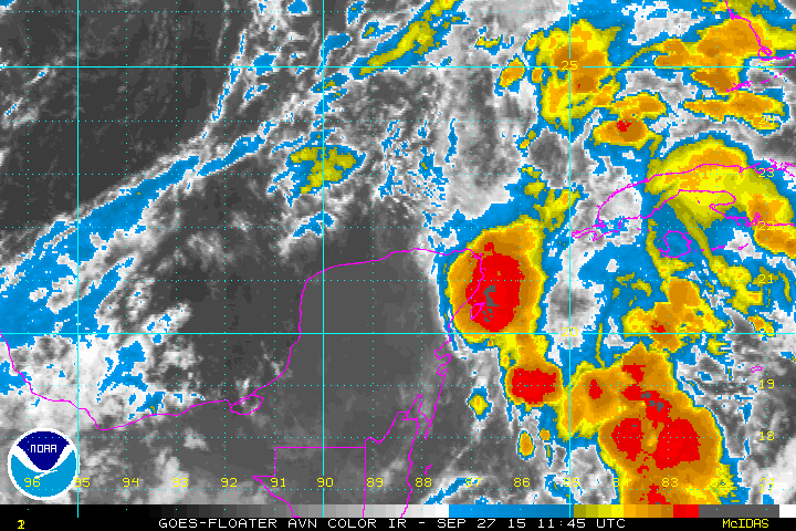
TROPICAL LOW? A broad low is over the Yucatan early this afternoon, with lots of disturbed weather extending northward from the system all the way into the coastal waters of the Florida Big Bend from Apalachicola to Tampa. More storms are over the Texas and Louisiana coastal waters, associated with the upper level low. I think we are seeing better outflow this morning from the storms each of the Yucatan where ridge is building.
The National Hurricane Center has dropped their probability that this low might become a tropical cyclone to 30%. Wind shear has relaxed a bit in the region where the low is situated now, but it still about 20 knots, which makes conditions unfavorable for significant development. And to the northwest, there is over 40 knots of shear. Even if it doesn’t become a tropical depression, with will have significant impact along the Gulf Coast, with heavy rain, winds of around 40 mph, seas of 6-8 feet and a high rip tide threat until the low comes ashore Tuesday. We will look at the beach forecast shortly.
WET START TO THE WORK WEEK: As the low moves northward on Monday, waves of showers will spread northward. Monday won’t be an all day rain by any stretch, but should will have to dodge at least a couple of rounds of rain. The low should reach the coast Monday night or early Tuesday. Showers will be the rule again on Tuesday as the low turns northeastward. They will begin to diminish from the south Tuesday afternoon, but they won’t be done. &0s will be the rule Monday and Tuesday with the clouds and showers.
MIDWEEK MOISTURE: The leftover moisture will hang around into midweek. Meanwhile, a developing trough to the north will link with the upper low over Louisiana, forming a bigger trough and pushing a cold front our way. There should be one last hurrah of showers and storms Wednesday afternoon as the front pushes through, and then the front.
BUT THEN, WAIT: We had thought there would be improved weather for the remainder of the week into the weekend, but the GFS has introduced the idea that an upper level low may cut off in the deep trough that is left over the Ohio and Tennessee Valleys. If that happens, we probably will see enough atmospheric energy and moisture to trigger a few showers Thursday. Expect improving conditions as we head toward the weekend.
ROCKET CITY WEATHER FEST: Speaking of the weekend, the annual Rocket City Weather Fest is this coming weekend at UAH in Huntsville. Lots of fun activities for kids and education things for everyone. There will even be a weather balloon launch at 1 p.m. Check out their website.
Category: Alabama's Weather, Tropical
About the Author (Author Profile)
Bill Murray is the President of The Weather Factory. He is the site's official weather historian and a weekend forecaster. He also anchors the site's severe weather coverage. Bill Murray is the proud holder of National Weather Association Digital Seal #0001 @wxhistorianSubscribe
If you enjoyed this article, subscribe to receive more just like it.


