Warm, Dry Weather For Alabama
ANOTHER WARM OCTOBER DAY: We project a high in the low to mid 80s today, well above the average high of 72 for October 23. Also, today will be the 13th consecutive day with no measurable rain for Birmingham and most of the state. The sky will be partly sunny.
THE ALABAMA WEEKEND: Some uncertainty has creeped into the forecast situation. High resolution models are now showing a marked increase in moisture tomorrow, and with the tail end of an upper trough passing through North Alabama, we might need to consider adjusting the forecast to include some risk of showers during the day. The higher chance will be over the northern third of the state (north of a line from Hamilton to Cullman to Gadsden), but the high resolution NAM hints showers might form as far south as I-20 in a few spots.
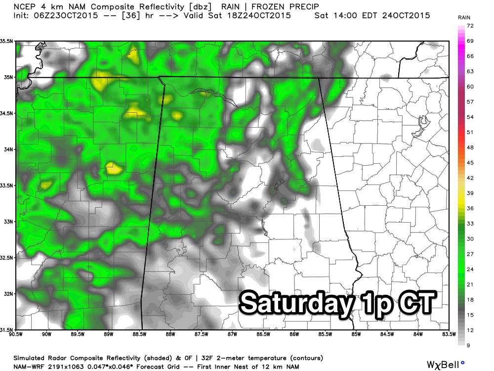
And, with the higher moisture pool in place, we might need to consider some risk of showers on Sunday as well, especially for North and West Alabama. For now I will just insert an outside chance of a shower in the forecast both days with more clouds than sun; let’s look at the new 12Z data later this morning before making big changes. We will adjust highs for the weekend downward into the 70s due to the increased cloud cover.
NEXT WEEK: A tropical low, the remnant of what is now powerful Hurricane Patricia in the eastern Pacific, will move into Louisiana from the western Gulf of Mexico, and will pull deep moisture into the state. Rain should become rather widespread Monday and Tuesday, with potential for heavy rain at times. The current look advertised by models suggests no risk of severe storms, just lots of rain.
Rain amounts of at least 1 to 2 inches are likely, and some spots could see even more. Showers could linger into Wednesday, and then cooler and drier air follows for Thursday and Friday.
PATRICIA: This is now the strongest eastern Pacific hurricane on record, with explosive deepening over the past 24 hours. The pressure is now down to 880 millibars, or 25.99″, and top sustained winds are at 200 mph.
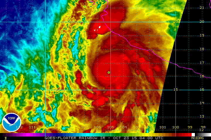
It will make landfall on the Pacific coast of Mexico later today with potential for catastrophic damage. While it will weaken over northern Mexico, there is some chance it redevelops to some degree over the far western Gulf of Mexico near the Texas coast Monday. Development into a tropical storm is not totally out of the question, water temperatures are cooler and upper air winds don’t favor any rapid deepening.
One way or another, it will bring more heavy rain to East Texas, and that deeper moisture will spread into Alabama.
FOOTBALL WEATHER: Dry and pleasant weather for the high school games tonight; temperatures will fall through the 70s.
Alabama will host Tennessee at Bryant-Denny Stadium in Tuscaloosa tomorrow (2:30p CT kickoff). The sky will be mostly cloudy, and we will need to adjust the forecast now to mention some risk of a shower, or a little light rain during the game. Temperatures will fall from the upper 70s at kickoff into the mid 70s by the fourth quarter.
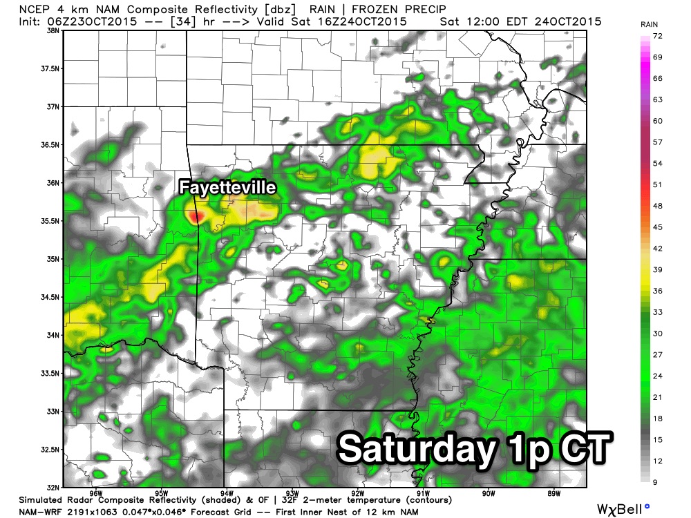
Auburn is on the road; they travel to Fayetteville to take on the Arkansas Razorbacks at 11:00a CT tomorrow. The day will be cloudy and wet; showers are likely during the game, but the good news is that now it looks like the heaviest rain could very well be south and east of Fayetteville at game time. Temperatures will be in the mid 60s.
RACE WEEKEND: The sky will be mostly cloudy at the Talledega Superspeedway tomorrow and Sunday, but only a slight risk of a shower both days. Highs will be in the mid to upper 70s.
WEATHER BRAINS: Don’t forget you can listen to our weekly 90 minute netcast anytime on the web, or on iTunes. This is the show all about weather featuring many familiar voices, including our meteorologists here at ABC 33/40.
CONNECT: You can find me on all of the major social networks…
Facebook
Twitter
Google Plus
Instagram
I have a weather program this morning at Hanceville Middle School in Cullman County… look for the next Weather Xtreme video here by 4:00 this afternoon. Enjoy the day!
Category: Alabama's Weather
About the Author (Author Profile)
James Spann is one of the most recognized and trusted television meteorologists in the industry. He holds the AMS CCM designation and television seals from the AMS and NWA. He is a past winner of the Broadcast Meteorologist of the Year from both professional organizations.Subscribe
If you enjoyed this article, subscribe to receive more just like it.


