

Mild, Humid Weather Continues
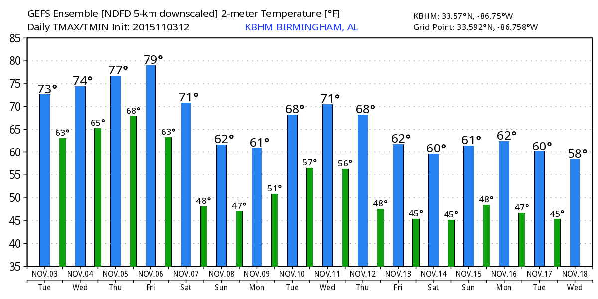
THIS AFTERNOON: Cloud cover is variable across the great state of Alabama this afternoon; there is a good supply of sunshine south and east of Birmingham, but much of North and West Alabama remains socked in by clouds. Temperatures are generally in the 70s…
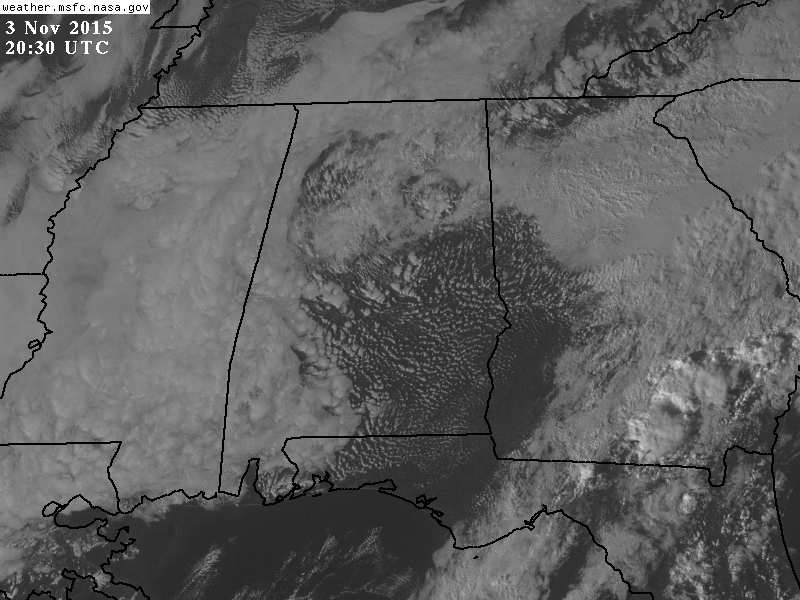
Not much on radar, just a few scattered sprinkles.
TOMORROW/THURSDAY: Not much change on these two days. The weather stays unseasonably mild and humid with morning clouds and some afternoon sun. Highs will be in the upper 70s, a few spots might even touch 80 degrees. And, while a few showers are possible, they will be widely scattered.
To the west, severe storms are possible Thursday afternoon and Thursday night across parts of Texas, and northward to near Chicago as the cold upper trough over the western U.S. begins to lift out.
FRIDAY: The day will be mostly cloudy and mild, and we expect to see an increase in the number of showers and thunderstorms by afternoon and into Friday night with the approach of a cold front. The main dynamic support will pass well to the north of Alabama, so no severe weather is expected. And, again the high Friday afternoon will be well up in the 70s.
OUR WEEKEND: The surface front won’t be in a hurry to move through, the the ECMWF (European model) continues the idea of periods of rain and a few thunderstorms Saturday, Saturday night, and possibly into at least part of the day Sunday. We will continue to roll with this solution in our forecast. The overall severe weather threat looks low, and rain amounts of 1-2 inches seem likely.
It won’t rain all weekend, and it is pretty much impossible to give specific start/stop times for the rain, but just be ready for showers or storms at just about any time. The high Saturday will be in the low 70s, and back in the 60s Sunday.
NEXT WEEK: The weather looks dry and cooler Monday and Tuesday; highs in the 60s and lows in the 40s. Next chance of showers and storms will come Wednesday night into Thursday; for now it looks like the main dynamic support will remain pretty far north, and the overall severe weather threat seems low. See the Weather Xtreme video for maps, graphics, and more details.
FOOTBALL WEATHER: For the high school playoff games in Alabama Friday night, showers and thunderstorms are a good possibility, and a few lightning delays are possible. Temperatures will be in the mid to upper 60s at most stadiums.
The biggest college game in the nation is Saturday night in Tuscaloosa, when LSU takes on Alabama at Bryant-Denny Stadium (7:00p CT kickoff). We will need to mention a chance of rain at times during the game, and a thunderstorm is possible as well. Temperatures will be in the mid 60s. I can’t give you specific start/stop times for the rain, but everyone needs to take some rain gear to the stadium.
Auburn is in College Station to take on the Aggies of Texas A&M Saturday night (6:30p CT kickoff)… and like Tuscaloosa we will need to include a chance of showers, and possibly a thunderstorm for this game. Temperatures will fall from the mid 60s at kickoff into the low 60s by the fourth quarter.
WEATHER BRAINS: Don’t forget you can listen to our weekly 90 minute netcast anytime on the web, or on iTunes. This is the show all about weather featuring many familiar voices, including our meteorologists here at ABC 33/40.
CONNECT: You can find me on all of the major social networks…
Facebook
Twitter
Google Plus
Instagram
Look for the next Weather Xtreme video here by 7:00 a.m. tomorrow…
Category: Alabama's Weather
About the Author (Author Profile)
James Spann is one of the most recognized and trusted television meteorologists in the industry. He holds the AMS CCM designation and television seals from the AMS and NWA. He is a past winner of the Broadcast Meteorologist of the Year from both professional organizations.Subscribe
If you enjoyed this article, subscribe to receive more just like it.


