Archive for April 26th, 2011

Quick Nowcast

Quick Nowcast

| April 26, 2011 @ 11:21 pm | 16 Replies

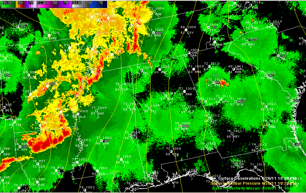
Scan down to read Dr. Tim’s excellent analysis of our current severe weather situation. Of concern right now is an intense complex of storms over North Central Louisiana. It recently produced damage from a possible tornado at Monroe. Another very dangerous and potentially tornadic storm is going to be passing just south of Ruston in […]

Read More

Analysis 1030 pm

Analysis 1030 pm

| April 26, 2011 @ 10:46 pm | 4 Replies

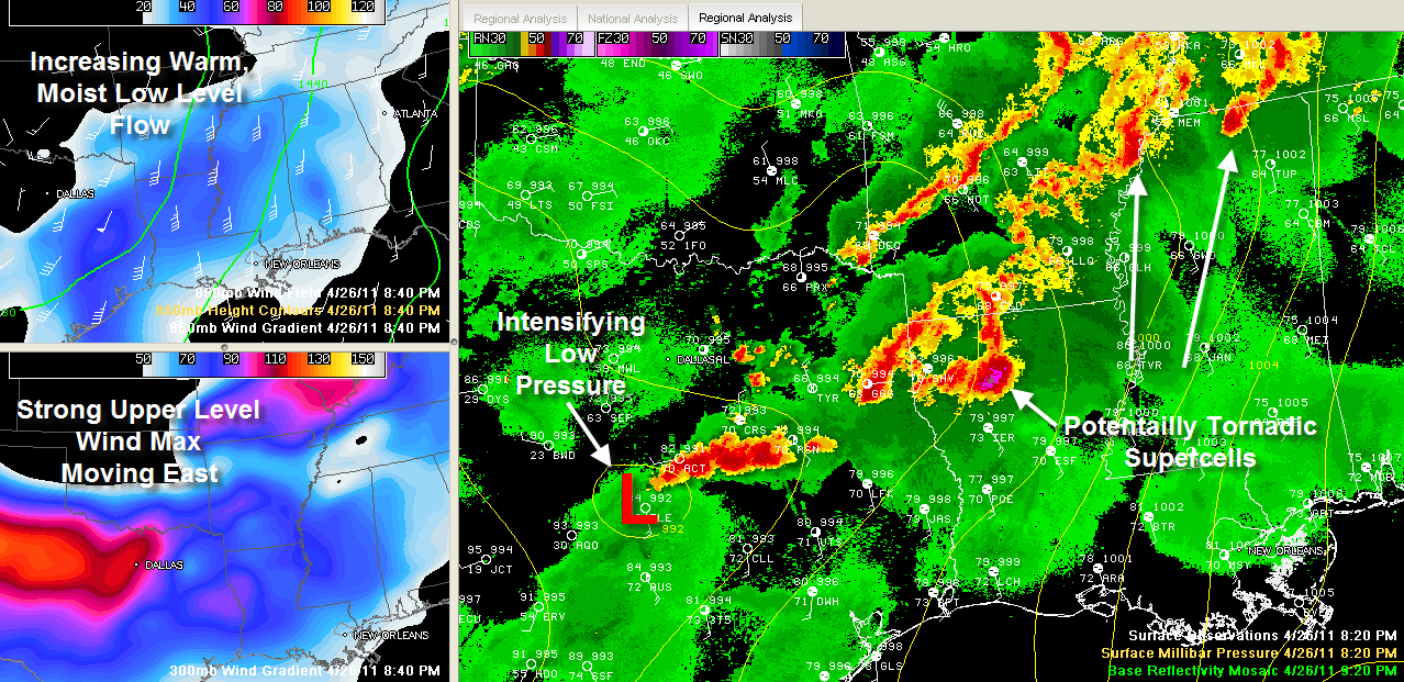
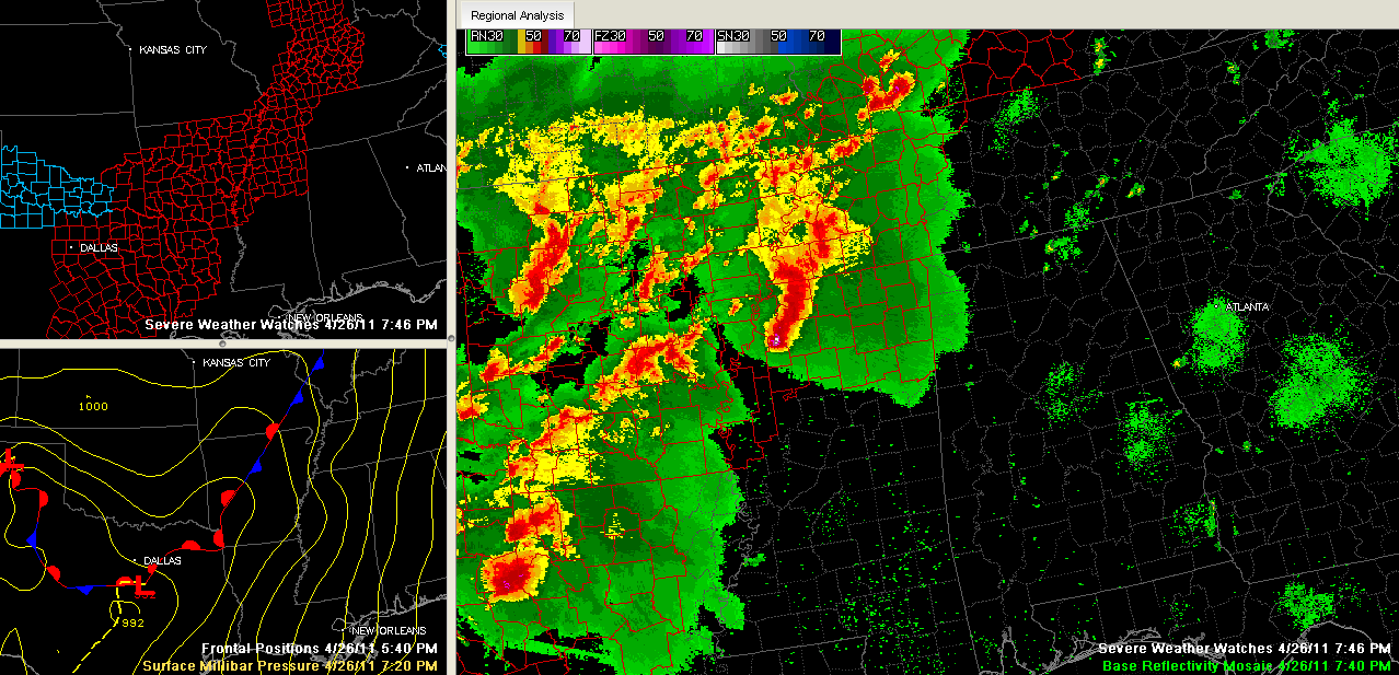
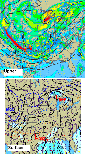
Very complex and dangerous weather situation over the SE US tonight.  Large upper trough over central US, with surface low in south Texas.  Supercell storms and MCS’s (areas of storms) are spread from Texas to Kentucky.  A lot of red on the radar tonight, and reports of very large hail, wind damage, and tornadoes have […]

Read More

New Tornado Watch Includes NW Alabama

New Tornado Watch Includes NW Alabama

| April 26, 2011 @ 9:45 pm | 14 Replies

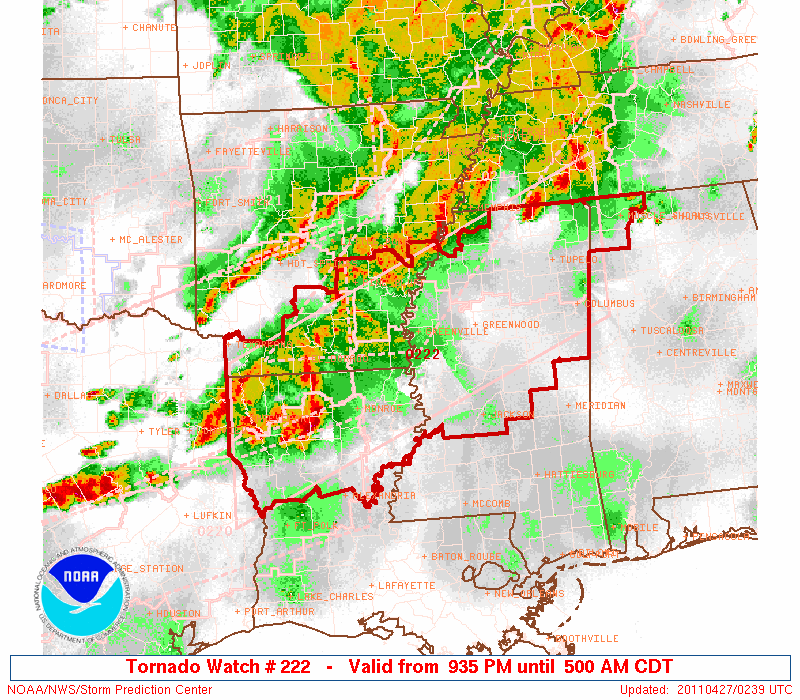
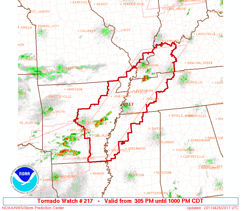
The SPC has issued a new tornado watch for Northwest Alabama, the northern half of Mississippi, southern Arkansas and northern Louisiana. The watch goes until 5 a.m. It is a PDS watch. The SPC says there is a high probability of tornadoes, EF2+ tornadoes, severe wind and severe hail within the watch area. Here is […]

Read More

Monitoring Things to the West

Monitoring Things to the West

| April 26, 2011 @ 9:30 pm | 13 Replies

We continue to monitor the happenings to the west of Alabama tonight, both out of concern for our friends in the areas where severe weather is occurring, and to discern signs that might help understand the timing and intensity of the storms in Alabama tomorrow. Storms are moving across northern Mississippi at this hour. The […]

Read More

Dangerous Mississippi Tornado Signature

Dangerous Mississippi Tornado Signature

| April 26, 2011 @ 8:32 pm | 15 Replies

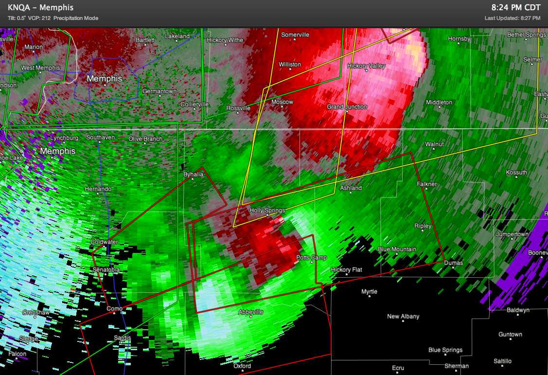
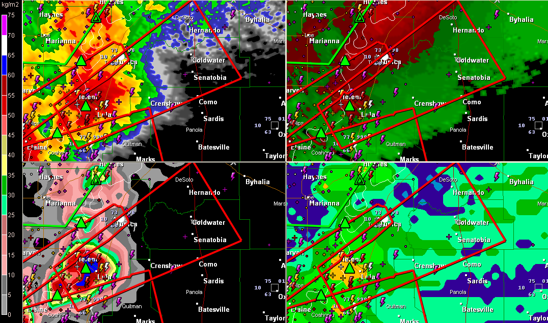
In North Mississippi near Holly Springs…

Read More

Baseball Sized Hail

Baseball Sized Hail

| April 26, 2011 @ 8:22 pm | 40 Replies

Baseball sized hail was recently reported at Como MS. Trained spotters report a tornado at Sardis, north of Batesville from this storm. Tornado warnings continue for these severe storms over northern Mississippi. Rotation is increasing rapidly near Holly Springs from the second storm in this image. In eastern Texas, strong rotation has moved from the […]

Read More

Dangerous Situation Tomorrow

Dangerous Situation Tomorrow

| April 26, 2011 @ 8:00 pm | 11 Replies

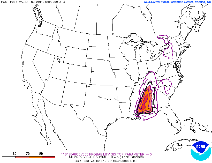
Not much change in our thinking for tomorrow… See the SREF output below, valid at 7:00 p.m. tomorrow. This is the chance of the significant tornado parameter (STP) exceeding 5 units; the model gives that a 90 percent chance in the general area from Gadsden to Mobile. Understand a STP over 2 is very significant, […]

Read More

Outbreak Underway

Outbreak Underway

| April 26, 2011 @ 7:48 pm | 3 Replies

A severe weather outbreak is occurring over the Arklatex and Mid South tonight and it is expected to get worse as upper level winds intensify during the evening. Let’s summarize some of the bigger storms… NORTHWEST LOUISIANA/NORTHEAST TEXAS …possible tornado on the ground now near Blanchard, northwest of Shreveport…moving northeast toward Benton…rotation is increasing… …another […]

Read More

Attn: Cleburne, Randolph, Marengo, Lamar Counties

Attn: Cleburne, Randolph, Marengo, Lamar Counties

| April 26, 2011 @ 7:03 pm | 30 Replies

No, this is not about severe weather… but about TV coverage for severe weather. I have written a series of these articles over the years, but it comes up every time we have active weather. There are a number of counties in which some people seem to prefer our severe weather coverage, but we can’t […]

Read More

Memphis Under the Gun

Memphis Under the Gun

| April 26, 2011 @ 6:46 pm | 4 Replies

Watch live overage from WMC-TV in Memphis here. A severe thunderstorm with rotation is crossing northern parts of Memphis right now, heading toward Millington. This circulation has weakened a bit, but could be recycling. Half dollar sized hail was reported near Arlington, which is in advance of this big storm. Two trucks blown over on […]

Read More

Major Severe Weather Threat For Alabama

Major Severe Weather Threat For Alabama

| April 26, 2011 @ 3:39 pm | 28 Replies

An all new edition of the ABC 33/40 Weather Xtreme video is available in the player on the right sidebar of the blog. You can subscribe to the Weather Xtreme video on iTunes by clicking here. WATCH THE VIDEO: It is usually easier for us to describe major weather events using graphics, that is why […]

Read More

PDS Tornado Watch for TN/MS/AR/IL/KY/MO

PDS Tornado Watch for TN/MS/AR/IL/KY/MO

| April 26, 2011 @ 3:24 pm | 11 Replies

Read More

Analysis – 1155 am

Analysis – 1155 am

| April 26, 2011 @ 11:59 am | 35 Replies

…MAJOR TORNADO OUTBREAK LIKELY IN SOUTHEAST OVER THE NEXT 48 HOURS… The morning model runs are in now, and it still looks like a significant severe weather outbreak will occur over the SE US today and tomorrow.  I will primarily talk about Alabama here, but this is a large-scale event. A line of showers is […]

Read More

An 11:30 Look at Alabama Weather

An 11:30 Look at Alabama Weather

| April 26, 2011 @ 11:26 am | 8 Replies

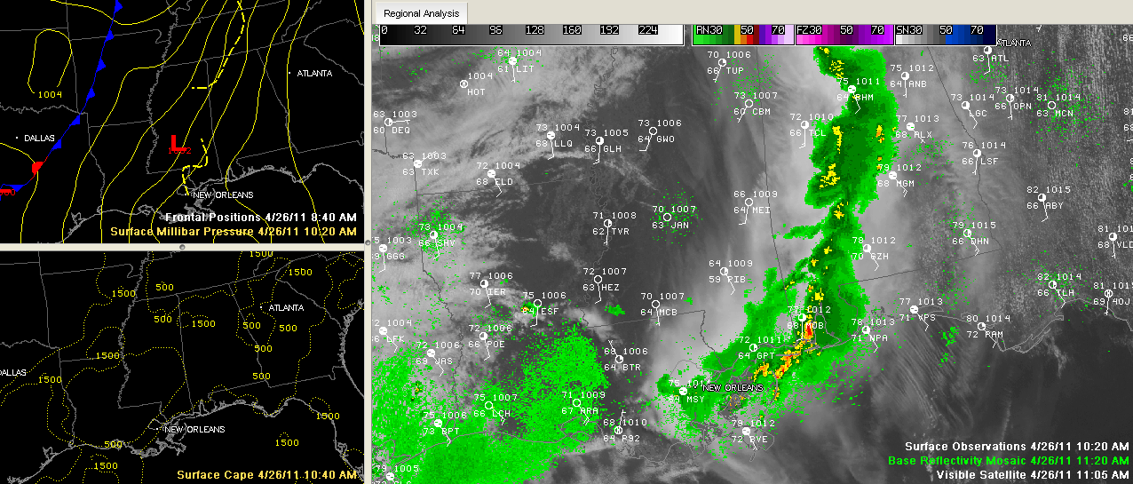
Here is a look at the Alabama weather situation as we approach 11:30. Dr. Tim Coleman is preparing a thorough analysis of the morning model data and will have it up in about an hour. A band of weakening showers extends Cullman and Blount Counties through Jefferson, Shelby, Bibb, Perry and Dallas Counties. Lightning is […]

Read More