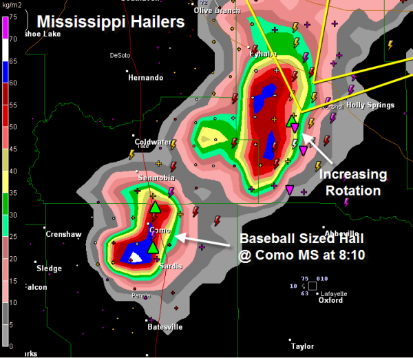
Baseball Sized Hail
Baseball sized hail was recently reported at Como MS. Trained spotters report a tornado at Sardis, north of Batesville from this storm.
Tornado warnings continue for these severe storms over northern Mississippi. Rotation is increasing rapidly near Holly Springs from the second storm in this image.
In eastern Texas, strong rotation has moved from the Tyler area and is now just west of Kilgore. A tornado could form at any time from this dangerous storm. It is right on I-20 right now and will track near Longview.
The activity over northeastern Texas, Louisiana, Arkansas, western Tennessee and northwestern Mississippi is expected to intensify in the next couple of hours as a powerful upper level jet maximum moves eastward out of North Central Texas.
Category: Severe Weather


