Alabama 811 | Know What's Below.

Archive for April 11th, 2013

Tornado Warning Pickens County – Dangerous Tornado

Tornado Warning Pickens County – Dangerous Tornado

| April 11, 2013 @ 12:37 pm

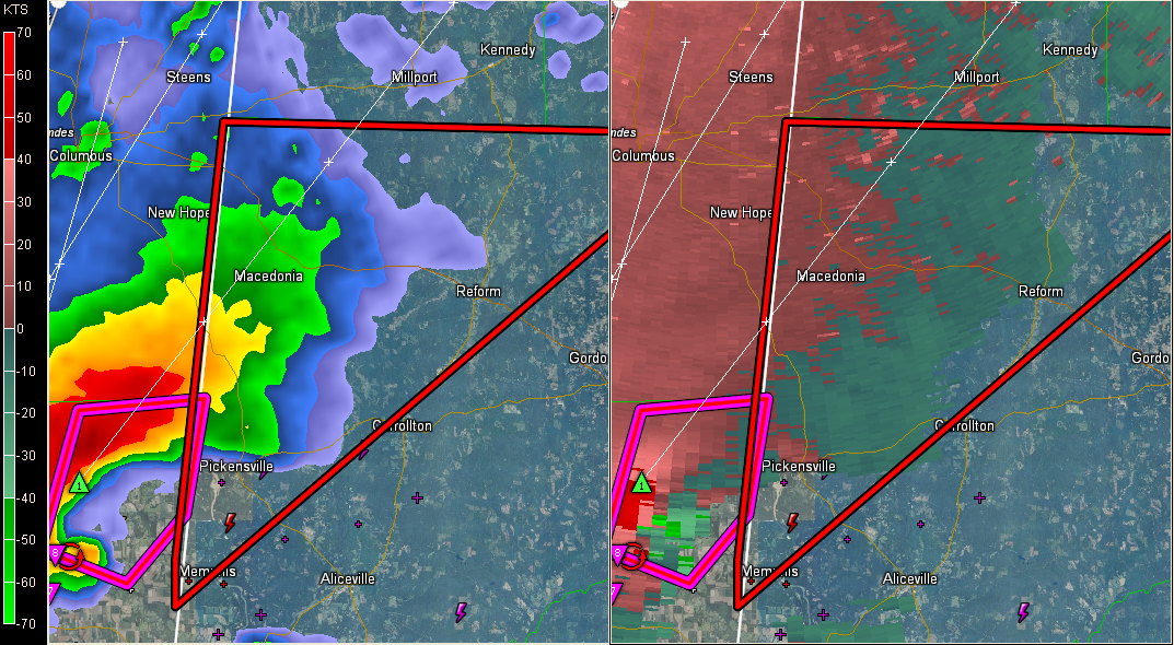
A tornado warning has been issued for Pickens County. LATE REPORTS 12:42 Dangerous confirmed tornado, possibly large and violent, is about to cross the Mississippi border into Alabama’s Pickens County. It will pass near Pickensville and Macedonia and could evetually impact Reform. BE IN A SAFE PLACE NOW!!! Reports of significant damage near Shuqualak. Tornado […]

Read More

Tornado Emergency

Tornado Emergency

| April 11, 2013 @ 12:05 pm

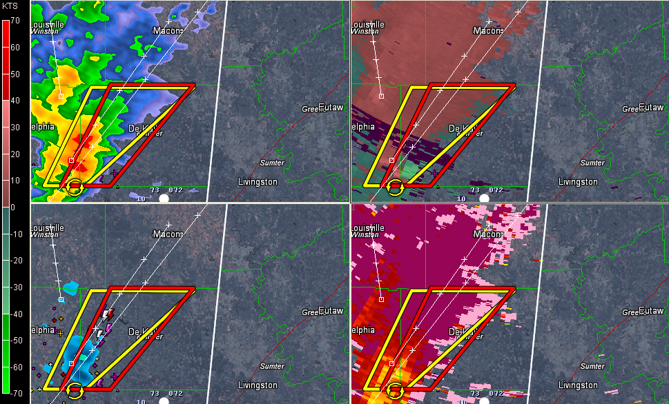
The NWS in Jackson has issued a tornado emergency for northern Kemper and southern Noxubee. SEVERE WEATHER STATEMENT NATIONAL WEATHER SERVICE JACKSON MS 1203 PM CDT THU APR 11 2013 MSC069-111730- /O.CON.KJAN.TO.W.0046.000000T0000Z-130411T1730Z/ KEMPER MS- 1203 PM CDT THU APR 11 2013 …A TORNADO WARNING REMAINS IN EFFECT UNTIL 1230 PM CDT FOR NORTH CENTRAL KEMPER […]

Read More

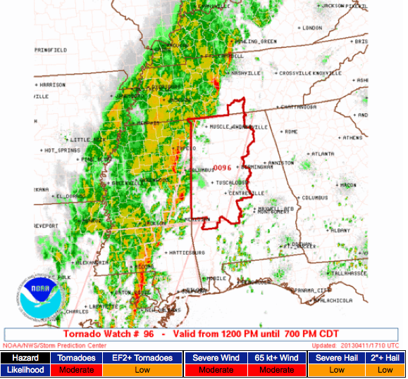
Tornado Watch for Central Alabama

Tornado Watch for Central Alabama

| April 11, 2013 @ 11:56 am

A tornado watch has been issued for the western half of Central Alabama. It will go until 7 p.m. COUNTIES INCLUDE: Bibb, Blount, Chilton, Dallas, Fayette, Greene, Hale, Jefferson, Lamar, Marengo, Marion, Perry, Pickens, Shelby, Sumter, Tuscaloosa, Walker and Winston. The storm in Kemper County MS has us concerned. It shows strong indications of rotation […]

Read More

Likely Tornado Debris Signature

Likely Tornado Debris Signature

| April 11, 2013 @ 11:49 am

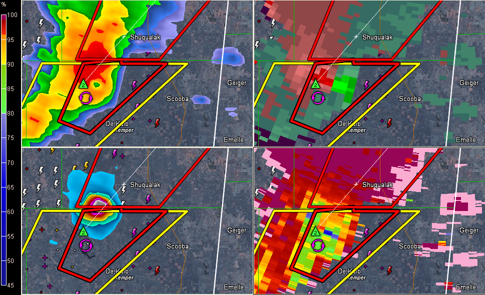
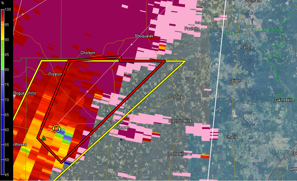
Alan Gerard reports TDS on the Kemper County MS storm. It is north of Damascus. Another note from Alan at 11:50. Large TDS now on KGWX radar WNW of DeKalb. People in the path of the tornado in northern Kemper County need to be in shelter now!! Another note at 11:52: AT 1151 AM CDT…A […]

Read More

First Tornado Warning

First Tornado Warning

| April 11, 2013 @ 11:38 am

A tornado warning has been issued for a severe thunderstorm for a couple of counties in East Central Mississippi. There is strong indication of rotation near Damascus. This is just northwest of Meridian. Alan Gerard at the NWS Jackson mentioned that the cell has 80 knots of gate to gate shear. LATE NOTE 11:44 Alan […]

Read More

Watch Possible

Watch Possible

| April 11, 2013 @ 10:51 am

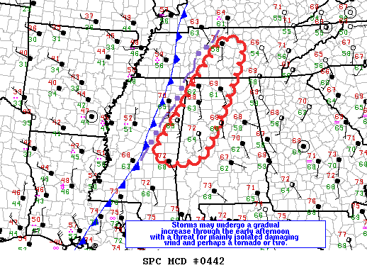
SPC is considering a watch that would include a sizable portion of western and northwestern Alabama. Rather than rehash it, I’m posting the discussion below. I will add that the latest High Resolution Rapid Refresh model runs have focused on the area between Mobile, Birmingham, and Montgomery in the time frame of 3 to 5 […]

Read More

The Latest on the Severe Weather Threat

The Latest on the Severe Weather Threat

| April 11, 2013 @ 10:34 am

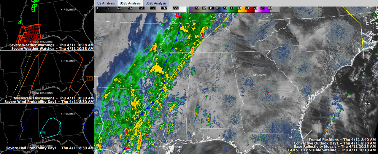
UPDATE: SPC’s latest mescoscale discussion on today’s severe weather threat is very similar to our thinking as well as the NWS Birmingham thoughts. Weather conditions will begin to deteriorate heading into the afternoon. Daytime heating and upper-level features begin to cause a greater chance for severe thunderstorms into the afternoon and evening hours. We continue […]

Read More

Storms Inching Closer

Storms Inching Closer

| April 11, 2013 @ 8:26 am

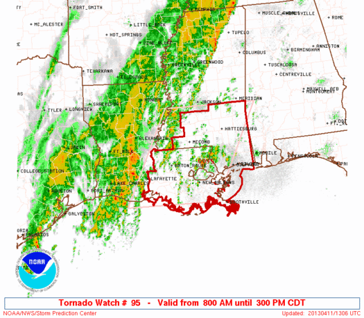
Storms along a frontal zone were inching ever so closer to Alabama just after 8 am this morning. SPC has issued a Tornado Watch for most of southern Mississippi and southeastern Louisiana. This watch is in effect until 3 pm CDT and butts up to Southwest Alabama. Along the frontal zone, a number of flash […]

Read More

Severe Storms Likely For Alabama Today

Severe Storms Likely For Alabama Today

| April 11, 2013 @ 6:08 am

An all new edition of the ABC 33/40 Weather Xtreme video is available in the player on the right sidebar of the blog. You can subscribe to the Weather Xtreme video on iTunes by clicking here. RADAR CHECK: A band of rain and storms is over West Tennessee and Northwest Mississippi this morning, and is […]

Read More