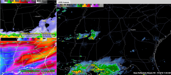
Showers, Storms Along and South of I-20 This Afternoon
Showers and storms are marching across Central Mississippi this morning and will enter West Alabama within the next hour.
They will affect areas from Lamar, Pickens and Sumter Counties over into Fayette, Tuscaloosa, Greene and Hale Counties before 130 p.m.
They are not severe at this time, but have produced hail.
Jet stream winds above us are increasing, providing lift, and the rate with which temperatures decrease with height is strong today, providing the increased hail threat.
Showers and storms will increase in coverage through the afternoon for areas south of a line from Sulligent to Jasper to Oneonta to Piedmont.
Storms could be strong later today, south of a line from Reform to Centreville to White Hall to Luverne. This area is in an SPC marginal severe weather risk today. A slight risk covers parts of Sumter, Choctaw, Clarke, Washington and Mobile Counties.
More storms will form during the afternoon ahead of a cold front that extends from Dallas to Little Rock to western Kentucky at this time.
Expect cooler conditions tomorrow behind the front.
Category: Alabama's Weather, Severe Weather


