Rain Ending, Colder Weather Ahead
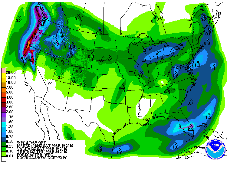
Our weather pattern will be settling down today after having been somewhat unsettled for the last couple of days. A cold front was poised to move into and through Alabama today. That will make the temperature forecast somewhat challenging since for much of Central Alabama we will see temperatures holding steady or falling slowly through the 50s. There was an area of rain stretching from about Hoover westward to Pickensville, and this area should be moving steadily eastward with most areas seeing the rain end by late morning or early afternoon.
For anyone at the beach, occasional showers and storms will continue along the Gulf Coast from Dauphin Island to Panama City Beach today along with gusty wind, but the weather will be dry Sunday and into early next week with sunny days and fair nights. High temperatures will be in the 60s until mid-week when lower 70s will return. The sea water temperature yesterday at Perdido Pass at Orange Beach was 69 degrees. Rip currents remain a threat as well, so pay attention to the flags along the beaches. Purple flags are flying as well for dangerous marine life, particularly Portuguese Man-of-War. You can find See the complete Gulf Coast 7 Day Planner here.
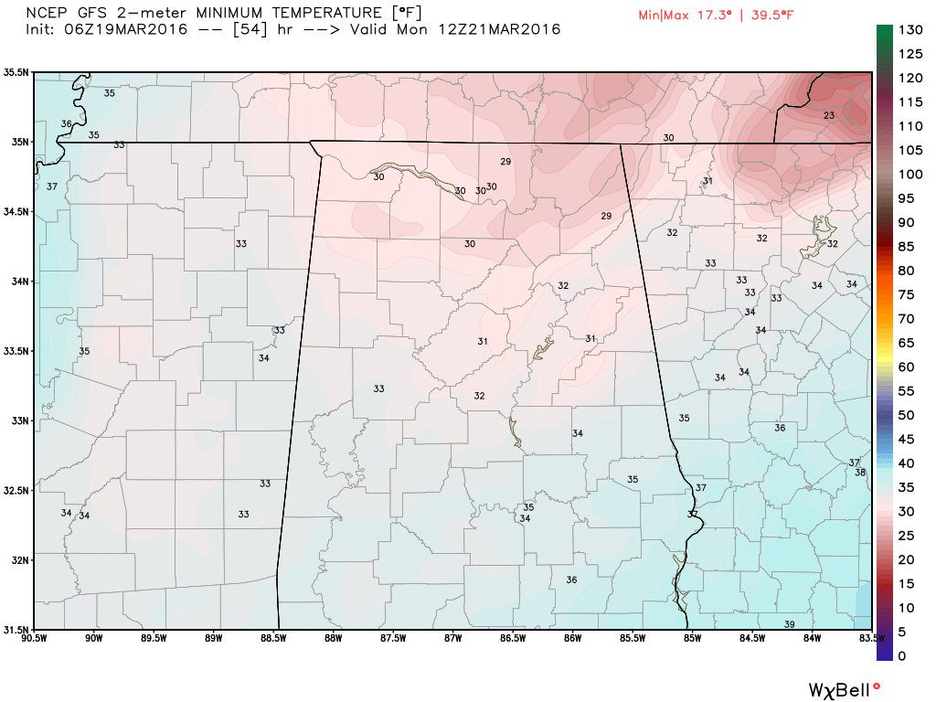
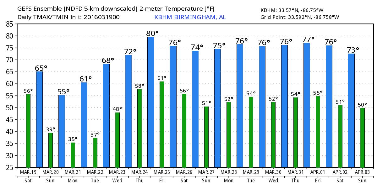
While the rain will end today, clouds are expected to hang around well into Sunday as we finally begin to see some sunshine. But Sunday will be a chilly day starting out in the mid and upper 30s with highs only in the middle 50s. While some of those typically colder spots will come close to freezing Sunday morning, the likelihood of frost will be minimal since the northerly wind is expected to stay in the 5 to 10 mph range for the night and early morning hours.
The upper trough moves off the East Coast Monday as a surface high settles into the Lower Mississippi River Valley. Monday morning is expected to be our coldest as we see good radiational cooling and the wind is expected to drop off and become nearly calm. Frost is likely to occur on Monday morning especially along and north of a line from Eutaw in Greene County to Clanton in Chilton County to Lafayette in Chambers County. Any sensitive plants will need to be protected, and please be sure to give any outdoor pets a warm place to be.
The upper air pattern flattens substantially on Tuesday as we begin to watch the development of another trough over the Rockies. We should remain dry and warm up through mid-week, with the next good chance of rain coming Thursday as a surface low moves through the Great Lakes region dragging a cold front through the Southeast US once again. Rain comes to an end late Thursday or early Friday. Highs should be in the 70s on Tuesday, Wednesday, and Thursday, but temperatures will drop off again but only into the 60s for Friday and Saturday.
The weather pattern remains active as we peek out into voodoo country. A strong upper trough with a closed low will come by in the March 27th/28th time frame. We warm up nicely to end March, but the first of April promises another round of wet and stormy weather with the potential for another shot at some near freezing temperatures around April 2nd/3rd. Remember, the average date of the last freeze for Central Alabama is around April 5th.
Thanks for tuning into the Weather Xtreme Video. I plan to have the next edition posted first thing on Sunday morning. Remember, you can check back here frequently for updates on what’s happening in Alabama’s weather.
-Brian-
Category: Alabama's Weather
About the Author (Author Profile)
Brian Peters is one of the television meteorologists at ABC3340 in Birmingham and a retired NWS Warning Coordination Meteorologist. He handles the weekend Weather Xtreme Videos and forecast discussion and is the Webmaster for the popular WeatherBrains podcast.Subscribe
If you enjoyed this article, subscribe to receive more just like it.


