Juicy El Nino Moisture
Let’s geek out this afternoon with some technical forecast thoughts from retired satellite meteorologist and Friend of the Blog Sheldon Kusselson!
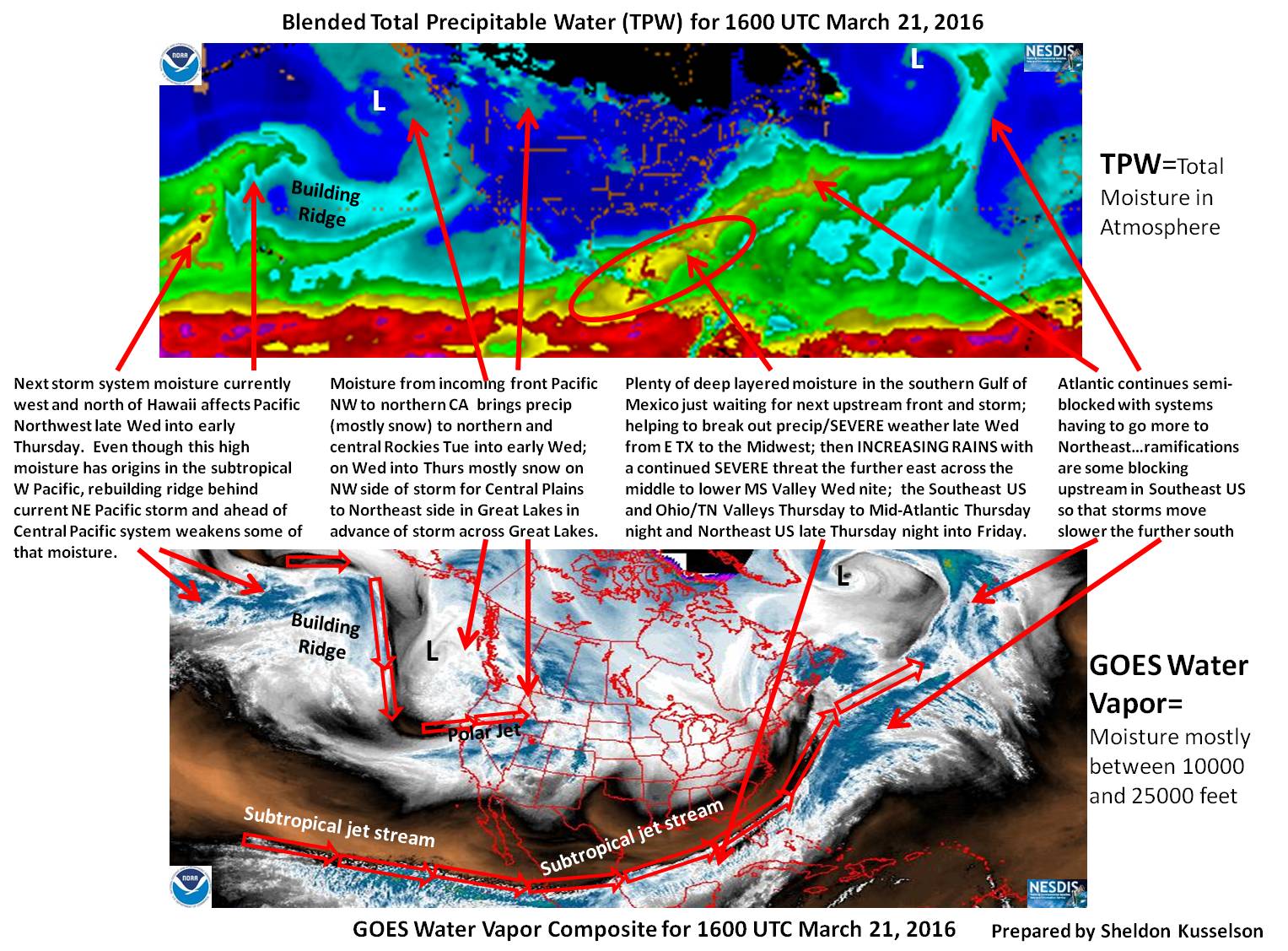
Click image to enlarge.
Guest Post by Meteorologist Sheldon Kusselson
Here is my satellite analysis and words of wisdom for what can happen this week thanks to the players on the current analysis.
There have been differences as you may have seen between the position of storm/low on the GFS and EURO models for the middle to eastern part of North America later in the week. Since we are still in El Nino and the low tends to be a little deeper and further south…I would tend to lean toward the EURO further south position, especially if the ridge rebuilding in eastern Pacific is stronger in the coming days. That would put more emphasis on snow across the north and heavy rain/possibly flash flooding and severe weather further south.
Some helpful loops of Total Precipitable Water : /bTPW/TPW_Animation.html?product=GLOBAL_TPW
And for any snow that happens. Remember the precip is snow-water equivalent instantaneous rate per hr to help you out
And of course the Layered Precipitable Water loop showing moisture at 4 different layers.
This should add value to your heavy precipitation and severe weather threat forecasts, especially in the middle to last half of the week.
-Sheldon
Category: Alabama's Weather, Severe Weather
About the Author (Author Profile)
Bill Murray is the President of The Weather Factory. He is the site's official weather historian and a weekend forecaster. He also anchors the site's severe weather coverage. Bill Murray is the proud holder of National Weather Association Digital Seal #0001 @wxhistorianSubscribe
If you enjoyed this article, subscribe to receive more just like it.


