Storms Ramping Down
Conditions are improving rapidly tonight across North and North Central Alabama.
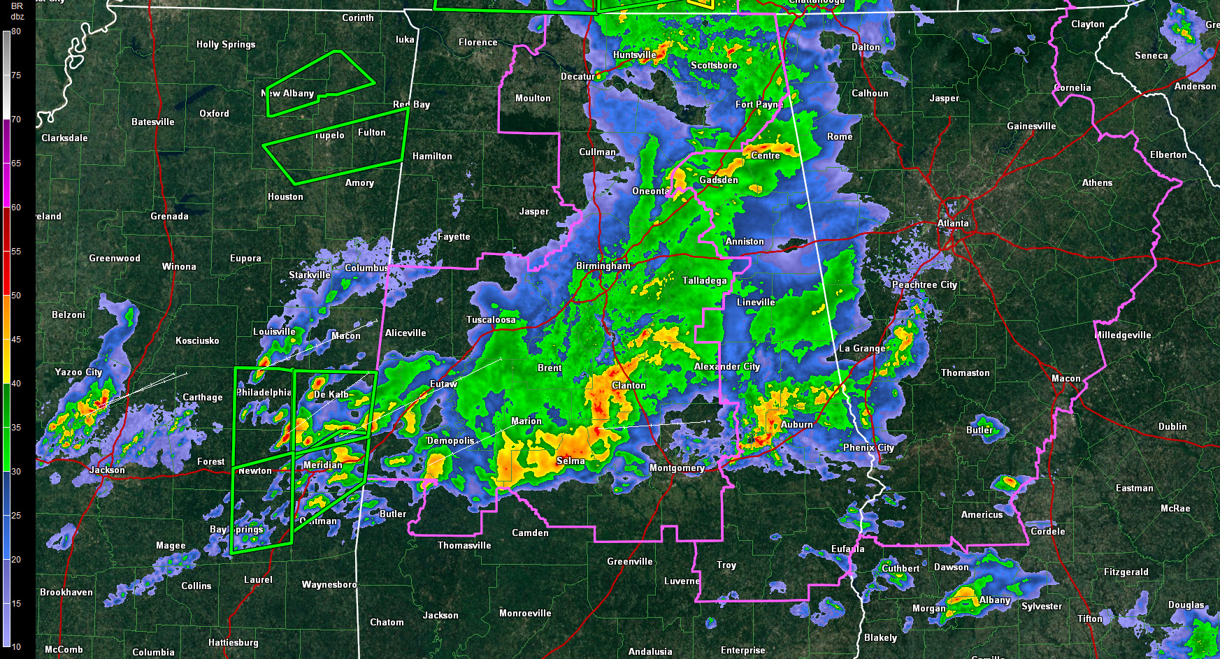
Thunderstorms over the Tennessee Valley have weakened considerably in the past hour after producing a tornado near Priceville.
The activity in northern Jefferson and Blount County weakened quickly just minutes after showing 90 knot gate to gate shear. Fortunately there were no damage reports from northern Jefferson or Blount Counties.
Lightning has ramped down considerably.
There is still 500 joules of surface based CAPE in areas along and east of I-65.
Over South Central Alabama, storms remain strong tonight from Uniontown to Selma to Maplesville to east of Calera. They are very strong as well just to the west of Auburn/Opelika. High winds will be possible from Notasulga to Loachapoka into the Auburn/Opelika areas. Be in a well constructed home or building as their storms approach.
Instability values will continue to drop from the northwest overnight.
Two different tornado watches continue for Central Alabama into the wee hours of the morning. A large part of the first watch will likely be canceled soon. South Central Alabama and eastern sections may remain in the watches until well after midnight.
A flash flood watch is still in effect for the area until late Friday night, but the heavy rain threat is winding down for areas along and north of I-20.
The cold front is near the Mississippi and will be near I-59 by sunrise. It will only push slowly southeastward during the day.
More heavy rain and storms will develop over South Central and South Alabama on Friday. Some of the rain may work its way back into the I-20 Corridor as well as a surface low moves along the front, but no severe weather is expected across North or North Central Alabama tomorrow.
There could be a few showers late Friday night, but the rain should be gone by Saturday morning.
Tomorrow should be mild, with highs in the lower 70s under fairly cloudy skies. Highs on Saturday will be limited to the middle 60s despite near total sunshine.
Next rain chance will come late next week, most likely on Thursday.
Category: Alabama's Weather, Severe Weather
About the Author (Author Profile)
Bill Murray is the President of The Weather Factory. He is the site's official weather historian and a weekend forecaster. He also anchors the site's severe weather coverage. Bill Murray is the proud holder of National Weather Association Digital Seal #0001 @wxhistorianSubscribe
If you enjoyed this article, subscribe to receive more just like it.


