Storms Return Wednesday Night
NO COMPLAINTS TODAY: Another delightful day for Alabama with sunshine in full supply; temperatures are mostly in the mid 70s.
An “Alberta Clipper” to the north will pull down cooler air into our state tomorrow; the high will drop into the mid 60s, about ten degrees cooler than today. But the air stays dry and the sky will remain sunny.
MID-WEEK STORM SYSTEM: Wednesday should begin with a fair sky, but clouds will roll in Wednesday afternoon, and showers and storms are likely Wednesday night ahead of a cold front. SPC maintains a “marginal risk” of severe storms for most of the state…
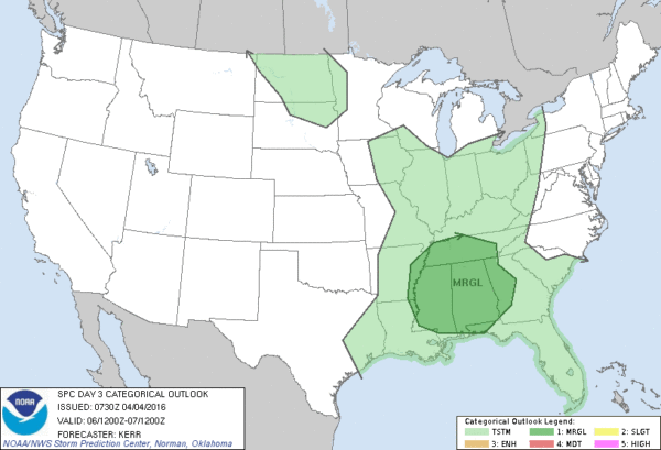
The best chance of storms will come from about 8:00 p.m. Wednesday through 3:00 a.m. Thursday. The latest model runs are showing little surface based instability, and relatively weak wind fields. So, at the moment the overall severe weather threat looks low, but you will always need to watch systems that pass through in early April. Rain amounts of about 1/2 to 3/4 inch can be expected.
THURSDAY/FRIDAY: These two days will be dry with a cooling trend. The high Thursday will be in the mid 60s with a good supply of sunshine, and by Friday the high will be close to 60. Friday’s sky will remain sunny, but a north wind of 12-22 mph will make it a rather blustery day. Communities north of Birmingham won’t make it out of the 50s Friday afternoon.
THE ALABAMA WEEKEND: Cold mornings will headline the forecast; sure looks like we are headed down into the 30s both Saturday and Sunday morning with the risk of frost for a large part of North/Central Alabama, along with a freeze for the colder spots. Growers/gardeners will need to monitor temperature forecasts in coming days. The sky will be sunny; the high Saturday will be close to 60, and then close to 70 degrees Sunday afternoon.
NEXT WEEK: Monday will be dry and pleasant with a high in the 70s, then the next storm system will bring a risk of showers and thunderstorms Tuesday. That one will need to be monitored for severe thunderstorm potential, but at the moment it doesn’t look especially ominous. See the Weather Xtreme video for maps, graphics, and more details.
AT THE BEACH: The weather looks great on the coast for the next seven days with sunny pleasant days and clear nights… the exception is Wednesday night when a few showers or storms could pass through the area between Gulf Shores and Panama City Beach. Highs will be in the 70s, except for the 60s along the immediate coast due to the cooler ocean water (sea surface temperatures are mostly in the mid 60s). See a very detailed Gulf Coast forecast here.
STORM SPOTTER TRAINING: We have a basic storm spotting class at the Helena Community Center in Shelby County tomorrow evening at 6:30.
And, Storm Spotter Xtreme is coming up this Saturday, April 9 at the BJCC from 9am to 2pm. This will feature both the basic and advanced SKYWARN classes, along with a session from Kevin Laws of the Birmingham NWS office. And, if you come, you get free admission to the Alabama International Auto Show, going on at the BJCC that same day. There is no cost and no need to register. Just show up with a curious mind. Kids 10 and older will also enjoy this if they love weather and want to learn more. Please help us make the severe weather warning process better!
WEATHER BRAINS: Don’t forget you can listen to our weekly 90 minute netcast anytime on the web, or on iTunes. This is the show all about weather featuring many familiar voices, including our meteorologists here at ABC 33/40. We will produce this week’s show tonight at 8:30 CT… you can watch it live here.
CONNECT: You can find me on all of the major social networks…
Facebook
Twitter
Google Plus
Instagram
I had a great time today visiting with the second graders at Pinson Elementary School… be looking for them on the Pepsi KIDCAM today at 5:00 on ABC 33/40 News! The next Weather Xtreme video will be posted here by 7:00 a.m. tomorrow…
Category: Alabama's Weather
About the Author (Author Profile)
James Spann is one of the most recognized and trusted television meteorologists in the industry. He holds the AMS CCM designation and television seals from the AMS and NWA. He is a past winner of the Broadcast Meteorologist of the Year from both professional organizations.Subscribe
If you enjoyed this article, subscribe to receive more just like it.


