Late Afternoon Weather Update
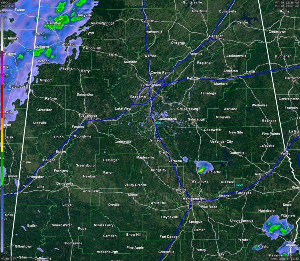
Currently at 4PM across the state, a few showers have developed in Autauga county just south of Billingsley. Showers are starting to push across the Mississippi-Alabama state line in Lauderdale, Colbert, Franklin, Marion, and Lamar counties. There are no active watches or warnings for the state at the moment.
Temperatures across the state are mostly in the 70 to 75 degree range across much of north and central Alabama, with some upper 60s reported north of I-20 and east of I-65. Dewpoints are mostly in the upper 40s north of I-20, with lower to mid 50s south of there.
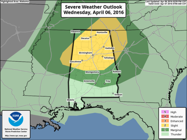
SPC UPDATE: At 3PM CDT, the Storm Prediction Center released their update on their Day 1 Convective Outlook, and there was no change in the slight risk for severe weather for much of northern Alabama.
SEVERE?: CAPE values are still not all that impressive on the latest model runs (less than 1000 J/kg), and with dewpoint values staying below the 60 degree mark, this should keep this a low-end severe event. Significant Tornado Parameter numbers are below 1 throughout the event. This means that tornado threat will be low, but not at zero. The low-level jet at 5,000 feet in the latest model run does not look as impressive as it did earlier, but still could have winds at 50 to 60 MPH. If that translates down to the surface, that could cause some damage.
MAIN THREAT: A few severe thunderstorms could form tonight, and the main threat from those would be damaging straight-line winds and maybe some damaging hail. As the night progresses, please be sure to have your source of getting severe weather warnings handy.
Category: Alabama's Weather, Severe Weather


