Tornado Warning – Barbour County Until 1:30 AM CDT
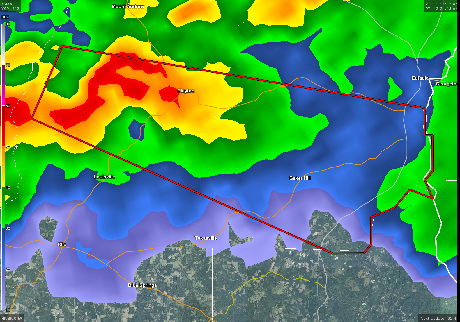
A Tornado Warning has been issued until 1:30 AM CDT for central Barbour County. A severe thunderstorm capable of producing a tornado is located near Boot Hill and north of Clio. Storm is moving to the east at 30 MPH. Locations in the path of this storm are listed below. If you are in the path of this storm, seek shelter immediately.
THE NATIONAL WEATHER SERVICE IN BIRMINGHAM HAS ISSUED A
* TORNADO WARNING FOR…
CENTRAL BARBOUR COUNTY IN SOUTHEASTERN ALABAMA…
* UNTIL 130 AM CDT
* AT 1223 AM CDT…A SEVERE THUNDERSTORM CAPABLE OF PRODUCING A
TORNADO WAS LOCATED NEAR BOOT HILL…OR 12 MILES NORTH OF CLIO…
MOVING EAST AT 30 MPH.
HAZARD…TORNADO.
SOURCE…RADAR INDICATED ROTATION.
IMPACT…FLYING DEBRIS WILL BE DANGEROUS TO THOSE CAUGHT WITHOUT
SHELTER. MOBILE HOMES WILL BE DAMAGED OR DESTROYED.
DAMAGE TO ROOFS…WINDOWS…AND VEHICLES WILL OCCUR. TREE
DAMAGE IS LIKELY.
* LOCATIONS IMPACTED INCLUDE…
CLAYTON…GAINO…RICHARDS CROSSROADS…MILLERS FORD…BAKER HILL AND
CLAYTON MUNICIPAL AIRPORT.
Category: Alabama's Weather, Severe Weather
About the Author (Author Profile)
Subscribe
If you enjoyed this article, subscribe to receive more just like it.


