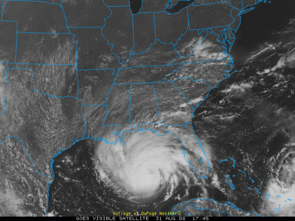
The Latest on Gustav…1 p.m.
Here is the latest information on Gustav…
FAST FACTS AS OF 1 PM CDT
LOCATION: 25.9N/86.6W…270 ESE of Mouth of Mississippi River
MOVEMENT: NW 17
TOP WINDS: decreased to 115 mph (on lower bound of Category Three)
CENTRAL PRESSURE: 960 mb
Watching satellite pictures and waiting on the latest data from the hurricane hunter plane. Convection is having a hard time organizing around the center because of strong southerly wind shear. In addition, dry air is being drawn into the circulation, eroding convection on the southern, eastern and northern sides of the core.
Gustav is about to move off a very strong warm eddy in the Gulf. It will be moving over much cooler water, which would tend to prevent further intensification. It is moving much faster, so it does not have long until landfall. This would prevent it from weakening from the cooler water. Gustav could become a Category Four.
Top winds are 115 mph. This is the lower bound for Category Three status. It should remain at least a Three.
Storm surge values could reach 12-15 along the Mississippi Coast in Hancock County MS. 9-12 foot surge values could be measured in Gulfport and Biloxi. Jackson County should see 6-9 feet. The Alabama coast will see 3-6 feet.
In southern Louisiana, the eastern facing coastline from St. Tammany through Orleans, St. Bernard and Plaquemines Parishes should be 12-15 feet. This could cause overtopping of some levees and breaches in others, but is not as catastrophic as it could have been had Gustav become a Category Four.
9-12 feet of water will surge far into southern Terrebonne, St. Mary, Lafourche, Jefferson, St. Charles and Plaquemines Parishes.
Remember, one mile of wetland will knock down a storm surge by one foot. So, depending on topography, surge could go inland 12 miles.
Last minute shifts in the track will dictate where the worst tidal flooding will occur.
Hurricane force winds extend out 50 miles. Tropical storm force winds extend out 200 miles.
Tropical storm force winds will reach the mouth of the Mississippi River by 9-10 p.m. tonight and move inland over southern parishes starting around 11 p.m. Strong tropical storm force winds (>58 mph) will reach Buras by 2 a.m. and New Orleans by 6 a.m. These stronger winds will continue to overspread much of Southreast Louisiana through the morning hours. Hurricane force winds will follow about two hours later, reaching New Orleans during the late morning, and Houma as early as 9 a.m.
On its current track, Gustav will bring 100+ mph winds to Terrebonne, Lafourche and St. Mary Parishes. Hurricane force winds will be felt as far inland as Evangeline Parish, south of Alexandria.
Flooding rains will be a problem. 7-12 inches will be common, but a wide stripe of 15+ inch rains will parallel I-49 from Lafayette to Shreveport.
Tornadoes will be likley, primarily 5-200 miles east of the center as it moves along.
Category: Uncategorized


