Radar Check at 12:30PM
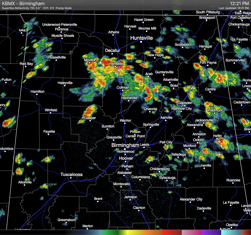
Showers and thunderstorms are continuing to push to the east-northeast across much of North/Central Alabama. A few storms are starting to diminish, while new ones are forming. One of the new storms that has recently formed is located just to the west-northwest of Jasper in Walker County. This heavy shower has really blossomed within the last 30 minutes, but no lightning is currently associated with it.
The heaviest storms on the radar at this time are located from Moulton in Lawrence County, to the east through Hartselle in Morgan County, and down into northeastern Winston County. Another strong storm is located in Northern Blount County in between Blountsville and Susan Moore.
More smaller showers are starting to develop along and north of the I-85 and US-80 corridors. These are light in nature and are moving to the east-northeast as well. At this time, no severe warning are in effect across the state.
Category: Alabama's Weather
About the Author (Author Profile)
Scott Martin is an operational meteorologist, professional graphic artist, musician, husband, and father. Not only is Scott a member of the National Weather Association, but he is also the Central Alabama Chapter of the NWA president. Scott is also the co-founder of Racecast Weather, which provides forecasts for many racing series across the USA. He also supplies forecasts for the BassMaster Elite Series events including the BassMaster Classic.Subscribe
If you enjoyed this article, subscribe to receive more just like it.


