

Radar Check at 1:30PM
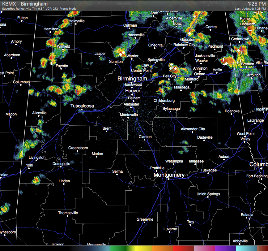
More showers and thunderstorms have formed over the western counties of Alabama, and these are slowly making their way to the east. Showers now stretch in an unorganized line from eastern Lauderdale County in North Alabama, back to the south and southwest through Lawrence, Marion, Lamar, Fayette, Tuscaloosa, Sumter, Greene, and Choctaw Counties.
The stronger storms that were located over the northern parts of the area have now pushed into the counties up in the northeastern corner of the state. Those stronger storms are lined up from Hazel Greene in Madison County, to the southeast through Marshall and Dekalb Counties, and ending in Etowah and Calhoun Counties.
A few more stronger thunderstorms out there at this time. A hefty storm was located over Fruithurst in Cleburne County. It will be pushing into Georgia with in the next 30-60 minutes. Another strong storm was located just north of Riverside in St. Clair County. It stretches down in Northwestern Talladega, and will soon move into Southwestern Calhoun County.
None of these storms are severe at this moment, but please seek shelter if you are in the path of any of these storms. Gusty winds up to 40 MPH, hail up to 1/2 inch in diameter, and dangerous lightning can be possible.
Category: Alabama's Weather
About the Author (Author Profile)
Scott Martin is an operational meteorologist, professional graphic artist, musician, husband, and father. Not only is Scott a member of the National Weather Association, but he is also the Central Alabama Chapter of the NWA president. Scott is also the co-founder of Racecast Weather, which provides forecasts for many racing series across the USA. He also supplies forecasts for the BassMaster Elite Series events including the BassMaster Classic.Subscribe
If you enjoyed this article, subscribe to receive more just like it.


