

Significant Weather Advisory – Central Fayette County Until 2:45 PM CDT
A Significant Weather Advisory has been issued for Central Fayette County until 2:45 PM CDT. A strong thunderstorm was located near Fayette, and it was moving east at 10 MPH. Hail of 1/2 inch in diameter and gusty winds of 40 MPH or greater could be possible with this storm. Locations in the path of this storm are listed below. Please seek shelter immediately.
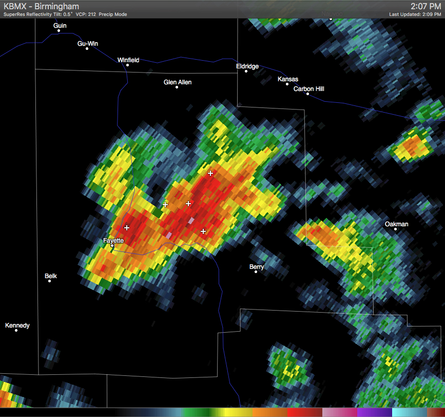
AT 208 PM CDT…DOPPLER RADAR WAS TRACKING A STRONG THUNDERSTORM NEAR
FAYETTE…MOVING EAST AT 10 MPH.
HALF INCH HAIL AND WINDS IN EXCESS OF 40 MPH WILL BE POSSIBLE WITH
THIS STORM.
LOCATIONS IMPACTED INCLUDE…
FAYETTE…BERRY…BANKSTON…FOWLERS CROSSROADS…RICHARD ARTHUR FIELD…
FAYETTE COUNTY PUBLIC LAKE…STONE WALL AND BEVILL STATE COLLEGE
FAYETTE.
PRECAUTIONARY/PREPAREDNESS ACTIONS…
TORRENTIAL RAINFALL IS ALSO OCCURRING WITH THIS STORM…AND MAY LEAD
TO LOCALIZED FLOODING. DO NOT DRIVE YOUR VEHICLE THROUGH FLOODED
ROADWAYS.
FREQUENT CLOUD TO GROUND LIGHTNING IS OCCURRING WITH THIS STORM.
LIGHTNING CAN STRIKE 10 MILES AWAY FROM A THUNDERSTORM. SEEK A SAFE
SHELTER INSIDE A BUILDING OR VEHICLE.
Category: Alabama's Weather
About the Author (Author Profile)
Scott Martin is an operational meteorologist, professional graphic artist, musician, husband, and father. Not only is Scott a member of the National Weather Association, but he is also the Central Alabama Chapter of the NWA president. Scott is also the co-founder of Racecast Weather, which provides forecasts for many racing series across the USA. He also supplies forecasts for the BassMaster Elite Series events including the BassMaster Classic.Subscribe
If you enjoyed this article, subscribe to receive more just like it.


