

Radar Check at 9:30PM – Cold Front Is Making Its Way Into North/Central Alabama
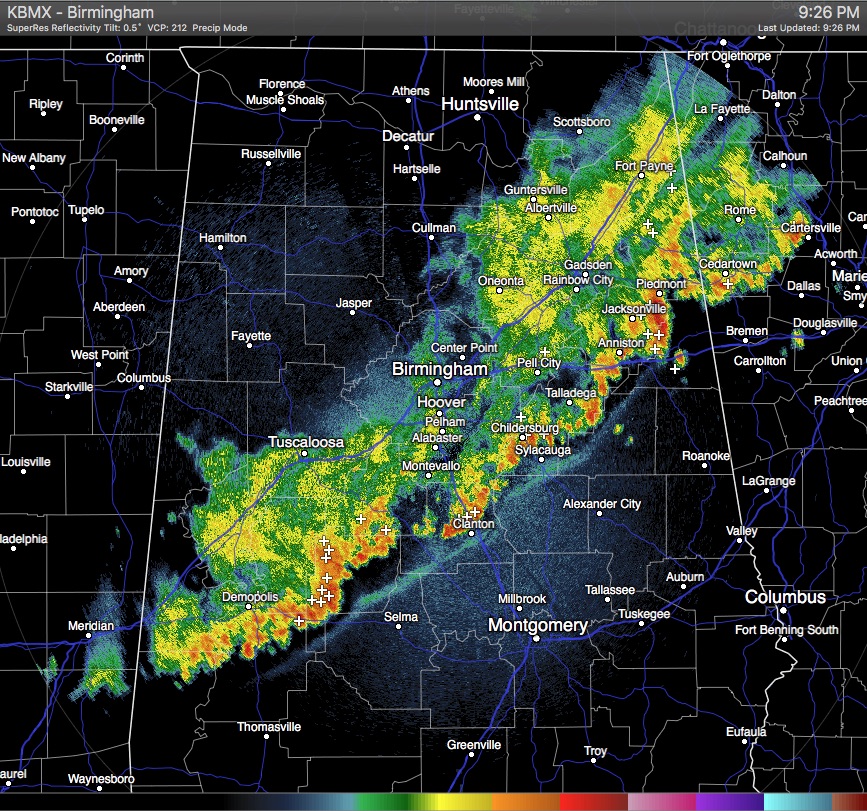
All of the stronger storms have now pushed their way east of the I-20 and I-59 corridors. The line now stretches from Piedmont to Anniston to Clanton to Demopolis. Behind that part of the line, only light to moderate rain is falling. Within the next 30 minutes, Tuscaloosa to Birmingham to Cullman to Scottsboro will be out of the rainfall.
Lightning is still prevalent in the southwestern part of the line in Perry, Marengo, and Choctaw. This part of the line has a bow echo look to it, so be mindful that strong, gusty winds are still possible.
Another secton of strong thunderstorms are located in Calhoun and Talladega Counties, about to push into Cleburne County. Heavy rain and possible gusty winds looks to be the main threat with this part of the line.
The line as a whole is starting to show breaks and is weakening in some parts. This trend should continue through the remainder of the evening and overnight hours. The rain should be completely out of our area by the 1:00 AM to 3:00 AM time frame. After that, skies will start to clear leading up to a fantastic day tomorrow.
Category: Alabama's Weather
About the Author (Author Profile)
Scott Martin is an operational meteorologist, professional graphic artist, musician, husband, and father. Not only is Scott a member of the National Weather Association, but he is also the Central Alabama Chapter of the NWA president. Scott is also the co-founder of Racecast Weather, which provides forecasts for many racing series across the USA. He also supplies forecasts for the BassMaster Elite Series events including the BassMaster Classic.Subscribe
If you enjoyed this article, subscribe to receive more just like it.


