

Thursday Midday Nowcast for North/Central Alabama
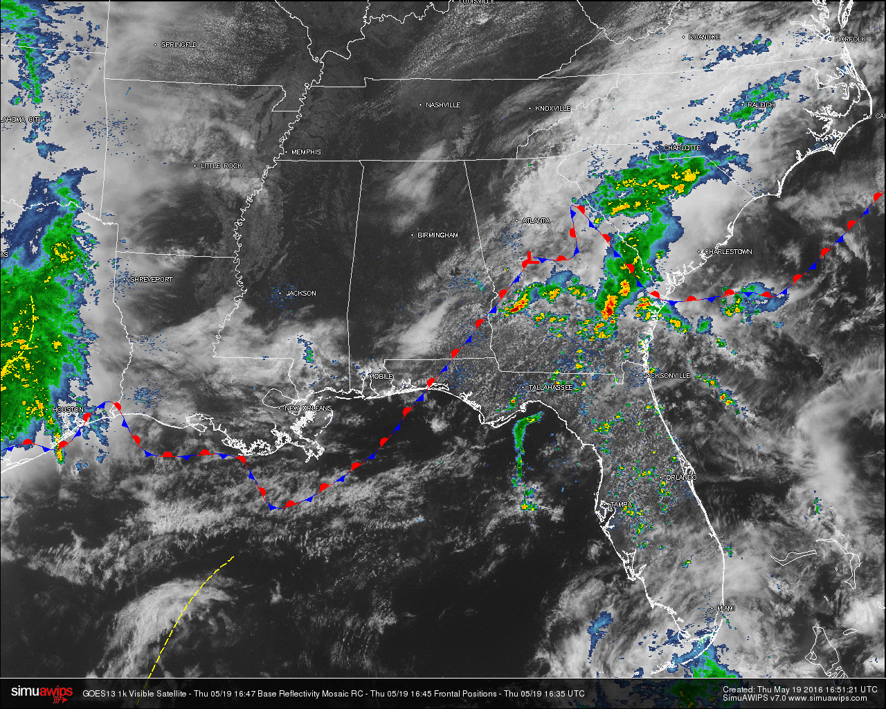
RADAR CHECK AT 12:00 PM: Skies across North/Central Alabama are mainly sunny except for this one mess of clouds covering the center of the area, from Jefferson County all the way north to the Alabama/Tennessee state line. Radar across the area at this moment is pretty quiet, except for a decent shower showing up just northwest of Opelika in Lee County. Other than that, its dry north of the US 82 and I-85 corridors. Most of the rain and thunderstorm activity in the southeastern states today is located in South/Central Georgia and up through much of South Carolina. Good news is that severe weather is not an issue as of now.
QUICK LOOK AT TEMPERATURES: You can definitely tell where the cloud cover is affecting the temperature at this hour. Most communities are into the upper 60s to 70s, with the warm spot in the state being Dothan at 81. Here is a list of temperature readings from across the state at this time:
Birmingham 70
Tuscaloosa 67
Muscle Shoals 66
Huntsville 64
Anniston 74
Alexander City 76
Montgomery 79
Dothan 81
Mobile 72
REST OF TODAY: Most communities in the area will have a mix of sun and clouds with high topping out in the low 80s. Any showers or thunderstorms that develop today will mainly be confined to the southern parts of the state. Even there, they should be widely scattered.
CLIMATOLOGY FOR BIRMINGHAM: The normal high temperature for May 19th in Birmingham is 82, while the normal low is 59. The record high of 98 was reached in 1962. The record low of 43 was set back in 1976.
FRIDAY: Tomorrow has the possibility to be a pretty active day across North/Central Alabama, as a disturbance will form on a surface front that will be draped over the southern parts of the state bringing rain and thunderstorms to the state. Right now, it appears that the main window for rain and storms will be from 8:00 AM to 8:00 PM, even though it is possible for some rain to fall earlier in the morning. The main risk for stronger storms will come during the afternoon and evening hours.

SEVERE WEATHER: We do note that the SPC has defined the standard “Slight Risk” for severe weather for the southern quarter of the state, with a “Marginal Risk” for nearly the rest of the state.In terms of the severe weather risk, there is no tight surface low, and wind fields are not especially strong. However, high resolution model data suggests surface based CAPE values could rise to near 3,000 j/kg over the southern two-thirds of the state by afternoon, and storm relative helicity values would be close to 200 m2/s2. But, there is some uncertainty due to the potential of an MCS (mesoscale convective system) near the Gulf Coast, and also the chance that morning rain could leave the atmosphere more stable than expected. The bottom line is that the main threat will come from hail and gusty straight line winds tomorrow afternoon. The tornado threat is low, but not zero.
HEADED TO THE BEACH: About 5 to 7 hours of sunshine today on the coast from Panama City Beach over to Gulf Shores with just a few scattered showers. Showers and storms are likely Friday and Friday night; this will be the one weather problem for the Hangout Music Festival at Gulf Shores. Then, the weekend looks nice with ample sunshine Saturday and Sunday. Highs on the immediate coast will be around 80 degrees. See a very detailed beach forecast here.
THE REGIONS TRADITION: The Regions Tradition continues at the Greystone Golf and Country Club through Sunday… Partly sunny today with a high near 82 degrees. Rain and storms are likely tomorrow; it won’t rain all day, but there could be a few strong storms involved; temperatures won’t get out of the 70s due to clouds and rain. Then, expect a beautiful weekend with ample sunshine Saturday and Sunday along with highs in the low 80s. Find out more information and purchase your tickets here.
SEC BASEBALL TOURNAMENT: Coming up at the Hoover Met May 24-29… the weather looks warm and dry Tuesday, then we will mention the risk of “scattered, mostly afternoon and evening showers and thunderstorms” for the rest of the week and the weekend, pretty typical weather for late May in Alabama. There could be a rain delay or two along the way, but at the moment we don’t see anything to suggest especially widespread rain. Highs will be in the 80s. Find out more information and purchase your tickets here.
WEATHERBRAINS: Don’t forget you can listen to our weekly 90 minute netcast anytime on the web, or on iTunes. This is the show all about weather featuring many familiar voices, including our meteorologists here at ABC 33/40. You can find it here.
Category: Alabama's Weather
About the Author (Author Profile)
Scott Martin is an operational meteorologist, professional graphic artist, musician, husband, and father. Not only is Scott a member of the National Weather Association, but he is also the Central Alabama Chapter of the NWA president. Scott is also the co-founder of Racecast Weather, which provides forecasts for many racing series across the USA. He also supplies forecasts for the BassMaster Elite Series events including the BassMaster Classic.Subscribe
If you enjoyed this article, subscribe to receive more just like it.


