Friday Midday Nowcast for Central Alabama
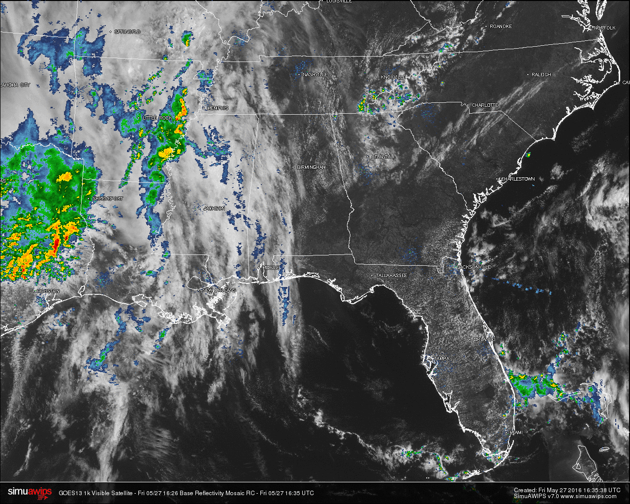
The latest visible satellite image for the state shows that most of the eastern half of the state is mostly sunny, with the western part of the state with partly to mostly cloudy skies. Currently there are no showers showing up on radar for any part of the state, and for most of us, it should remain that way throughout the rest of the day.
Once again, the active weather in the United States is located back over from Eastern Texas through Eastern Arkansas and Louisiana, and up in the central and northern plains states, up through Eastern Minnesota, Eastern Wisconsin, and some activity in Southern Illinois. As of right now, there are no severe weather watches or warnings in effect for the Contiguous U.S. We do note that the SPC has much of central Kansas and Oklahoma outlined in the standard “Slight Risk” for severe storms, with the main risks being from sporadic large hail and damaging wind gusts. Good news is that it appears to be a day where the risk for tornadoes will be lower than the previous.
QUICK LOOK AT TEMPERATURES: Temperatures at this time are already up in the 80s. The warm spot in the state is Montgomery at 86. Here is a list of temperature readings from across the state at this time:
Birmingham 85
Tuscaloosa 82
Muscle Shoals 82
Huntsville 85
Anniston 83
Alexander City 80
Montgomery 86
Dothan 82
Mobile 82
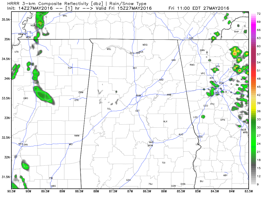
HRRR Simulated Radar valid through midnight tonight.
REST OF TODAY: A mix of sun and clouds throughout the remainder the day with just a very small risk of an isolated afternoon or evening shower or thunderstorm. The odds for any one place receiving any rainfall is small, and most places will remain dry. Afternoon highs for the Central Alabama area will be in the 87-92 range, and with the dewpoints around 60 today, it will feel a little less comfortable.
AIR QUALITY ALERT FOR BIRMINGHAM AREA: Today’s Air Quality Index will be in the CODE YELLOW (moderate) for ozone and particulate matter. Unusually sensitive people should consider limiting prolonged outdoor exertion.
CLIMATOLOGY FOR BIRMINGHAM: The normal high temperature for May 27th in Birmingham is 84, while the normal low is 61. The record high of 98 was reached in 1962. The record low of 42 was set back in 1961.
THE WEEKEND: A hot and humid weekend in store for Central Alabama, with partly to mostly sunny skies during the day, and fair nights. Only a 10-20% chance of showers and thunderstorms throughout the weekend, with the highest risk being tomorrow. Afternoon highs will be in the 87-92 degree range.
HEADED TO THE BEACH: Mostly sunny days, fair nights from Panama City Beach over to Gulf Shores through early next week; showers will be very hard, if not impossible to find. Highs will be in the low 80s on the immediate coast, with upper 80s to near 90 degrees inland. See a very detailed beach forecast here.
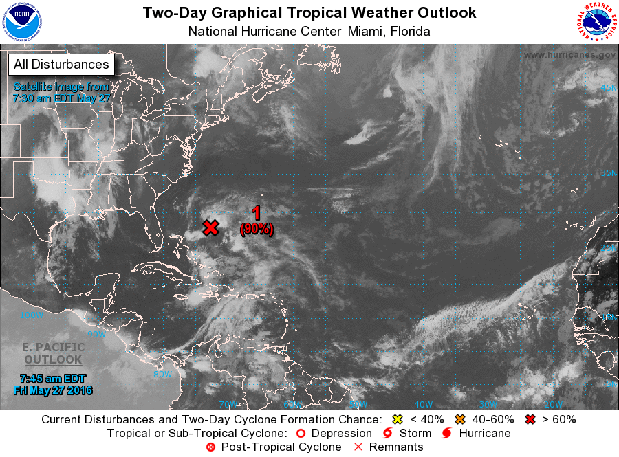
THE TROPICS: A sub-tropical storm is expected to form off the South Atlantic coast of the U.S. today or tomorrow; it will head for the coast of the Carolinas where breezy and wet weather is likely. No direct impact one way or another on Alabama or the Gulf Coast.
SEC BASEBALL TOURNAMENT: Afternoon highs will remain in the 87-90 degree range in Hoover through Sunday… only a few isolated afternoon showers around. Otherwise, mostly sunny days and fair nights… a great weekend for baseball at the Hoover Met. Get information about the big event here.
WEATHERBRAINS: Don’t forget you can listen to our weekly 90 minute netcast anytime on the web, or on iTunes. This is the show all about weather featuring many familiar voices, including our meteorologists at ABC 33/40. You can find it here.
Category: Alabama's Weather
About the Author (Author Profile)
Scott Martin is an operational meteorologist, professional graphic artist, musician, husband, and father. Not only is Scott a member of the National Weather Association, but he is also the Central Alabama Chapter of the NWA president. Scott is also the co-founder of Racecast Weather, which provides forecasts for many racing series across the USA. He also supplies forecasts for the BassMaster Elite Series events including the BassMaster Classic.Subscribe
If you enjoyed this article, subscribe to receive more just like it.


