Significant Weather Advisory – Southwestern Calhoun & Northeastern Talladega Counties Until 2:15 PM CDT
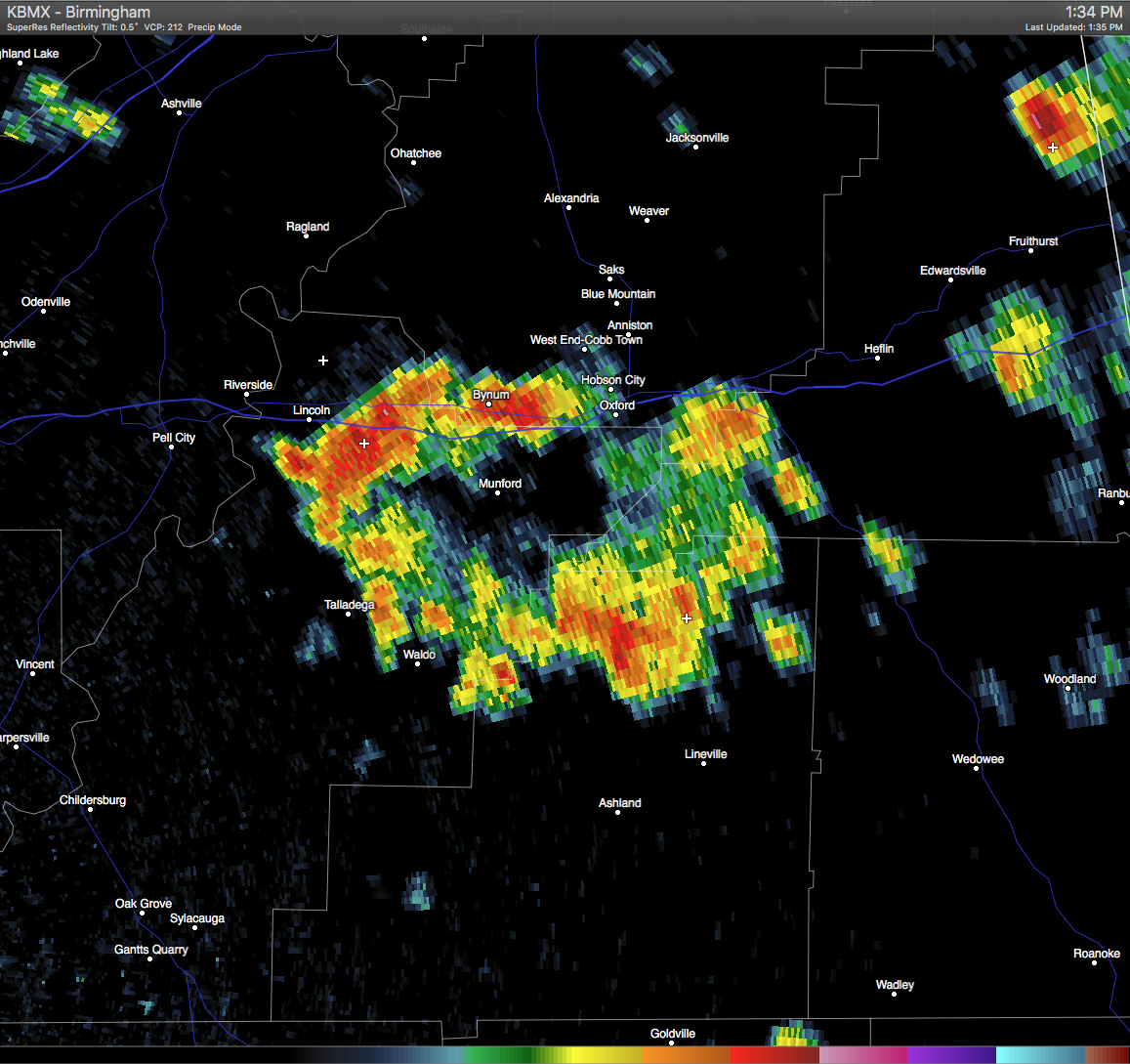
A Significant Weather Advisory has been issued for Southwestern Calhoun & Northeastern Talladega Counties until 2:15 PM CDT. A strong thunderstorm was located over Talladega Municipal Airport, and was moving northeast at 15 MPH. Pea size hail and wind gusts in excess of 40 MPH will be possible with this storm. If you are in the path of this storm, seek safe shelter until it has passed. Locations in the path are listed below.
ALZ019-027-011915-
CALHOUN AL-TALLADEGA AL-
130 PM CDT WED JUN 1 2016
…SIGNIFICANT WEATHER ADVISORY FOR SOUTHWESTERN CALHOUN AND
NORTHEASTERN TALLADEGA COUNTIES UNTIL 215 PM CDT…
AT 129 PM CDT…DOPPLER RADAR WAS TRACKING A STRONG THUNDERSTORM OVER
TALLADEGA MUNICIPAL AIRPORT…OR 10 MILES NORTH OF TALLADEGA…MOVING
NORTHEAST AT 15 MPH.
PEA SIZE HAIL AND WINDS IN EXCESS OF 40 MPH WILL BE POSSIBLE WITH
THIS STORM.
LOCATIONS IMPACTED INCLUDE…
ANNISTON…OXFORD…COBB TOWN…SAKS…WEST END-COBB TOWN…
LINCOLN…MUNFORD…OHATCHEE…HOBSON CITY…
TALLADEGA SUPERSPEEDWAY…OXFORD LAKE…BLUE MOUNTAIN…
TALLADEGA MUNICIPAL AIRPORT…GRANT TOWN…
ANNISTON REGIONAL AIRPORT…BYNUM…HONDA MANUFACTURING OF ALABAMA…
ALEXANDRIA…ANNISTON ARMY DEPOT AND JENIFER.
Category: Alabama's Weather, Severe Weather
About the Author (Author Profile)
Scott Martin is an operational meteorologist, professional graphic artist, musician, husband, and father. Not only is Scott a member of the National Weather Association, but he is also the Central Alabama Chapter of the NWA president. Scott is also the co-founder of Racecast Weather, which provides forecasts for many racing series across the USA. He also supplies forecasts for the BassMaster Elite Series events including the BassMaster Classic.Subscribe
If you enjoyed this article, subscribe to receive more just like it.


