Mostly Dry For Most of Central Alabama, Colin Brings Rain To SE Alabama
RADAR & SATELLITE CHECK
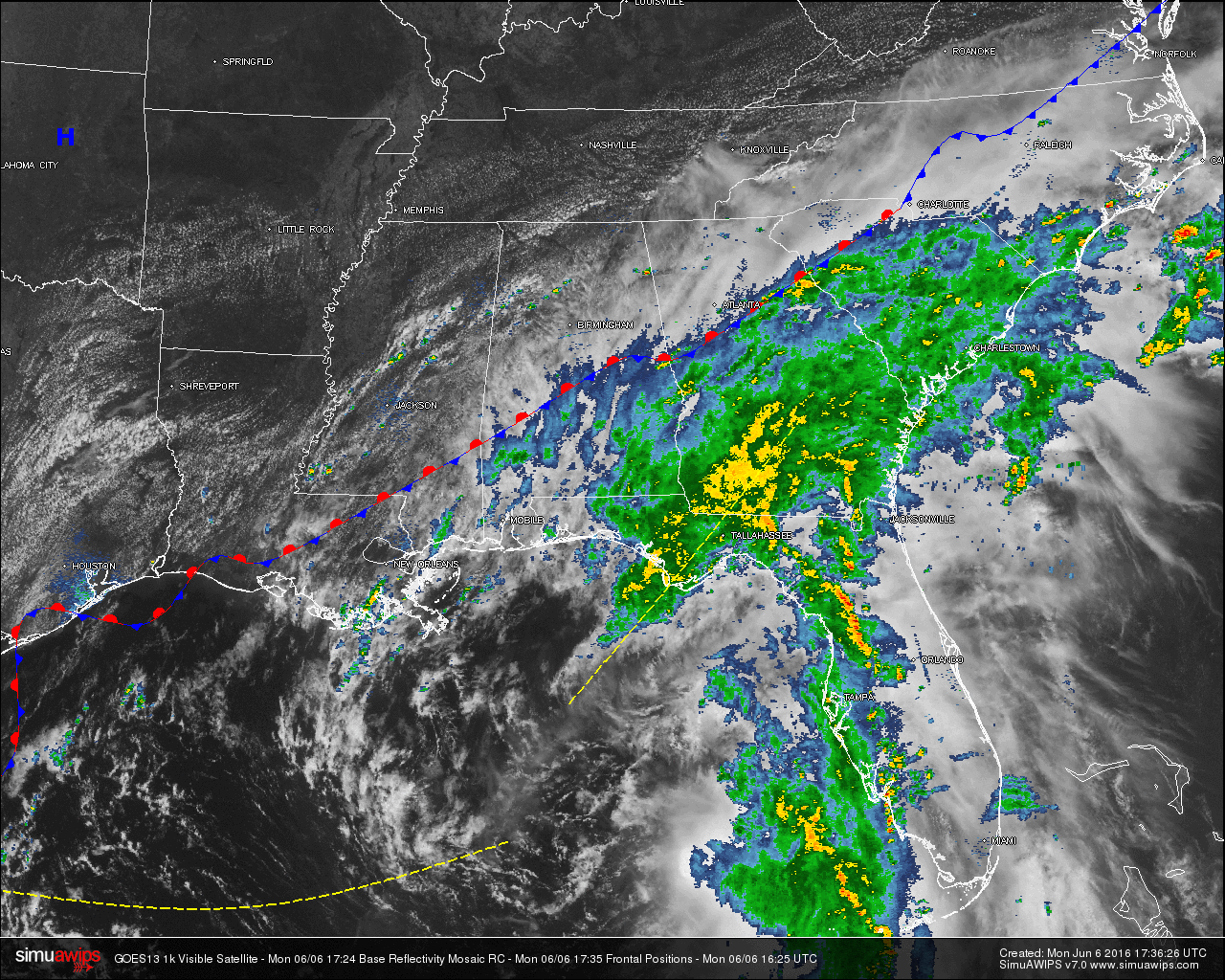
In Central Alabama, skies are mostly cloudy for areas south of I-20, while a mix of sun and clouds prevail north of that. Looking at radar, showers associated with the outer bands of Tropical Storm Colin have made their way into the southeastern parts of the state, but a few showers have started popping up north of I-20 as well. Parts of Marion, Lamar, Winston, Walker, and Cullman counties are being affected by some small showers that have developed within the last 15-20 minutes. These are pushing to the east slowly. Another shower has formed in northeastern Cherokee County, and is slowly moving to the east as well.
TEMPERATURES ACROSS THE AREA
With the cloud cover and some rainfall, temperatures have been held back a few degrees, as most of the reading are in the upper 70s to low 80s. Here is a list of readings form around the state:
Birmingham: 81
Tuscaloosa: 82
Anniston: 80
Muscle Shoals: 83
Huntsville: 82
Alexander City: 78
Montgomery: 84
Dothan: 76
Mobile: 78
REST OF TODAY
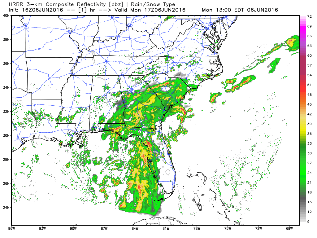
With the frontal boundary located over the southern part of the state trying to push its way to the south, and with the flow from Tropical Storm Colin beginning to block that process, a battle over the air masses will take place for at least the next 24 hours. A mix of sun and clouds for most areas north of the I-20 corridor with an isolated shower possible. South of that, the risk of showers and storms are greater, especially for areas in the southeastern part of the state. Afternoon highs will be in the low to mid 80s.
TODAY’S CLIMATOLOGY FOR BIRMINGHAM
The normal high for June 6th in Birmingham is 86F, and the normal low is 63F. The record high for this date, in Birmingham, was set back in 1977 at 98F. The record low of 53F was set back in 1998.
AIR QUALITY REPORT
Air quality index for the Birmingham metropolitan area for today is in the Moderate – Code Yellow range for ozone and particulate matter. Unusually sensitive people should consider limiting prolonged outdoor exertion.
TOMORROW
Mostly sunny skies and dry air begins to take over for a while in Central Alabama. Afternoon highs will be in the mid to upper 80s. Good news is that cooler air will start to push into the area during the evening hours tomorrow, and daytime highs for the next couple of days will be a tad cooler.
TROPICS
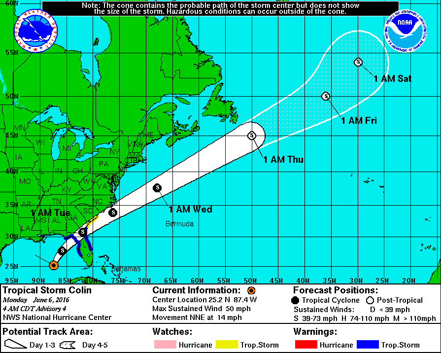
At the last update from the NHC, Tropical Storm Colin was located about 285 miles west-southwest of Tampa, FL, and about 225 southwest of Apalachicola, FL. Maximum sustained winds were at 50 MPH, and the movement was to the north-northeast at 16 MPH. The minimum central pressure was at 1004 mb, or 29.65 in. A turn to the northeast with an increase in northeastern motion is expected this afternoon, with an accelerated northeastern motion tonight through Tuesday. Landfall is expected on the Big Bend area of Florida sometime late this afternoon or early evening. The center is forecasted to move across Florida and southeastern Georgia during the day tomorrow and move out into the Atlantic by late tomorrow evening. Heavy rainfall with some flash flooding, coastal flooding and dangerous surf, and a few tornadoes could be expected across portions of Florida and southern Georgia.
WEATHERBRAINS
This is the show all about weather featuring many familiar voices, including our meteorologists at ABC 33/40. This week, the gang will entertain Gary Piltz, the meteorologist in charge at the NWS in Tulsa. Don’t forget you can listen to our weekly 90 minute netcast anytime on the web, or on iTunes. You can find it here.
Category: Alabama's Weather
About the Author (Author Profile)
Scott Martin is an operational meteorologist, professional graphic artist, musician, husband, and father. Not only is Scott a member of the National Weather Association, but he is also the Central Alabama Chapter of the NWA president. Scott is also the co-founder of Racecast Weather, which provides forecasts for many racing series across the USA. He also supplies forecasts for the BassMaster Elite Series events including the BassMaster Classic.Subscribe
If you enjoyed this article, subscribe to receive more just like it.


