Today Will Be Great, But Tomorrow Will Be Even Better
RADAR & SATELLITE CHECK
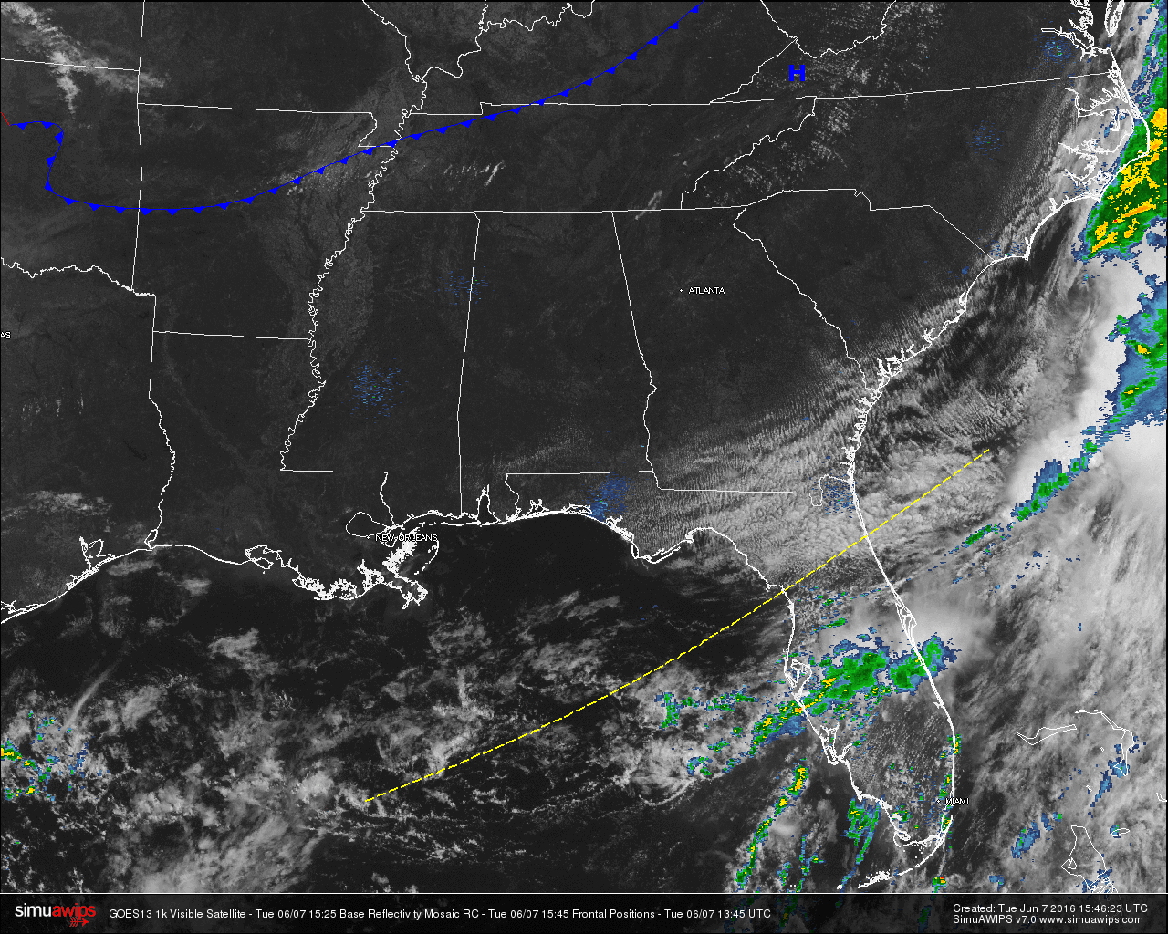
Skies across Central Alabama are crystal clear, and of course with a clear sky, that means that radar is clear as well. As a matter of fact, just about the whole southeastern United States is clear, except for remnant clouds hanging tough across the Atlantic Coast of the Carolinas, Georgia, and across the Florida Peninsula from Tropical Storm Colin. Most of the rainfall associated with Colin is offshore except for rain affecting the outer banks of North Carolina, and showers stretching across the Central Florida Peninsula.
TEMPERATURES ACROSS THE AREA
Most of the readings in Central Alabama are well up into the upper 70s. Here is a list of readings form around the state:
Birmingham: 78
Tuscaloosa: 79
Anniston: 76
Muscle Shoals: 78
Huntsville: 79
Alexander City: 78
Montgomery: 84
Dothan: 78
Mobile: 81
REST OF TODAY
With a drier airmass in place over Central Alabama, skies will be sunny and afternoon highs will be close to 90 degrees. A cooler airmass will make its way into the state tonight and will allow the overnight lows to drop down into the upper 50s for many places in the area.
TODAY’S CLIMATOLOGY FOR BIRMINGHAM
The normal high for June 7th in Birmingham is 86F, and the normal low is 64F. The record high for this date, in Birmingham, was set back in 1933 at 98F. The record low of 42F was set back in 1966.
AIR QUALITY REPORT
Air quality index for the Birmingham metropolitan area for today is in the Moderate – Code Yellow range for ozone. Unusually sensitive people should consider limiting prolonged outdoor exertion.
TOMORROW
Wow what a wonderful day in store for Central Alabama. It may be quite a while before we get another day like this. Sunny skies and lower humidity levels will make Wednesday feel comfortable, with afternoon highs in the mid 80s.
TROPICS
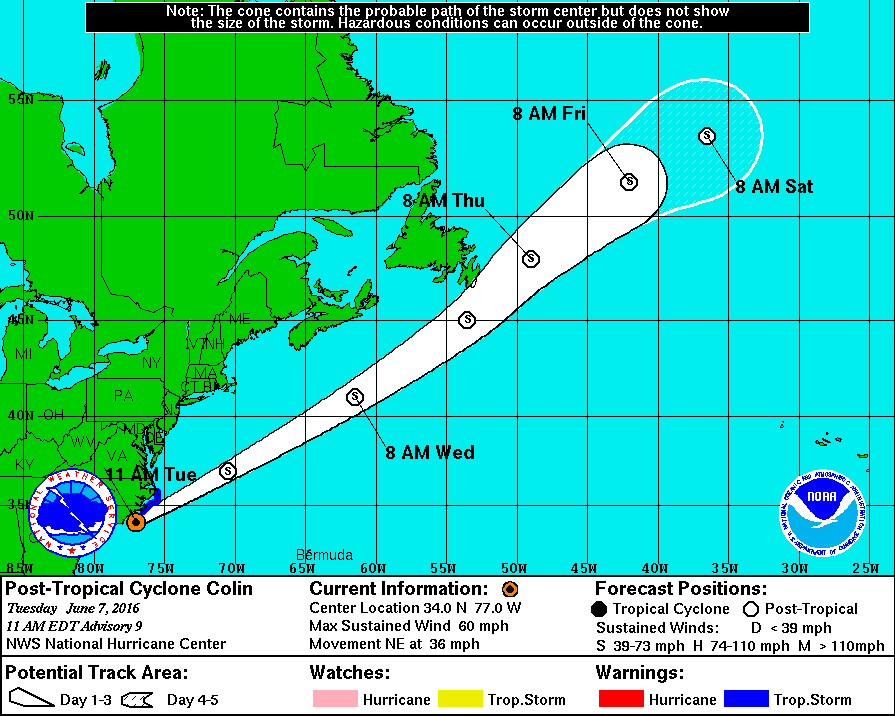
Colin has now become post-tropical, as it is quickly making its way off to the northeast and away from the U.S. Mainland. At latest report, the maximum sustained winds are 60 MPH, and the movement is to the northeast at 36 MPH, quickly becoming a “fish storm.” The rest of the Atlantic Basin is quiet.
WEATHERBRAINS
This is the show all about weather featuring many familiar voices, including our meteorologists at ABC 33/40. Don’t forget you can listen to our weekly 90 minute netcast anytime on the web, or on iTunes. You can find it here.
Category: Alabama's Weather
About the Author (Author Profile)
Scott Martin is an operational meteorologist, professional graphic artist, musician, husband, and father. Not only is Scott a member of the National Weather Association, but he is also the Central Alabama Chapter of the NWA president. Scott is also the co-founder of Racecast Weather, which provides forecasts for many racing series across the USA. He also supplies forecasts for the BassMaster Elite Series events including the BassMaster Classic.Subscribe
If you enjoyed this article, subscribe to receive more just like it.


