

Another Nice Day, But The Southern Oven Is About To Crank Up
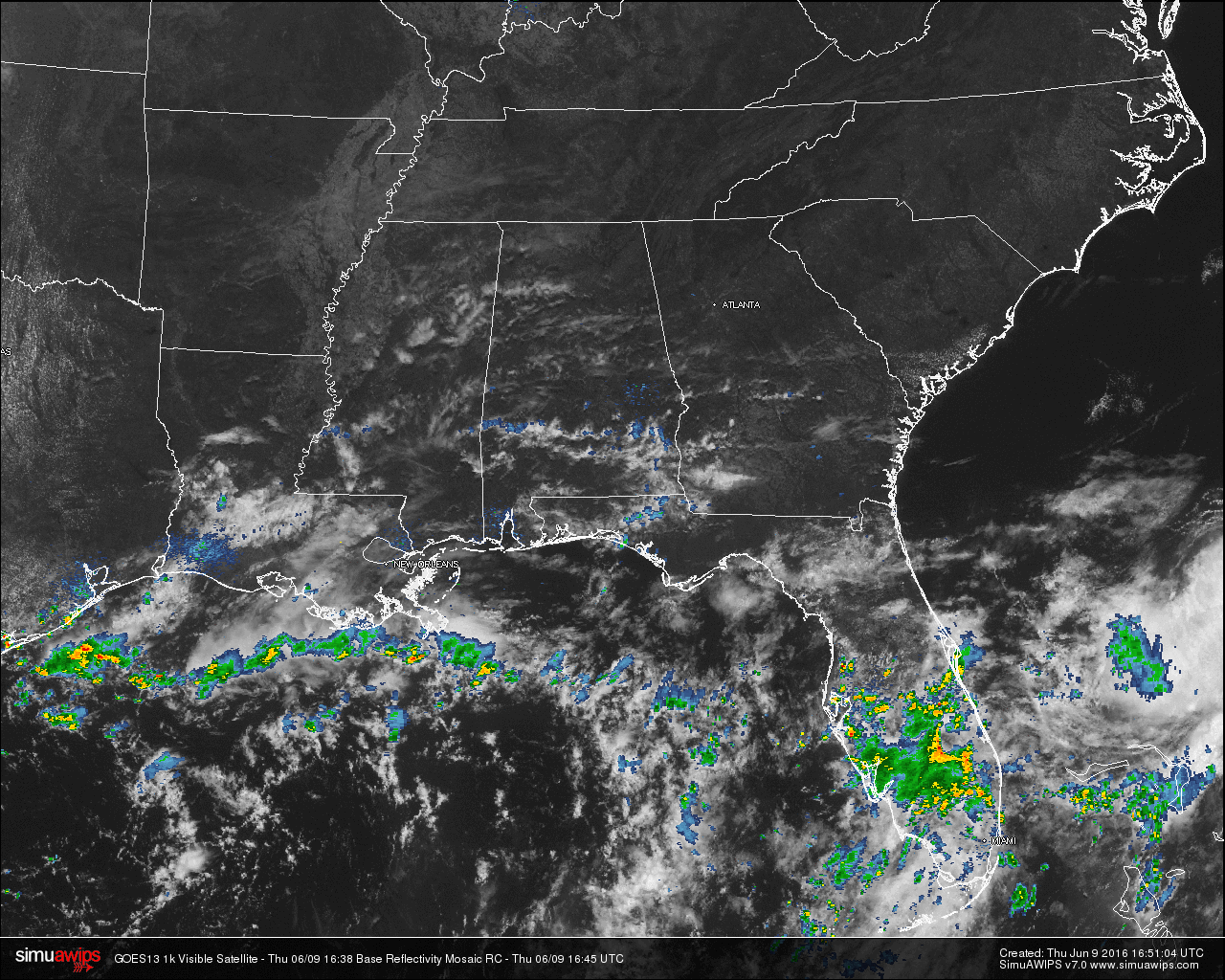
Another beautiful but warm day across Central Alabama at the noon hour. Skies across the area are currently mostly clear with just a few whispy cirrus clouds overhead. That also means that radar is clear for Central Alabama. The rest of the southeastern United States is mostly clear at this hour as well. The only organized activity to be found is located across the central and southern portions of the Florida Peninsula.
TEMPERATURES ACROSS THE AREA
Most of the readings in Central Alabama are in the low 80s, with the exception of Montgomery, which is at 86. Here is a list of readings form around the state:
Birmingham: 81
Tuscaloosa: 82
Anniston: 80
Muscle Shoals: 81
Huntsville: 81
Alexander City: 80
Montgomery: 86
Dothan: 82
Mobile: 84
REST OF TODAY
Skies will remain mostly clear for the rest of the day, with afternoon highs reaching at or just over 90 degrees in Central Alabama. Skies will be clear tonight and the overnight lows will be in the 60s.
TODAY’S CLIMATOLOGY FOR BIRMINGHAM
The normal high for June 9th in Birmingham is 87F, and the normal low is 64F. The record high for this date, in Birmingham, was set back in 1898 at 98F. The record low of 52F was set back in 1931.
CODE ORANGE AIR QUALITY ALERT
Air quality index for the Birmingham metropolitan area for today is in the Code Orange range for ozone. People with lung or heart disease, people who are active outdoors, and children and older adults should limit prolonged outdoor exertion.
TOMORROW
Mostly sunny skies with a few more cirrus clouds possibly forming during the afternoon hours. Afternoon highs should reach the upper 80s to the low 90s in some spots today for Central Alabama. Skies will be clear and overnight lows will be in the 60s.

TROPICS
The Atlantic Basin is quiet and tropical storm formation is not expected over the next five days..
HEADED TO THE BEACH
Mostly sunny weather continues along the Gulf Coast today from Panama City Beach over to Gulf Shores. Then, for tomorrow, Saturday, and Sunday, about 7 to 9 hours of sunshine daily with the risk of a few scattered showers and thunderstorms (pretty typical setup for summer). Highs on the immediate coast will be in the 80s, with low to mid 90s inland. See a very detailed Gulf Coast forecast here.
WEATHERBRAINS
This is the show all about weather featuring many familiar voices, including our meteorologists at ABC 33/40. Don’t forget you can listen to our weekly 90 minute netcast anytime on the web, or on iTunes. You can find it here.
Category: Alabama's Weather
About the Author (Author Profile)
Scott Martin is an operational meteorologist, professional graphic artist, musician, husband, and father. Not only is Scott a member of the National Weather Association, but he is also the Central Alabama Chapter of the NWA president. Scott is also the co-founder of Racecast Weather, which provides forecasts for many racing series across the USA. He also supplies forecasts for the BassMaster Elite Series events including the BassMaster Classic.Subscribe
If you enjoyed this article, subscribe to receive more just like it.


