Midday Nowcast: Mostly Clear Now, Storms Expected to Develop Later Today
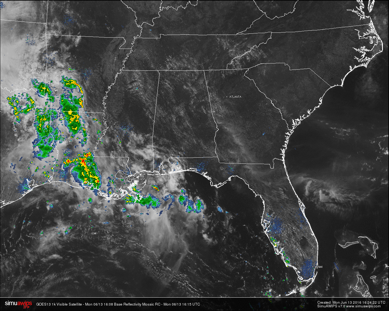
Across Central Alabama at this hour, skies are mostly clear with a few cumulus clouds floating around. The state of Alabama is dry as this moment on radar, with the most active weather in the southeastern United States located back in Louisiana, Arkansas and Texas. That will change later this afternoon and evening as scattered convective showers and thunderstorms will form.
TEMPERATURES ACROSS THE AREA
Most of the readings in Central Alabama are up in the 80s, with the warm spots being Montgomery and Dothan at 89. Here is a list of readings form around the state:
Birmingham: 86
Tuscaloosa: 88
Anniston: 84
Muscle Shoals: 86
Huntsville: 87
Alexander City: 88
Montgomery: 89
Dothan: 89
Mobile: 82
REST OF TODAY
With a moist and unstable airmass across Central Alabama, it will be a classic summer day for the area. Skies will be mostly clear, but clouds will build in the area due to convection, and scattered showers and thunderstorms will develop later this afternoon. Chance for any one spot getting rain today is one in three, and some of the storms could be strong.
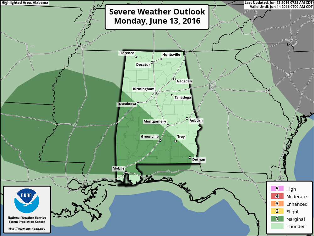
We do note that the SPC has defined a good part of the southwestern part of Alabama in a “Marginal Risk” for severe storms. Be mindful that summertime thunderstorms in Alabama usually have plenty of cloud-to-ground lightning. When thunder roars, go indoors.
TODAY’S CLIMATOLOGY FOR BIRMINGHAM
The normal high for June 10th in Birmingham is 87F, and the normal low is 65F. The record high for this date, in Birmingham, was set back in 1971 at 98F. The record low of 51F was set back in 1995.
AIR QUALITY
Air quality index for the Birmingham metropolitan area for today is in the Code Green (good) range for ozone and particulate matter.
TOMORROW
Tuesday should offer higher coverage of scattered showers and storms thanks to a weak upper trough approaching Alabama from the west. Still, it won’t rain everywhere, but most communities stand a good chance of getting some rain at times. Best chance of showers and thunderstorms will come during the afternoon and evening hours, but we can’t rule out a late night or morning shower. Afternoon highs should be in the 88-91 degree range with a mix of sun and clouds away from the storms.
HEADED TO THE BEACH
We project about 5 to 7 hours of sunshine each day this week from Gulf Shores to Panama City Beach; scattered showers and storms remain possible on a daily basis. Highs will be mostly in the 80s, with low 90s possible inland. The sea water temperature early this morning at the Dauphin Island Sea Lab is 84 degrees. See a very detailed Gulf Coast forecast here.
TROPICS
The Atlantic Basin is quiet and tropical storm formation is not expected over the next five days..
THIS DAY IN WEATHER HISTORY
On June 13, 1984, snow plows had to be called out in Denver as softball sized hail covered the ground after falling from severe thunderstorms. Car windows were smashed and holes were left as the hail ripped through the metal of the cars. A total of over 5 inches of rain fell and left parts of the area under 6 feet of water.
WEATHERBRAINS
This is the show all about weather featuring many familiar voices, including our meteorologists at ABC 33/40. Don’t forget you can listen to our weekly 90 minute netcast anytime on the web, or on iTunes. You can find it here.
Category: Alabama's Weather
About the Author (Author Profile)
Scott Martin is an operational meteorologist, professional graphic artist, musician, husband, and father. Not only is Scott a member of the National Weather Association, but he is also the Central Alabama Chapter of the NWA president. Scott is also the co-founder of Racecast Weather, which provides forecasts for many racing series across the USA. He also supplies forecasts for the BassMaster Elite Series events including the BassMaster Classic.Subscribe
If you enjoyed this article, subscribe to receive more just like it.


