

Midday Nowcast: Mostly Clear and Hot, Strong Widely Scattered Storms Possible Later Today
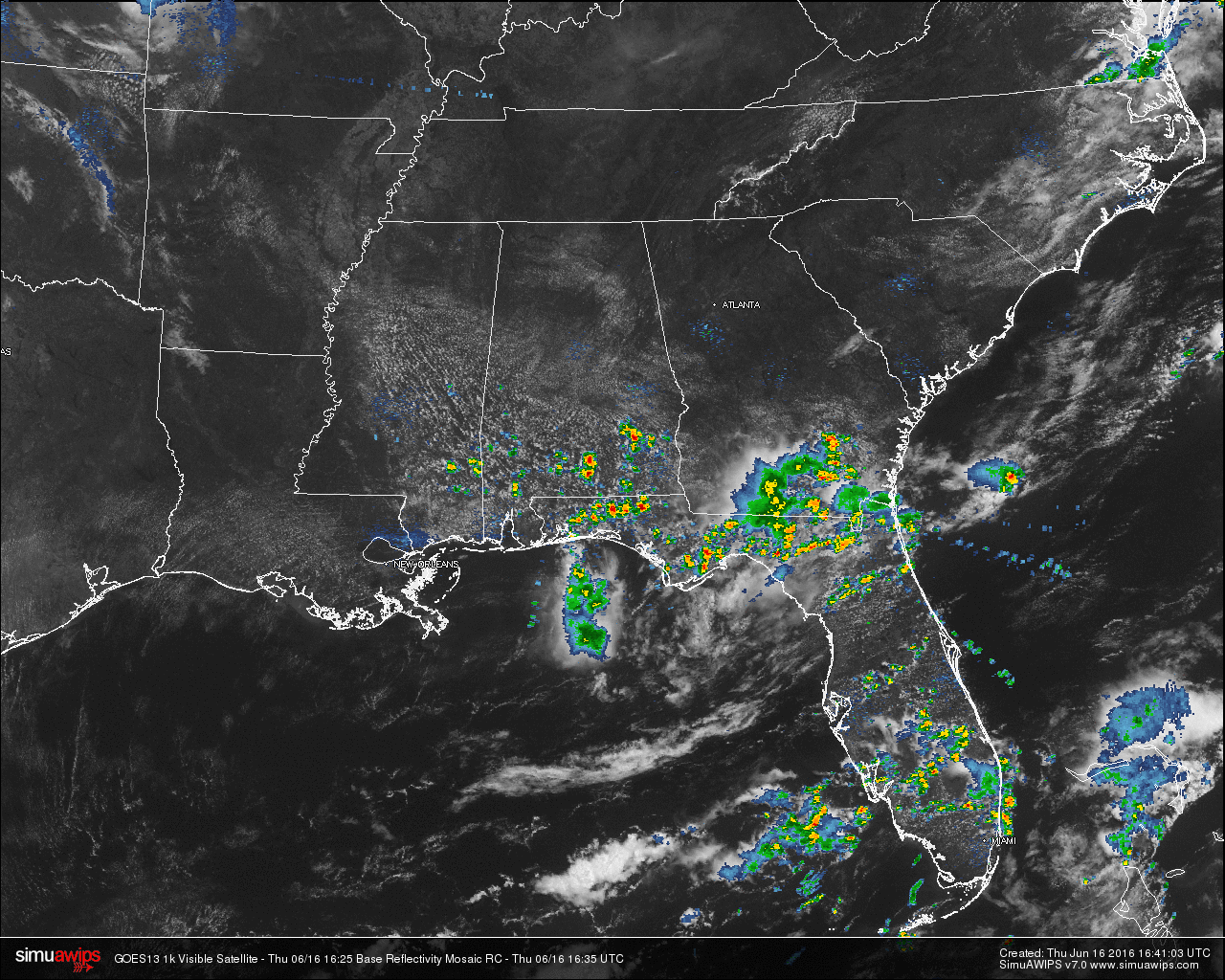
For Central Alabama at this midday hour, skies are mostly clear and there are no showers currently north of the I-85 and US 80 corridors. Shower and thunderstorm activity in the state at this moment is down in the southern parts of the state.
TEMPERATURES ACROSS THE AREA
Most reporting locations are in the 80s across the area. The warm spot at this hour is Montgomery at 85. Here is a list of readings form around the state:
Birmingham: 82
Tuscaloosa: 82
Gadsden: 81
Anniston: 80
Muscle Shoals: 85
Huntsville: 84
Cullman: 82
Alabaster: 81
Alexander City: 81
Montgomery: 85
Auburn: 83
REST OF TODAY
Skies should remain mostly sunny to partly cloudy for the remainder of the day. The air will start to become unstable this afternoon, and widely scattered showers and storms will begin to develop. Many places will not see rain today, but where they do develop, there is a potential for wet microbursts (localized areas of damaging straight line winds) and copious amounts of dangerous of cloud-to-ground lightning. Afternoon highs will be in the mid 90s.
TODAY’S CLIMATOLOGY FOR BIRMINGHAM
The normal high for June 16th in Birmingham is 88F, and the normal low is 66F. The record high for this date, in Birmingham, was set back in 1952 at 99F. The record low of 47F was set back in 1917.
TOMORROW
A surface boundary will push into the state during the afternoon, and with temperatures up in the mid 90s, the air will be unstable and once again we will have the risk of scattered, strong thunderstorms. It won’t rain everywhere, but where storms develop they could become strong to severe, with potential for wet microbursts. SPC has the standard “slight risk” of severe weather up for parts of Central and South Alabama, with a “marginal risk” for the rest of the state tomorrow.
HEADED TO THE BEACH
About 5 to 7 hours of sunshine today and tomorrow along the coast from Gulf Shores over to Panama City Beach with scattered thunderstorms. Then, for the weekend, expect increasing amounts of sunshine and fewer showers as dry air drops southward. Highs will be in the upper 80s along the immediate coast, with low 90s inland. See a very detailed Gulf Coast forecast here.
TROPICS
Just a slight risk of some slow development over the far Southwest Gulf of Mexico over the next five days, otherwise the Atlantic basin remains very quiet.
THIS DAY IN WEATHER HISTORY
On June 16, 1944, a tornado decided to be odd and travel a weird course in Sioux City, Iowa. It remained stationary in one spot for about twenty minutes, made a u-turn, traveled southeast for a few miles, then turned south, then east, then north, and finally back to the east again.
WEATHERBRAINS
This is the show all about weather featuring many familiar voices, including our meteorologists at ABC 33/40. Don’t forget you can listen to our weekly 90 minute netcast anytime on the web, or on iTunes. You can find it here.
Category: Alabama's Weather
About the Author (Author Profile)
Scott Martin is an operational meteorologist, professional graphic artist, musician, husband, and father. Not only is Scott a member of the National Weather Association, but he is also the Central Alabama Chapter of the NWA president. Scott is also the co-founder of Racecast Weather, which provides forecasts for many racing series across the USA. He also supplies forecasts for the BassMaster Elite Series events including the BassMaster Classic.Subscribe
If you enjoyed this article, subscribe to receive more just like it.


