

Midday Nowcast: Unsettled Pattern Continues, May Not Need To Water Garden
AT THIS HOUR: A mix of sun and clouds across Central Alabama currently. Temperatures at this time are cooler than what you would expect for a typical mid-July day thanks to rainfall from the past few days. Fortunately, my wife has been well-pleased that her garden has received the rainfall needed so she didn’t have to stretch the garden hose out to the back yard (hoping Bill Murray has had the same luck with rainfall for his garden). I’m happy because that helps my wallet when it comes to the water bill.

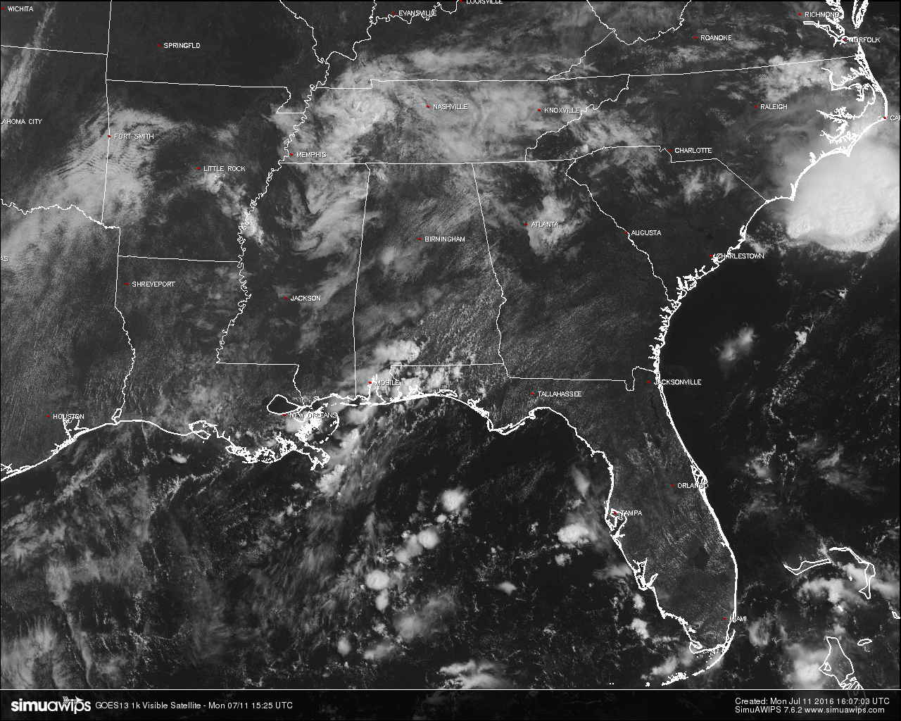
RADAR CHECK: Isolated showers and thunderstorms at this time are mostly confined to southernmost counties of the area, but that will probably change within a few hours as the daytime heating reaches its maximum and convection starts firing.
TEMPERATURES AT THIS HOUR: As mentioned earlier in the post, the air is cooler than usual for this time of year. Don’t let it fool you though. It will still get hot out there today, especially with dewpoints in the 70s, it will feel muggy. Here is a list of temperature observations from across the state:
Birmingham 79
Tuscaloosa 74
Gadsden 78
Anniston 82
Cullman 79
Decatur 78
Huntsville 81
Muscle Shoals 78
Alexander City 80
Montgomery 82
WHAT TO EXPECT FOR MONDAY: Unsettled weather for another day as a weakness in the upper air pattern is continuing to hover near the area. With partly cloudy skies and thunderstorms expected, temperatures will be held back into the upper 80s to just above 90, a little relief from the heat. Not everyone will get rain today, but odds for any one spot getting rain today is 50/50.
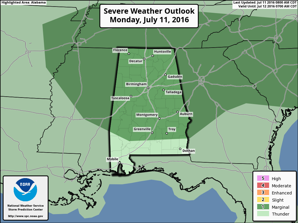
Unfortunately there will be a risk for a few strong to severe storms out there. Just about the whole state, minus the extreme southern counties in Alabama, has been defined in a “Marginal Risk” for severe storms throughout the daytime and evening hours, with the main threats being from strong winds associated with wet microbursts, very heavy rainfall, and dangerous cloud-to-ground lightning. With PWAT values in the 1.5 to 2.0 inch range, rainfall could be heavy and localized areas of flash flooding could be possible.
CODE GREEN AIR QUALITY: The Air Quality Index for the Birmingham Metropolitan Area will be in the “Code Green” for both ozone and particulate matter 2.5. No action needed today.
TODAY’S CLIMATOLOGY FOR BIRMINGHAM: The normal high for July 11th is 90, while the normal low is 70. The record high for today was set back in 1930 at 105. The record low was set back in 1952 at 56.
TUESDAY’S WEATHER: Not much change in the forecast from today to tomorrow. Partly to mostly cloudy skies with a scattered showers and thunderstorms. Once again, a few storms could be strong and dangerous cloud-to-ground lightning can be expected as with any typical summertime thunderstorm. Highs will once again be in the upper 80s to just over 90.
HEADED TO THE BEACH: About 8 to 10 hours can be expected daily from Fort Morgan all the way over to Panama City Beach through early next week. Just the normal risk of an isolated thunderstorm each day, with highs in the upper 80s to near 90 on the coast, with low to mid 90s inland. Sea water temperatures are mostly in the mid to upper 80s. See a very detailed Gulf Coast forecast here.
THE TROPICS: The tropical Atlantic is quiet for now, with no new tropical cyclone development expected during the next five days.
ON THIS DAY IN 1988: Southern Texas experienced heavy rainfall from thunderstorms. High totals were reported all over the area, with Medina reporting up to 13 inches of rainfall. West of the town of Hunt, two men drowned when their pick-up truck was swept into the Guadalupe River.
WEATHERBRAINS: This is the show all about weather featuring many familiar voices, including our meteorologists at ABC 33/40. You can listen anytime on the web, or on iTunes. You can find it here.
ADVERTISE WITH US: Deliver your message to a highly engaged audience by advertising on the AlabamaWX.com website. The site enjoyed 10.2 MILLION pageviews in the past 12 months. Don’t miss out! We can customize a creative, flexible and affordable package that will suit your organization’s needs. Contact Bill Murray at (205) 687-0782.
Category: Alabama's Weather
About the Author (Author Profile)
Scott Martin is an operational meteorologist, professional graphic artist, musician, husband, and father. Not only is Scott a member of the National Weather Association, but he is also the Central Alabama Chapter of the NWA president. Scott is also the co-founder of Racecast Weather, which provides forecasts for many racing series across the USA. He also supplies forecasts for the BassMaster Elite Series events including the BassMaster Classic.Subscribe
If you enjoyed this article, subscribe to receive more just like it.


