

Sun, Heat, Storms
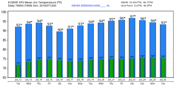
MUST BE JULY IN ALABAMA: Weather maps this morning are showing the classic July pattern. The main band of westerly winds aloft, or what most call the “jet stream”, is over the far northern part of the continental U.S., and down our way we have an upper ridge in place. There is a weak upper trough over Tennessee that is in the process of losing it’s identity. This will mean standard mid-summer weather for our state through the rest of the week. A good supply of morning sunshine, followed by scattered, mostly afternoon and evening showers and thunderstorms. Best chance of a passing storm will come from about 2:00 until 8:00 p.m., and the chance of any one spot getting wet is in the 25-30 percent range. Afternoon highs will be mostly in the 90-93 degree range, right at seasonal averages.
THE WEEKEND: Some chance the coverage of scattered storms will be a tad higher by Friday and the weekend thanks to a weak surface boundary north of us, but the overall idea remains the same. Partly sunny, hot, humid days with mostly afternoon and evening showers and storms in scattered spots. Highs remain between 90 and 93 degrees. We just don’t have big weather changes this time of the year unless there is a tropical system involved.
NEXT WEEK: Global models continue to strongly suggest a nasty 6000 meter 500 mb upper high will form over the center of the nation, representing some big time heat. Thankfully we will be just on the periphery of that upper high, meaning the weather probably won’t change much. Hot, humid days, scattered showers and storms. Highs mostly in the 90s. See the Weather Xtreme video for maps, graphics, and more details.
TROPICS: A large mass of dry air coming off the Africa deserts covers the Atlantic basin, meaning tropical storm formation isn’t expected anytime soon.
AT THE BEACH: About 7 to 9 hours of sunshine daily on the coast from Panama City Beach over to Gulf Shores through the weekend, with the continued chance of a passing thunderstorm from time to time. Highs 87-90 on the immediate coast, with low to mid 90s inland. See a very detailed Gulf Coast forecast here.
WEATHER BRAINS: Don’t forget you can listen to our weekly 90 minute netcast anytime on the web, or on iTunes. This is the show all about weather featuring many familiar voices, including our meteorologists here at ABC 33/40. Scroll down for the show notes for the new episode we recorded last night.
CONNECT: You can find me on all of the major social networks…
Facebook
Twitter
Google Plus
Instagram
I will be speaking to a senior adult group today at First United Methodist Church in Roanoke… look for the next Weather Xtreme video here by 4:00 this afternoon. Enjoy the day!
Category: Alabama's Weather
About the Author (Author Profile)
James Spann is one of the most recognized and trusted television meteorologists in the industry. He holds the AMS CCM designation and television seals from the AMS and NWA. He is a past winner of the Broadcast Meteorologist of the Year from both professional organizations.Subscribe
If you enjoyed this article, subscribe to receive more just like it.


