Midday Nowcast: Scattered Storms Again Today
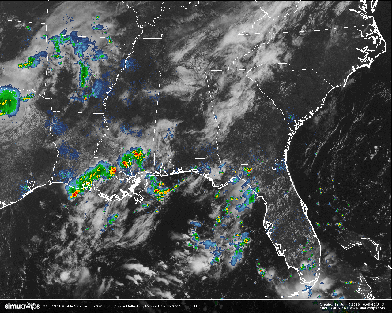
A mix of sun and clouds out there for Central Alabama at this hour. Wherever the clouds are hiding the sunshine, temperatures are being held back from where they would be normally. The only reading out of the 70s at this time is the Birmingham International Airport at 80. Only a few dying showers are showing up in Wilcox, Marengo, and Clarke counties. These are moving to the northeast, but with the latest radar trend, they may dissipate completely in about 30 minutes or so.
TEMPERATURES AT THIS HOUR: As I said earlier, cloud cover is really holding back the heat. Here is a list of temperature observations from across the state:
Birmingham 80
Tuscaloosa 75
Gadsden 79
Anniston 77
Cullman 75
Decatur 76
Huntsville 77
Muscle Shoals 79
Alexander City 75
Montgomery 79
WHAT TO EXPECT FOR TODAY: A mix of sun and clouds out there today for Central Alabama, with a risk for scattered showers and thunderstorms. Just like James said in his morning post, the latest HRRR run is showing less coverage in the shower activity. Summertime convection is a great mystery. Anybody who can develop an algorithm to correctly predict summertime convective thunderstorms will make instant millions. Afternoon highs will be in the upper 80s to the low 90s for the area. I believe the better chance for showers and storms will be along and south of the I-59 corridor.
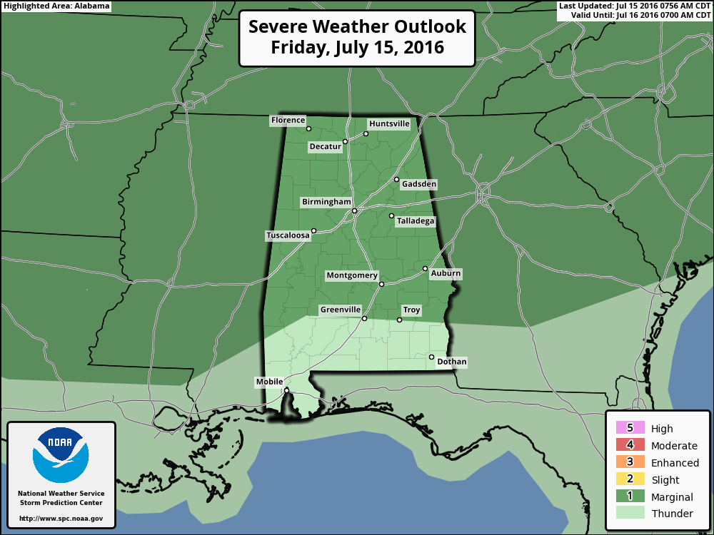
Any storms that develop today could pack a punch, and the SPC has defined the northern three quarters of the state in a “marginal risk” for severe storms. The main risks will be from wet microbursts, dangerous cloud-to-ground lightning, and for some small hail.
CODE GREEN AIR QUALITY: The Air Quality Index for the Birmingham Metropolitan Area will be in the “Code Green” for both ozone and particulate matter 2.5. No actions to take.
TODAY’S CLIMATOLOGY FOR BIRMINGHAM: The normal high for July 15th is 91, while the normal low is 70. The record high for today was set back in 1980 at 102. The record low was set back in 1967 at 51.
THE WEEKEND WEATHER: Not much change tomorrow; the general weakness in the summer ridge persists, and we will have mixed sun and clouds with the risk of scattered, mostly afternoon and evening showers and thunderstorms. The high will be in the 89-92 degree range for most places. Then, on Sunday, storms should be fewer in number as the ridge begins to grow stronger, and temperatures rise into the mid 90s.
HEADED TO THE BEACH: Not much change; pretty standard weather for the coast from Panama City Beach over to Gulf Shores through next week. About 7 to 9 hours of sunshine daily, with a passing storm from time to time. Highs on the immediate coast 87-90, with low to mid 90s inland. See a very detailed Gulf Coast forecast here.
THE TROPICS: The Atlantic basin remains very quiet, and tropical storm formation is not expected through the next five days.
WEATHERBRAINS: This is the show all about weather featuring many familiar voices, including our meteorologists at ABC 33/40. You can listen anytime on the web, or on iTunes. You can find it here.
ADVERTISE WITH US: Deliver your message to a highly engaged audience by advertising on the AlabamaWX.com website. The site enjoyed 10.2 MILLION pageviews in the past 12 months. Don’t miss out! We can customize a creative, flexible and affordable package that will suit your organization’s needs. Contact Bill Murray at (205) 687-0782.
Category: Alabama's Weather
About the Author (Author Profile)
Scott Martin is an operational meteorologist, professional graphic artist, musician, husband, and father. Not only is Scott a member of the National Weather Association, but he is also the Central Alabama Chapter of the NWA president. Scott is also the co-founder of Racecast Weather, which provides forecasts for many racing series across the USA. He also supplies forecasts for the BassMaster Elite Series events including the BassMaster Classic.Subscribe
If you enjoyed this article, subscribe to receive more just like it.


