Watching the Radar
During the morning hours, showers and storms began to develop across portions of Alabama and these are going to continue to expand in coverage the next several hours.
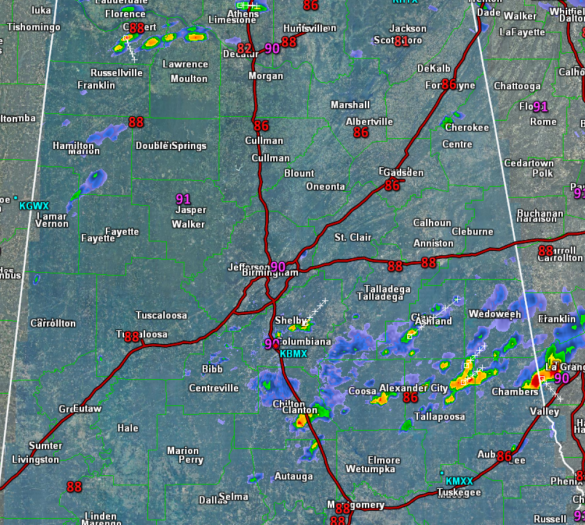
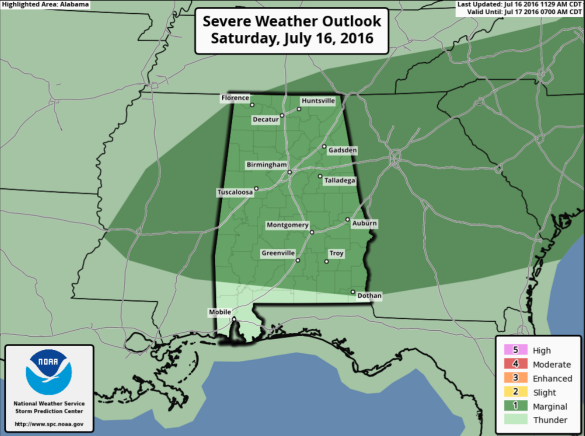
There is the possibility of a few strong storms and once again today, the SPC has a “marginal risk” of severe storms defined for nearly the entire state of Alabama. The main threat will come from wet microbursts (small scale areas of strong straight line winds) and small hail.
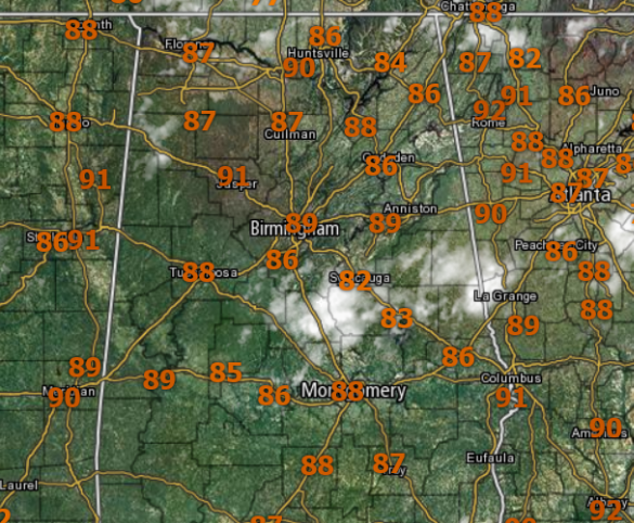
All summer storms pack tremendous amounts of lightning and of course intense rainfall which could lead to some areas of isolated flash flooding. Where there are no storms, we are seeing a more sun than clouds, with temperatures into the upper 80s and lower 90s in many spots.
For tonight, we will gradually see the convection wind down as the sun sets and daytime heating is loss. It will then become partly cloudy, with some areas of patchy fog, especially after midnight in locations that see rain today. Lows will be in the lower to mid-70s for most locations.
Tomorrow we will begin to see the ridge influence our weather as the overall convective coverage decreases, and actually the best chance of storms will over eastern portions of the state. Still, storms will be possible at just about any spot across the state. Highs tomorrow will be in the lower to perhaps mid 90s.
Category: Alabama's Weather
About the Author (Author Profile)
Macon, Georgia Television Chief Meteorologist, Birmingham native, and long time Contributor on AlabamaWX. Stormchaser. I did not choose Weather, it chose Me. College Football Fanatic. @Ryan_StinnetSubscribe
If you enjoyed this article, subscribe to receive more just like it.


