Midday Nowcast: Hot, Humid, Scattered Storms
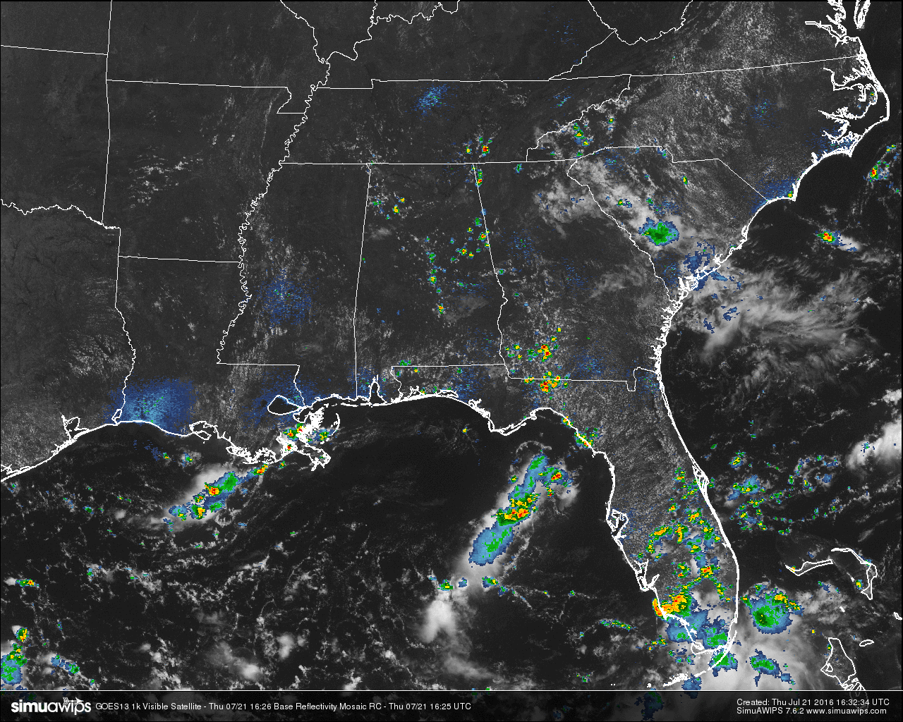
Across Central Alabama at this hour, mostly clear skies for most of the area on satellite, but we do have some convective clouds with rain associated with them. There are a few scattered showers and storms already forming at this time. Just while I was typing this entry, the radar has started to be dotted with showers and storms. Most of the activity right now is located east of I-65 and south of I-59 in east Alabama. There is another concentration of showers and storms in the northwestern counties of Marion and Winston. These are drifting to the southeast.
TEMPERATURES AT THIS HOUR: Heat is building as we start to reach the daytime maximum temperatures for the day across the area. Here is a list of temperature observations from across the area:
Birmingham 91
Tuscaloosa 89
Gadsden 90
Anniston 89
Cullman 91
Hamilton 91
Clinton 91
Alexander City 90
Montgomery 93
WHAT TO EXPECT FOR TODAY: Skies will be partly to mostly sunny throughout the remainder of the day, with a small risk of a scattered afternoon shower or thunderstorm. The SPC still has the much of the southeastern part of the state defined in a “Marginal Risk” for severe storms. Strong winds from wet microbursts and dangerous cloud-to-ground lightning will be the main threats. Afternoon highs will be in the mid to upper 90s, with the possibility of a few spots hitting 100. Heat index readings will be over 100, so use common sense while outside today.
CODE YELLOW AIR QUALITY: The Air Quality Index for the Birmingham Metropolitan Area will be in the “Code Yellow” for ozone and particulate matter 2.5. Unusually sensitive people should consider limiting prolonged outdoor exertion.
TODAY’S CLIMATOLOGY FOR BIRMINGHAM: The normal high for July 21th is 91, while the normal low is 70. The record high for today was set back in 1952 at 101. The record low was set back in 1971 at 61.
FRIDAY’S WEATHER: Same forecast , just on a different day. Hot and humid again tomorrow, with a small risk of a scattered afternoon shower or thunderstorm. Skies will be partly to mostly sunny, and afternoon highs will range in the mid to upper 90s, with a few spots hitting 100. Odds of any one spot getting rain will be about 1 in 5.
HEADED TO THE BEACH: Mostly sunny days, fair nights on the coast from Panama City Beach over to Gulf Shores through next week with just an occasional passing thunderstorm. Highs 87-90 on the immediate coast, with mid 90s inland. Sea water temperature early this morning at the Dauphin Island Sea Lab is 87 degrees. See a very detailed Gulf Coast forecast here.
THE TROPICS: The Atlantic basin remains very quiet, and tropical storm formation is not expected through the next five days.
ON THIS DATE IN 1911: The record low for the month of July in the continental United States was tied when the low for Painter, Wyoming dipped to 10 degrees. I love cooler weather, but that’s too cold for me!
WEATHERBRAINS: This is the show all about weather featuring many familiar voices, including our meteorologists at ABC 33/40. You can listen anytime on the web, or on iTunes. You can find it here.
ADVERTISE WITH US: Deliver your message to a highly engaged audience by advertising on the AlabamaWX.com website. The site enjoyed 10.2 MILLION pageviews in the past 12 months. Don’t miss out! We can customize a creative, flexible and affordable package that will suit your organization’s needs. Contact Bill Murray at (205) 687-0782.
Category: Uncategorized
About the Author (Author Profile)
Scott Martin is an operational meteorologist, professional graphic artist, musician, husband, and father. Not only is Scott a member of the National Weather Association, but he is also the Central Alabama Chapter of the NWA president. Scott is also the co-founder of Racecast Weather, which provides forecasts for many racing series across the USA. He also supplies forecasts for the BassMaster Elite Series events including the BassMaster Classic.Subscribe
If you enjoyed this article, subscribe to receive more just like it.


