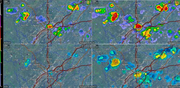
Best Storms Are In The 5 County Metro Birmingham Area For Now

Top left: base reflectivity; Top right: composite reflectivity; Bottom right: echo tops; Bottom left: Vertically Integrated Liquid
Showers and thunderstorms are trying to get their act together at mid-afternoon across Central Alabama. Small pulse storms are bubbling up in a environment of moderate instability and almost no wind shear. They rise up and fall back to earth just as quickly.
At 305 p.m. lightning was beginning near downtown Birmingham and over southern Walker County. Other lightning strikes have occurred in the past few minutes in the storm along the Jefferson/St. Clair County line near Argo.
The storms near downtown Birmingham and near West Jefferson appear to the best candidates to hold together right now.
These storms will continue to develop and push slowly west all afternoon and into the early evening.
The stronger storms will have gusty winds, heavy rain and deadly lightning.
Storms will continue to be rather scarce through Tuesday, with little hope for widespread relief from our growing drought. The outlook should improve from midweek into the weekend as we get more troughing over Alabama and the Southeast.
Category: Uncategorized


