

Strong Thunderstorms in the Northwestern Parts of the Area
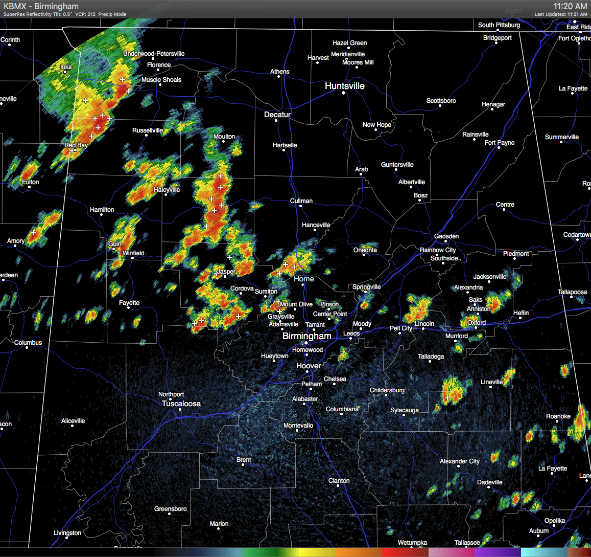
Showers and thunderstorms are forming west of I-65 and north of I-20. A few of these are pretty strong, putting down copious amounts of rain along with dangerous cloud-to ground lightning. The strongest storm in the state is located in Eastern Winston County, where the NWS has issued a Significant Weather Advisory until 11:45 AM. Storm is located near Moreland and Camp McDowell and is moving to the east at 25 MPH. 40 MPH wind gust can be expected with this storm. Places in the path of this storm should stay indoors until it passes.
There are other showers and storms out there at this moment along the I-20 corridor in the eastern part of the state, and a few more down in the southeastern part of the state. None of these are particularly strong right now. These will definitely bring some relief from the heat.
Category: Uncategorized
About the Author (Author Profile)
Scott Martin is an operational meteorologist, professional graphic artist, musician, husband, and father. Not only is Scott a member of the National Weather Association, but he is also the Central Alabama Chapter of the NWA president. Scott is also the co-founder of Racecast Weather, which provides forecasts for many racing series across the USA. He also supplies forecasts for the BassMaster Elite Series events including the BassMaster Classic.Subscribe
If you enjoyed this article, subscribe to receive more just like it.


