

The MCS is Coming, the MCS is Coming!
Most of Alabama waking up to clear skies with only a few spots here and there with some clouds to report. The upper ridge was becoming established just to our west, so Alabama will be on the eastern periphery of the ridge today. There appears to be a small short wave embedded in the upper flow helping in the production of showers across Middle Tennessee this morning. The wave embedded in the northerly flow aloft could help in upping the coverage of showers today along with the heat of the late morning and afternoon. So shower chances remain a bit better for Central Alabama today. Temperatures bottomed out in the middle and lower 70s for most spots. Look for highs to climb into the lower and middle 90s for highs today. Some spots across northern and northeastern Alabama may not get quite so hot as the embedded wave brings showers and clouds for the late morning and early afternoon to cut off the heating.
Beachgoers are seeing early morning showers and storms moving onshore during the day. This will be the trend through the week. There is the possibility that low pressure will develop over the eastern Gulf, leading to a wet weekend. Highs will be near 90 degrees with lows in the upper 70s. The sea water temperature at the Dauphin Island Sea Lab actually touched 90F Sunday and Monday. Get a complete beach forecast here.
With the main traveling weather systems along the US-Canadian border, SPC has a couple of marginal risk areas for Day 1 in the western Great Lakes area and in Montana. For Day 2, a slight risk has been drawn primarily on North Dakota. Day 3 that area moves eastward into the western Great Lakes.
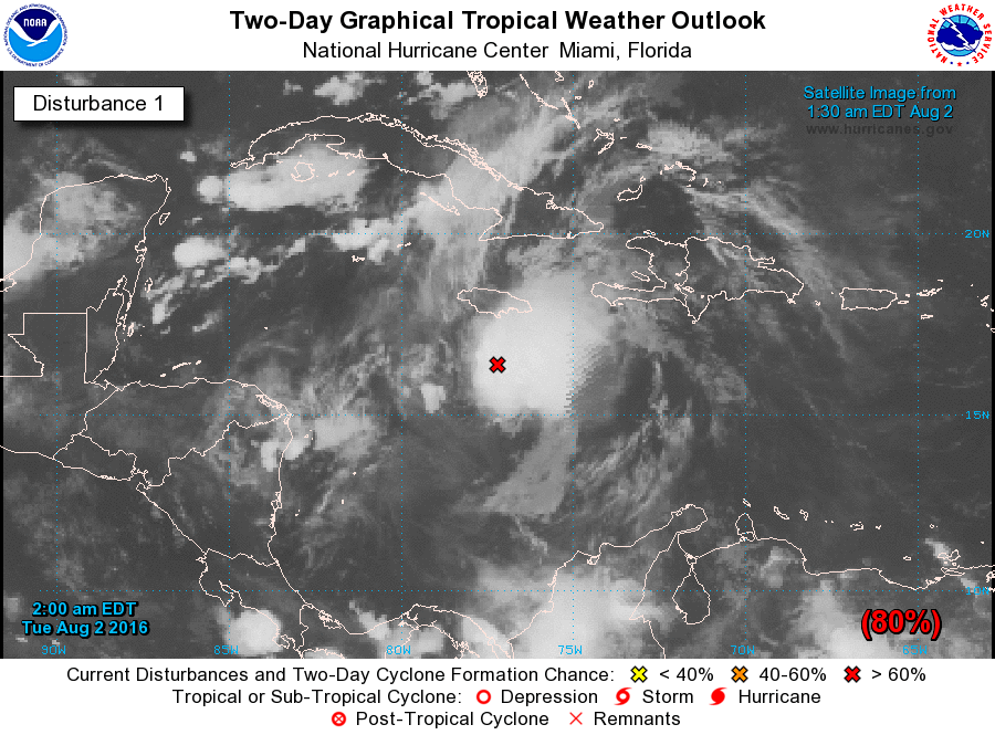
And in the tropics, we keep waiting on the strong tropical wave located about 150 miles south-southeast of Jamaica to become our next named tropical storm. While wind estimates indicate tropical storm force wind being produced in squalls, there still appears to be no defined circulation center. A Hurricane Hunter aircraft mission into the system is planned this morning, so if there is a closed circulation, those guys and gals will find it. The spaghetti plots for this system continue to focus on a westerly course into Mexico. The latest Tropical Weather Outlook from the Hurricane Center maintains a high probability that this system will become a tropical storm.
Unfortunately, as we’ve been saying over the last week or so, the upper ridge will be the prevailing feature in our weather pattern for the next several days. The ridge builds into the Southeast US through Monday while the main westerlies gradually work across southern Canada to dampen down the ridge a little. This will keep us in heat and with the humidity we will see isolated showers and thunderstorms during the heat of the afternoon. After today, showers and storms may be less numerous into the weekend. Temperatures are likely to remain in the middle 90s for highs into the weekend with morning lows in the 70s.
The GFS is still sticking with the idea of an easterly wave coming across the eastern Gulf of Mexico starting Monday. This is a bit slower than what the GFS had yesterday. The easterly wave moves to the Florida Panhandle on Tuesday while a small short wave comes across the Central Mississippi River Valley. The combination of these two weak features could well create some wet weather for Alabama early into next week. But that is verging on voodoo, so we’ll keep a watchful eye on this feature.
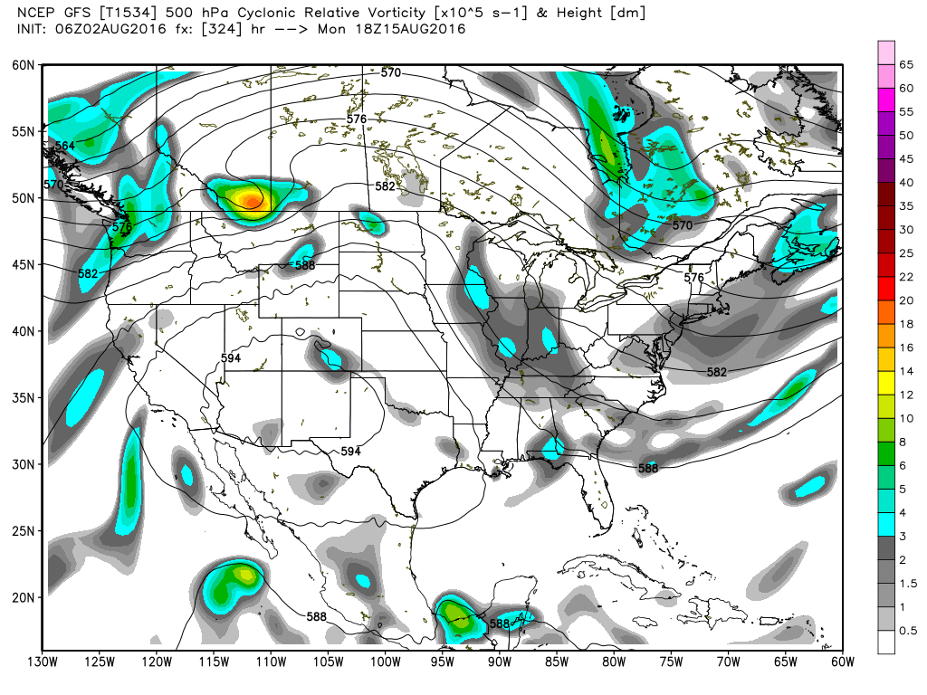
Looking into voodoo country, the ridge starts us off around August 11th, but by the 15th the GFS has continued with the idea of a fairly sharp trough developing over the eastern US. This trough could be enough to bring us that first front reminding us that Fall is not too far away. The ridge in the west with the trough along the East Coast is maintained through the 17th.
Just a quick side note about the models yesterday. I showed the HRRR model for the middle of the afternoon, and as it turns out it did a pretty good job on defining where the convection would be. The HRRR suggested the better chances for rain would be southeast and east of the I-20 corridor with even better chances in Southeast Alabama. That turned out to be pretty good definition on where the convection did occur.
I expect to have the next Weather Xtreme Video posted here by 7 am or so on Wednesday.
Category: Uncategorized
About the Author (Author Profile)
Brian Peters is one of the television meteorologists at ABC3340 in Birmingham and a retired NWS Warning Coordination Meteorologist. He handles the weekend Weather Xtreme Videos and forecast discussion and is the Webmaster for the popular WeatherBrains podcast.Subscribe
If you enjoyed this article, subscribe to receive more just like it.


