

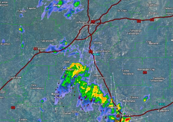
Storms Approaching Birmingham Metro from South
We are watching a cluster of storms racing towards the north through Central Alabama this afternoon. These storms have a lot of lightning, gusty winds, and very heavy rainfall with them. They will be impacting portions of the Birmingham Metro over the next couple of hours. They are essentially following the Interstate 65 corridor, so travel is likely to be impacted along the Interstate as well as U.S. 31. Locations from Montgomery and Prattville, north through Clanton, Alabaster, Pelham, Brent, and Centreville are being impacted or will be impacted before they track into the southern suburbs of Birmingham and likely into the city.
They are moving very rapidly this afternoon and should only impact locations for about thirty minutes or so. Lightning is the greatest threat with these storms today, and we want to remind folks, if you can hear thunder, you can be struck by lightning…WHEN THUNDER ROARS, GO INDOORS.
These showers and storms are providing heat relief as they are cooling temperatures down from the upper 80s and lower 90s ahead of them, to the upper 70s in spots behind them.
Category: Alabama's Weather
About the Author (Author Profile)
Macon, Georgia Television Chief Meteorologist, Birmingham native, and long time Contributor on AlabamaWX. Stormchaser. I did not choose Weather, it chose Me. College Football Fanatic. @Ryan_StinnetSubscribe
If you enjoyed this article, subscribe to receive more just like it.


