Midday Nowcast: Hot & Humid With Small Chance of PM Storms
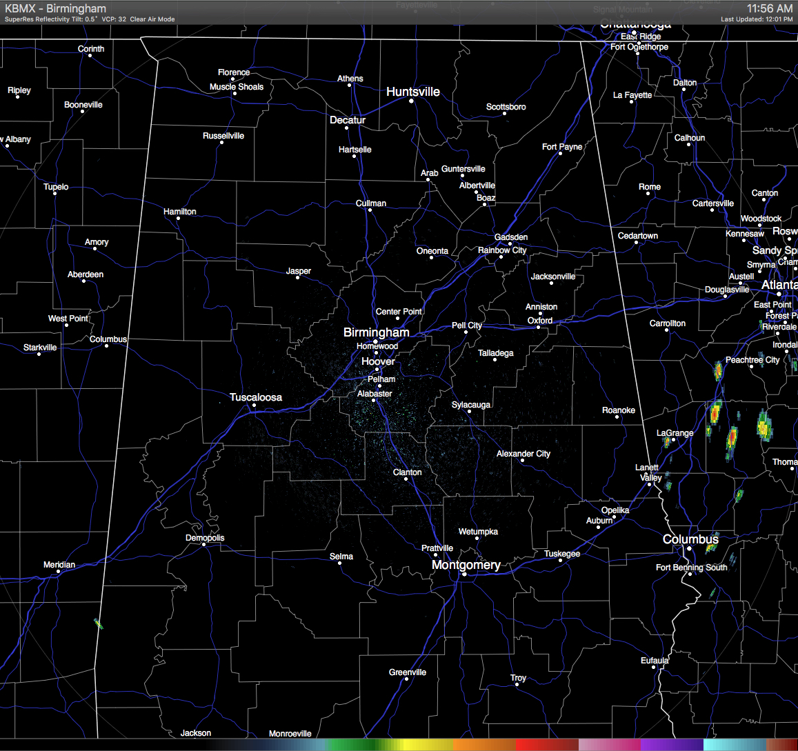
Skies across the Central Alabama area at this hour are mostly clear, and you can tell by how quickly the temperatures were able to climb. Also, with the mostly clear skies at this time, that also means that the radar is clear of any rainfall activity.
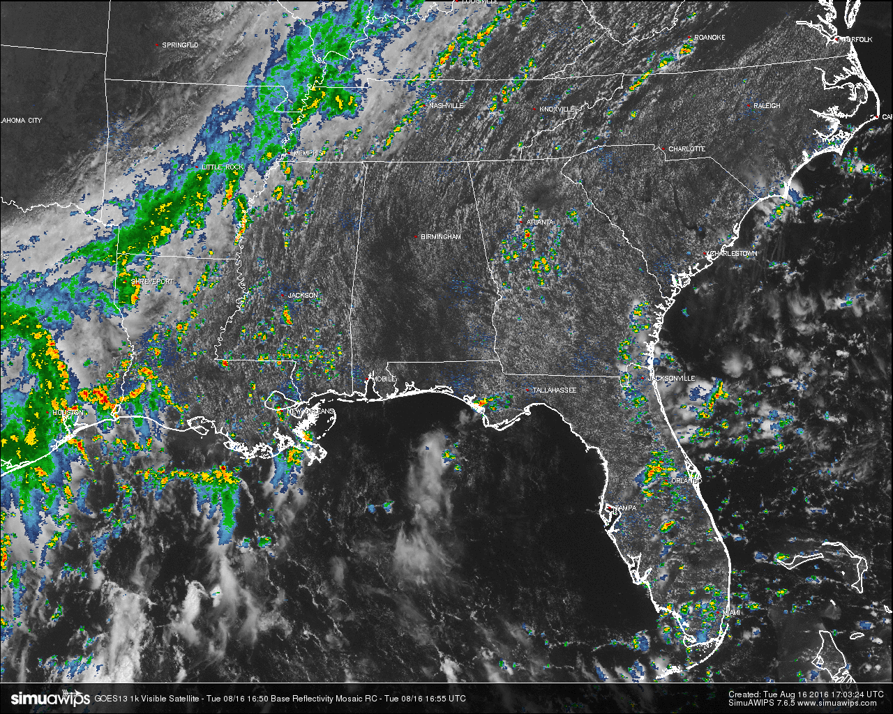
On the view of the Southeastern U.S., we see that convective storms have form in many areas, but the main area of rain activity is located along a frontal boundary that is stretching through the extreme western parts of Kentucky and Tennessee, through the southeastern parts of Arkansas, and ending in the eastern parts of Texas. No severe warnings are up at this time for anywhere in the southeast, but Flash Flood Warnings are up for a few counties in southern Arkansas.
TEMPERATURES AT THIS HOUR: With mostly clear skies, the heat is building up towards the daytime highs. Here is a list of temperature observations from across the area:
Birmingham 90
Tuscaloosa 90
Gadsden 90
Anniston 91
Cullman 87
Jasper 91
Alexander City 90
Selma 90
Montgomery 93
CODE GREEN AIR QUALITY: The Air Quality Index for the Birmingham Metropolitan Area is in the “Code Green” for ozone and particulate matter 2.5. No actions needed.
TODAY’S CLIMATOLOGY FOR BIRMINGHAM: The normal high for August 16th is 90, while the normal low is 69. The record high for today was set back in 2007 at 103. The record low was set back in 1992 at 57.
WHAT TO EXPECT FOR TODAY: Mostly sunny skies with a few widely scattered showers and thunderstorms, mainly during the afternoon and evening hours. Afternoon highs will be in the low to mid 90s for the most part. Odds for any one spot getting rain is about one in four, and any shower activity should die off by 10PM, and overnight lows will be in the 70s.
WEDNESDAY’S WEATHER: Mostly sunny skies with a few scattered showers and thunderstorms, mainly during the afternoon and evening hours. Afternoon highs will be in the mid 90s for the most part. Odds for any one spot getting rain is about one in three, and any shower activity should die off by 10PM, and overnight lows will be in the 70s.
HEADED TO THE BEACH: About 7 to 9 hours of sunshine daily on the coast from Gulf Shores to Panama City Beach through the weekend with widely scattered showers/storms. Highs upper 80s on the immediate coast, with low 90s inland. Sea water temperatures are mostly in the mid to upper 80s. See a very detailed Gulf Coast forecast here.
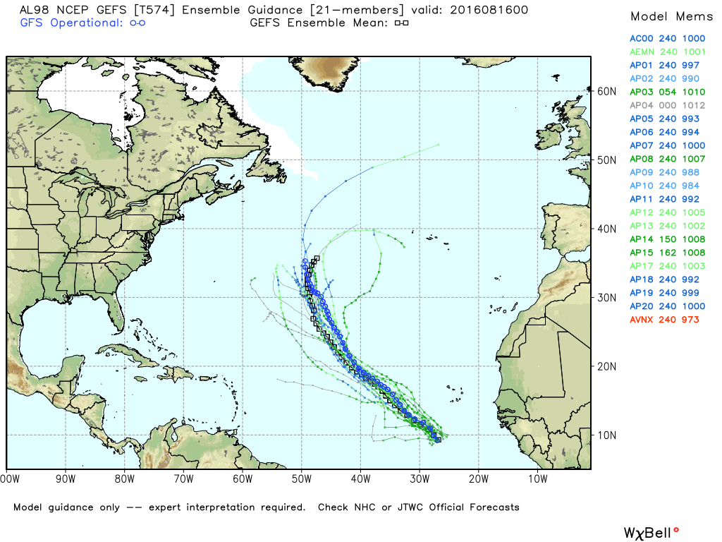
THE TROPICS: A disturbance in the eastern Atlantic has a good chance of becoming a tropical depression, and perhaps Tropical Storm Fiona in coming days, but it will be gaining latitude and should not be a threat to the Caribbean or the U.S. In fact, odds are high that it won’t impact any land mass…
ON THIS DAY IN 1987: Afternoon and evening thunderstorms developing along a cold front produced severe weather from Oklahoma to Wisconsin and Lower Michigan. Thunderstorms in central Illinois produced wind gusts to 80 mph at Springfield which toppled two large beer tents at the state fair injuring 58 persons. Thunderstorms also drenched Chicago IL with 2.90 inches of rain, making August 1987 their wettest month of record.
THE BLOG IS ON TWITTER: Be sure to follow the Alabama Wx Weather Blog on Twitter. Just click here to start following our feed.
WEATHERBRAINS: This week, we previewed the upcoming National Weather Association Annual Meeting with the President, Executive Director, Social Media Chair and Program Chair. This is the show all about weather featuring many familiar voices, including our meteorologists at ABC 33/40. You can listen anytime on the web, or on iTunes. You can find it here.
ADVERTISE WITH US: Deliver your message to a highly engaged audience by advertising on the AlabamaWX.com website. The site enjoyed 10.2 MILLION pageviews in the past 12 months. Don’t miss out! We can customize a creative, flexible and affordable package that will suit your organization’s needs. Contact Bill Murray at (205) 687-0782.
Category: Alabama's Weather
About the Author (Author Profile)
Scott Martin is an operational meteorologist, professional graphic artist, musician, husband, and father. Not only is Scott a member of the National Weather Association, but he is also the Central Alabama Chapter of the NWA president. Scott is also the co-founder of Racecast Weather, which provides forecasts for many racing series across the USA. He also supplies forecasts for the BassMaster Elite Series events including the BassMaster Classic.Subscribe
If you enjoyed this article, subscribe to receive more just like it.


