

Midday Nowcast: Radar is Clear Now, Won’t Be That Way In A Little While
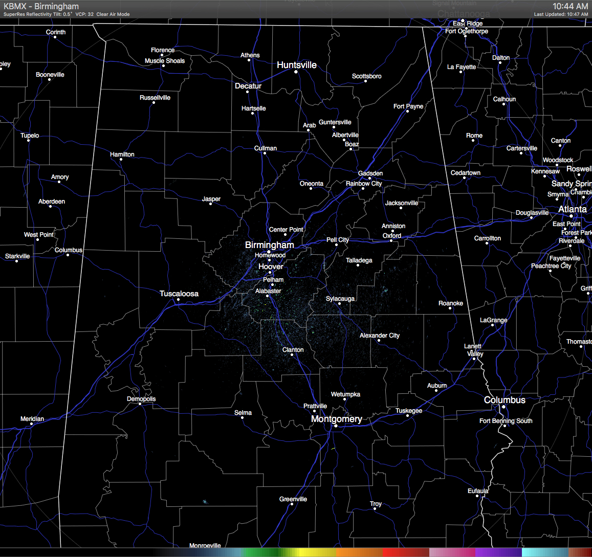

Skies are mostly clear to clear across Central Alabama at this hour, with the only thing showing up on radar is ground clutter. And with those clear skies, temperatures are already in the mid to upper 80s for the most part, with a few locations in the low 90s. The look of the satellite and radar will be changing as showers and storm are expected to start popping within the next hour or two.
TEMPERATURES AT THIS HOUR: With mostly clear skies, the heat is building up towards the daytime highs. Here is a list of temperature observations from across the area:
Birmingham 88
Tuscaloosa 84
Gadsden 86
Anniston 86
Cullman 79
Jasper 90
Alexander City 88
Selma 86
Montgomery 90
CODE GREEN AIR QUALITY: The Air Quality Index for the Birmingham Metropolitan Area is in the “Code Green” for ozone and particulate matter 2.5. No actions needed.
TODAY’S CLIMATOLOGY FOR BIRMINGHAM: The normal high for August 18th is 90, while the normal low is 69. The record high for today was set back in 1995 at 103. The record low was set back in 1992 at 59.
WHAT TO EXPECT FOR TODAY: The upper ridge that has been in control of our weather for the past few days will become weaker, and the air will start to become more unstable. Skies will become partly to mostly sunny, and we’ll have a number of showers and thunderstorms form during the peak heating time of the day. Most storms should diminish by 10PM, but don’t be surprised if a few last into the overnight hours. Afternoon highs will be in the low 90s for most of Central Alabama, with a few spots hitting the mid 90s. Overnight lows will be in the 70s. Odds of any one spot getting rain today will be just below 50/50.
FRIDAY’S WEATHER: The very moist and unstable airmass will remain over the area as the ridge over the deep south continue to weakens. A mix of sun and clouds can be expected, with scattered to numerous showers and thunderstorms. The better chance of storm development will be during the afternoon hours, but a few popping up during the morning would not be a surprise. Afternoon highs will be in the upper 80s to just over 90 degrees. The odds of any one spot getting rain will be near 50/50.
HEADED TO THE BEACH: About 7 to 9 hours of sunshine daily on the coast from Gulf Shores to Panama City Beach through the weekend with a few scattered showers/storms. Highs will be in the upper 80s on the immediate coast, with low 90s inland. Sea water temperatures are mostly in the mid to upper 80s. See a very detailed Gulf Coast forecast here.
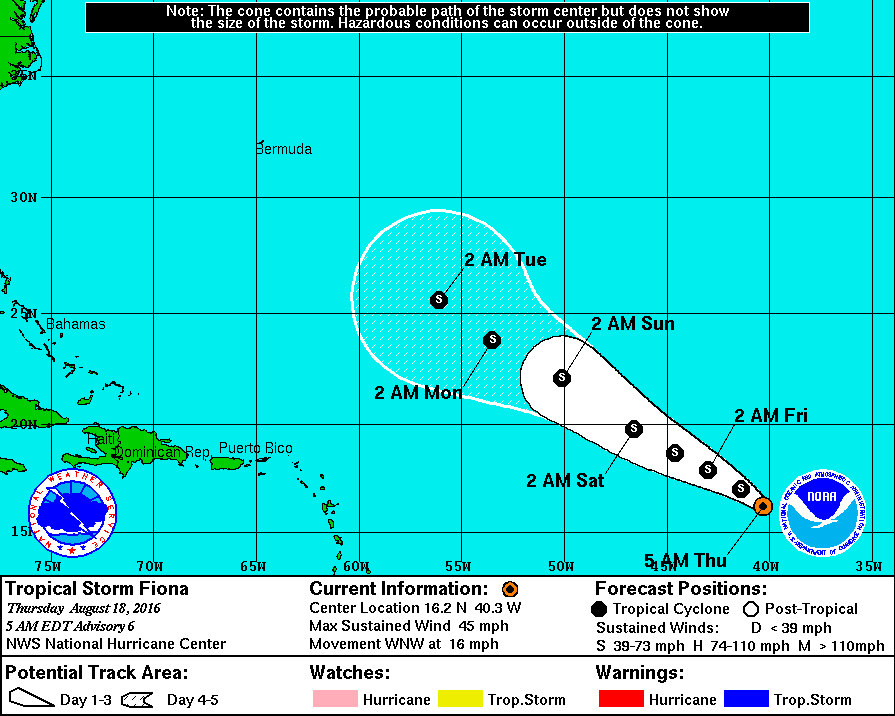
THE TROPICS: Tropical Storm Fiona is packing sustained winds of 45 mph in the open Atlantic; it will most likely stay at tropical storm status in coming days as it gains latitude; still seems to be no threat to land. The rest of the Atlantic basin is quiet for now.
ON THIS DAY IN 1989: Thunderstorms over the Middle Atlantic Coast Region and the Upper Ohio Valley produced torrential rains in eastern Virginia during the late morning and afternoon hours. Totals ranged up to twelve inches at Yorktown. Williamsburg VA was deluged with 10.78 inches of rain between 6 AM and 10 AM, with 6.72 inches reported in just two hours. Flash flooding caused nearly twelve million dollars damage in Accomack County VA. Early evening thunderstorms in the Central High Plains Region produced walnut size hail and wind gusts to 80 mph around Casper WY. Thunderstorms produced locally heavy rains in the Yellowstone Park area, causing fifteen mudslides.
THE BLOG IS ON TWITTER: Be sure to follow the Alabama Wx Weather Blog on Twitter. Just click here to start following our feed.
WEATHERBRAINS: This week, we previewed the upcoming National Weather Association Annual Meeting with the President, Executive Director, Social Media Chair and Program Chair. This is the show all about weather featuring many familiar voices, including our meteorologists at ABC 33/40. You can listen anytime on the web, or on iTunes. You can find it here.
ADVERTISE WITH US: Deliver your message to a highly engaged audience by advertising on the AlabamaWX.com website. The site enjoyed 10.2 MILLION pageviews in the past 12 months. Don’t miss out! We can customize a creative, flexible and affordable package that will suit your organization’s needs. Contact Bill Murray at (205) 687-0782.
Category: Alabama's Weather
About the Author (Author Profile)
Scott Martin is an operational meteorologist, professional graphic artist, musician, husband, and father. Not only is Scott a member of the National Weather Association, but he is also the Central Alabama Chapter of the NWA president. Scott is also the co-founder of Racecast Weather, which provides forecasts for many racing series across the USA. He also supplies forecasts for the BassMaster Elite Series events including the BassMaster Classic.Subscribe
If you enjoyed this article, subscribe to receive more just like it.


