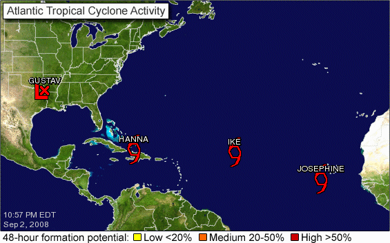
Tropical Headlines…
Taking a look at the overnight headlines from the National Hurricane Center tonight…
Tropical Storm Hanna
…HANNA NEARLY STATIONARY…
Hanna is stationary tonight and still being beaten down by wind shear. This will relax tomorrow. She should become a hurricane (minimal) by Thursday morning. By then, she will be moving NNW around the periphery of a strengthening high pressure system. By Friday morning, it will be east of the Florida coast near St. Augustine. It will make landfall mostly likely on the South Carolina coast Friday evening as a category one hurricane.
Tropical Storm Ike…
…IKE HEADING TOWARD THE WESTERN ATLANTIC…A CYCLONE TO CAREFULLY WATCH OVER THE NEXT FEW DAYS…
We don’t like Ike. We will be watching this one for some time I fear. It should continue on a generally westerly track despite the fact that it is at a latitude which generally sees a tropical cyclone recurve…We may be dealing with an intense hurricane in the Bahamas in five days. Where it goes from there is specualtion, but into the Gulf if a possibility. Model agreement is exceptionally good through 5 days. The GFS takes it across the Yucatan and into the SW Gulf where it lingers before coming north in about two weeks into…of all places…Louisiana…
Tropical Storm Josephine
…JOSEPHINE MOVING WESTWARD OVER THE FAR EASTERN ATLANTIC…
Josephine will be another long lived storm. This storm will be shoved west northwestward by a building high pressure ridge also. In five days, it should be north of the islands of the Lesser Antilles. It is not forecast to become a hurricane.
Category: Uncategorized


