Midday Nowcast: A Great Weekend Ahead & Hermine Moves Away
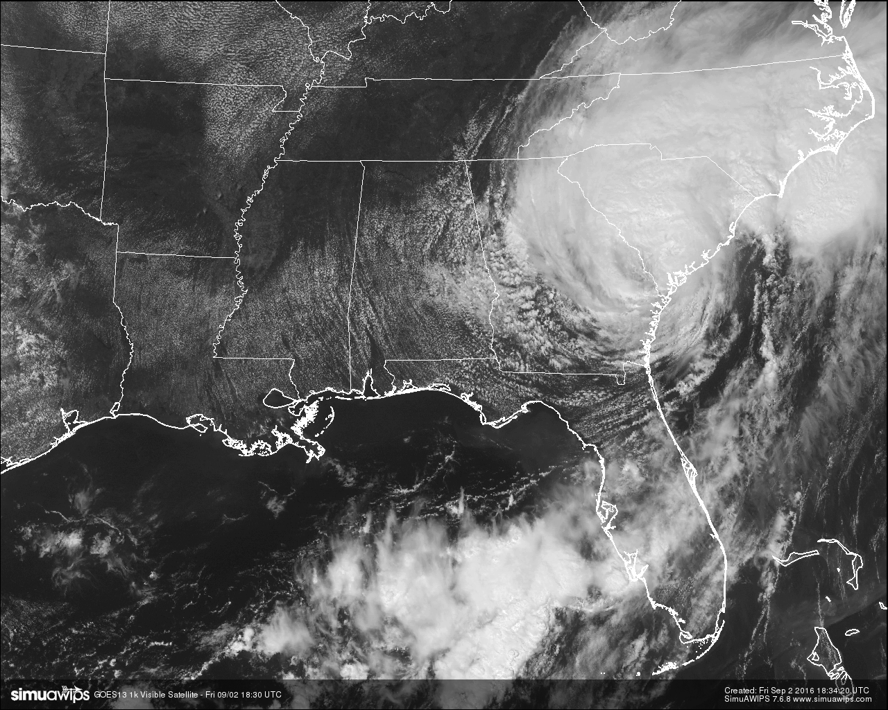
Skies across Central Alabama are partly to mostly cloudy at this time thanks to the left edge of Tropical Storm Hermine. Very light returns are showing up on radar, so there are a few areas of mist to very light rain out there, some of which may not be reaching the ground.
TEMPERATURES AT THIS HOUR: Even with the cloud cover outside, temperatures are still pretty warm out there. Here is a list of temperature observations from across the area at this hour:
Birmingham 90
Tuscaloosa 90
Gadsden 90
Anniston 88
Cullman 84
Jasper 91
Alexander City 87
Selma 86
Montgomery 86
CODE YELLOW AIR QUALITY: The Air Quality Index for the Birmingham Metropolitan Area is in the “Code Yellow” for particulate matter 2.5. Unusually sensitive people should consider limiting prolonged outdoor exertion.
TODAY’S CLIMATOLOGY FOR BIRMINGHAM: The normal high for September 1st is 88, while the normal low is 67. The record high for today was set back in 1925 at 98. The record low was set back in 1987 at 55.
REMAINDER OF TODAY: Skies will eventually start to clear out later today as heroine continues its trek to the northeast, and we’ll only have a very slight chance of a shower for the remainder of the afternoon and evening hours. Afternoon highs will be in the upper 80s to just over 90 degrees. Tonight’s weather for the high school football games should be great with lower humidity levels, and temperatures falling into the 70s.
THE WEEKEND WEATHER: Mostly clear skies are expected throughout the weekend with hardly any chance of rain on either day for Central Alabama. Afternoon highs will be back up in the upper 80s to the low 90s.
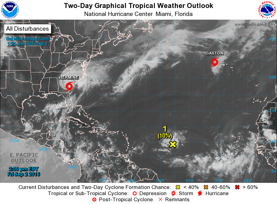
TROPICAL STORM HERMINE: Latest update from the National Hurricane Center has the center passing over the Charleston radar site in South Carolina. Maximum sustained winds are currently at 50 MPH with gusts up to 65 MPH. Latest track has the center of Hermine moving off the North Carolina coast by Saturday morning as a tropical storm, then staying near the coast as it moves north-northeastward, and may restrengthen into a hurricane by Monday night. Tropical storm warnings are up from Nassau Sound, FL up to Fenwick Island, DE.
THE TROPICS: A wave is moving along in the Central Atlantic, but it is fighting very dry and, and it remains to be seen if it can survive. And, Gaston is a tropical storm now in the North Atlantic approaching the Azores. Noting threatening the Gulf of Mexico for at least the next seven days.
HEADED TO THE BEACH: About 7 to 9 hours of sunshine each day through Labor Day from Gulf Shore over to Panama City Beach, with just a few widely scattered showers or storms. Highs in the upper 80s on the immediate coast, with low 90s inland. The Gulf of Mexico will settle down and the rip current danger will subside over the weekend. See a very detailed Gulf Coast forecast here.
ON THIS DAY IN 1987: Late evening thunderstorms in the Northern Plains Region produced wind gusts to 75 mph at Jordan MT, and a “”hot flash”” at Redig SD. The temperature at Redig rose from 66 degrees at 10 PM to 86 degrees at 11 PM as thunderstorm winds gusted to 36 mph. Nine cities in the Upper Ohio Valley, the Tennessee Valley and the Central Gulf Coast States reported record low temperatures for the date, including Elkins WV with a reading of 38 degrees.
THE BLOG IS ON TWITTER: Be sure to follow the Alabama Wx Weather Blog on Twitter. Just click here to start following our feed.
WEATHERBRAINS: This is the show all about weather featuring many familiar voices, including our meteorologists at ABC 33/40. You can listen anytime on the web, or on iTunes. You can find it here.
ADVERTISE WITH US: Deliver your message to a highly engaged audience by advertising on the AlabamaWX.com website. The site enjoyed 10.2 MILLION pageviews in the past 12 months. Don’t miss out! We can customize a creative, flexible and affordable package that will suit your organization’s needs. Contact Bill Murray at (205) 687-0782.
Category: Alabama's Weather
About the Author (Author Profile)
Scott Martin is an operational meteorologist, professional graphic artist, musician, husband, and father. Not only is Scott a member of the National Weather Association, but he is also the Central Alabama Chapter of the NWA president. Scott is also the co-founder of Racecast Weather, which provides forecasts for many racing series across the USA. He also supplies forecasts for the BassMaster Elite Series events including the BassMaster Classic.Subscribe
If you enjoyed this article, subscribe to receive more just like it.


