

Midday Nowcast: Hot Again With A Few Showers Showing Up
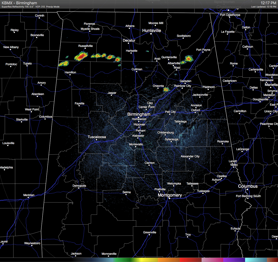
ANOTHER HOT DAY OUT THERE: At this hour, only a few clouds are showing up in the northern parts of the state, with heavy showers showing up across the northwestern corner of Marion County, and stretching across southern Franklin and Lawrence Counties. Showers are also showing up in the southern part of Dekalb County and at the meeting point of Blount, Etowah, and St.Clair Counties. They are stationary at this moment.
For the rest of Central Alabama, skies are clear at this moment, and this is allowing the temperatures to climb up towards the daytime highs. Skies should remain mostly sunny for the remainder of the day, and only the extreme northwestern part of the area could have a stray shower or two this afternoon. Even with that said, those odds for any one place getting any rain is around one in eight. Afternoon highs will be in the mid 90s.
AIR QUALITY: Air quality index will be in the “Code Yellow” for today for ozone and particulate matter 2.5. Unusually sensitive people should consider limiting prolonged outdoor exertion.
TEMPERATURES ACROSS CENTRAL ALABAMA AT THIS HOUR:
Birmingham 93
Tuscaloosa 93
Gadsden 92
Anniston 93
Cullman 91
Alexander City 90
Auburn 90
Selma 91
Montgomery 92
NORMS AND RECS FOR TODAY IN BIRMINGHAM: The normal high for September 15th is 85, while the normal low is 64. The record high for today was set back in 1927 at 102. The record low was set back in 1985 at 52.
FRIDAY’S FORECAST: Another hot day with a mix of sun and clouds, and a very small risk of a few isolated afternoon and evening showers or thunderstorms. Odds for any one place getting any rain is about one in eight. Afternoon highs will be in the low to mid 90s across the area. The risk for rain should be diminished by the time high school football kicks off tomorrow night, with temperatures falling through the 80s during the games.
HEADED TO THE BEACH: About 7 to 9 hours of sunshine daily from Panama City Beach over to Gulf Shores with the usual chance of scattered showers and storms around through the weekend. Highs in the upper 80s on the immediate coast, with low 90s inland. See a very detailed Gulf Coast forecast here.

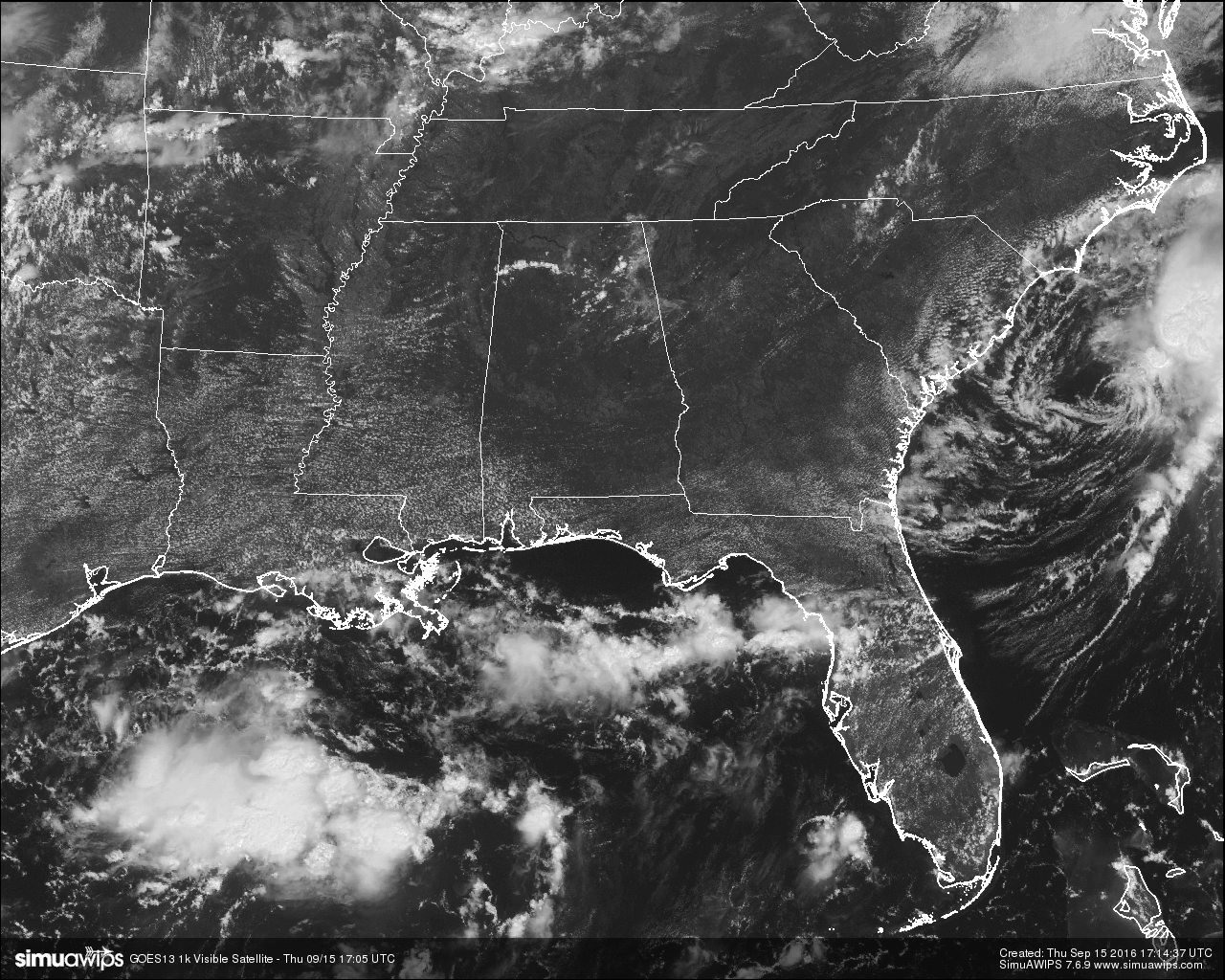
THE TROPICS: There are four active areas out there being watched. Julia is now a tropical depression off the coast of South Carolina. Steering currents have collapsed, and this thing will pretty much just hang around for the next five days. Heaviest rain should remain just offshore. No impact on Alabama. Tropical Storm Ian remains in the middle of the Atlantic, far from land, and will become post-tropical tomorrow as it gains latitude. Tropical Depression 12 is in the eastern Atlantic; it has a chance of becoming Tropical Storm Karl in 3 to 5 days as it moves westward. The GFS ensemble mean suggests it will be north of Puerto Rico early next week, it remains to be seen if this will be a threat in the longer term to the U.S. Just something to watch for now. Finally, a disturbance in the Gulf of Mexico is not expected to develop as it moves toward the Texas Coast.
ON THIS DAY IN 1988: Thunderstorms brought much needed rains to parts of the central U.S. Rainfall totals of 2.87 inches at Sioux City IA and 4.59 inches at Kansas City MO were records for the date. Up to eight inches of rain deluged the Kansas City area, nearly as much rain as was received the previous eight months. Hurricane Gilbert, meanwhile, slowly churned toward the U.S./Mexican border.
THE BLOG IS ON TWITTER: Be sure to follow the Alabama Wx Weather Blog on Twitter. Just click here to start following our feed.
WEATHERBRAINS: This is the show all about weather featuring many familiar voices, including our meteorologists at ABC 33/40. You can listen anytime on the web, or on iTunes. You can find it here.
ADVERTISE WITH US: Deliver your message to a highly engaged audience by advertising on the AlabamaWX.com website. The site enjoyed 10.2 MILLION pageviews in the past 12 months. Don’t miss out! We can customize a creative, flexible and affordable package that will suit your organization’s needs. Contact Bill Murray at (205) 687-0782.
Category: Alabama's Weather
About the Author (Author Profile)
Scott Martin is an operational meteorologist, professional graphic artist, musician, husband, and father. Not only is Scott a member of the National Weather Association, but he is also the Central Alabama Chapter of the NWA president. Scott is also the co-founder of Racecast Weather, which provides forecasts for many racing series across the USA. He also supplies forecasts for the BassMaster Elite Series events including the BassMaster Classic.Subscribe
If you enjoyed this article, subscribe to receive more just like it.


