Midday Nowcast: Another Hot and Mainly Dry Day
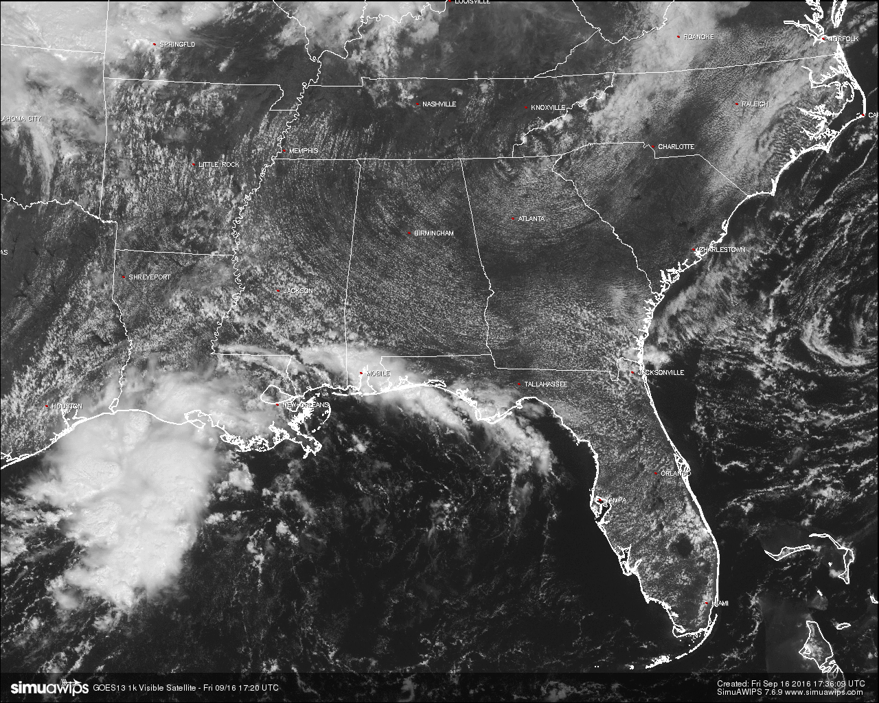
ISN’T IT FALL YET?: Unfortunately, we still have a few day remaining until the first day of Autumn, and the summertime is making its presence felt across Central Alabama today. With mostly clear skies out there at the noon hour, temperatures are climbing their way up with nothing to slow them down. Rain chances through the remainder of the day look very slim, and afternoon highs will top out in the low to mid 90s across the area under mostly clear skies.
As far as high school football games tonight across the area, skies should generally remain mostly clear and temperatures will be falling through the 80s as the games are in progress. Any rain that pops up this afternoon should have dissipated by kickoff.
AIR QUALITY: Air quality index will be in the “Code Yellow” for today for ozone and particulate matter 2.5. Unusually sensitive people should consider limiting prolonged outdoor exertion.
TEMPERATURES ACROSS CENTRAL ALABAMA AT THIS HOUR:
Birmingham 90
Tuscaloosa 91
Gadsden 90
Anniston 90
Cullman 90
Alexander City 90
Auburn 88
Selma 91
Montgomery 89
NORMS AND RECS FOR TODAY IN BIRMINGHAM: The normal high for September 16th is 85, while the normal low is 63. The record high for today was set back in 1927 at 101. The record low was set back in 1961 at 48.
THE WEEKEND FORECAST: The ridge that has been in control of our weather pattern will slightly weaken, and allow for an increase in our chances for widely scattered showers and storms for Saturday. Odds for any one spot getting rain tomorrow will be one in four. Afternoon highs will be in the upper 80s to the low 90s. Sunday will feature a better chance of showers and storms, as a surface front will be approaching from the north. Skies will be occasionally cloudy at times and we’ll have scattered to numerous showers and thunderstorms across the area. Afternoon highs will remain in the 80s due to the clouds and rain.
CRIMSON TIDE: A passing shower or thunderstorm is possible in Oxford, as Alabama travels to Ole Miss to take on the Rebels. Temperatures should hover around the mid to upper 80s throughout the game, and humidity levels will be high.
WAR EAGLE: Skies will be mostly clear down on the plains as Auburn plays host to Texas A&M. Can’t rule out a passing shower or storm during the first half, with temperatures falling from the mid 80s at kickoff (6:30PM CDT) to the upper 70s by the 4th quarter.
HEADED TO THE BEACH: About 7 to 9 hours of sunshine on the Gulf Coast from Gulf Shores to Panama City Beach through the weekend with just a few widely scattered storms. Highs in the upper 80s on the immediate coast, with low 90s inland. See a very detailed Gulf Coast forecast here.
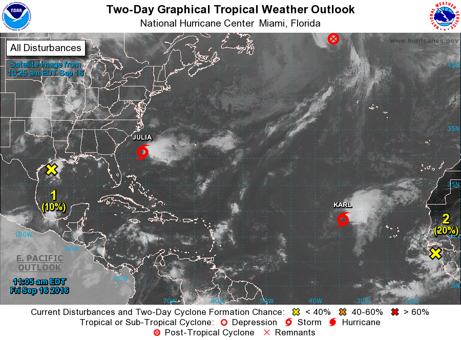
THE TROPICS: Julia is a weak tropical storm off the coast of South Carolina and will be hanging around in pretty much the same spot for several days, and should begin to dissipate next week. It will remain far enough offshore to prevent any serious impact on the South Atlantic coast other than rough surf. Ian is a high latitude system in the Atlantic that will become post-tropical over the next 24 hours. No threat to land. Karl is the newest system on the board in the eastern Atlantic. It will move to the west/northwest over the next five days, and is expected to become a hurricane early next week. But, long range model guidance suggests this will recurve, and won’t be a threat to the U.S.
ON THIS DAY IN 1988: Hurricane Gilbert moved ashore into Mexico. The hurricane established an all-time record for the western hemisphere with a barometric reading of 26.13 inches. Winds approached 200 mph, with higher gusts. Gilbert devastated Jamaica and the Yucatan Peninsula. (The Weather Channel) Hurricane Gilbert made landfall 120 miles south of Brownsville TX during the early evening. Winds gusted to 61 mph at Brownsville, and reached 82 mph at Padre Island. Six foot tides eroded three to four feet off beaches along the Lower Texas Coast, leaving the waterline seventy-five feet farther inland. Rainfall totals ranged up to 8.71 inches at Lamar TX. Gilbert caused three million dollars damage along the Lower Texas Coast, but less than a million dollars damage along the Middle Texas Coast.
THE BLOG IS ON TWITTER: Be sure to follow the Alabama Wx Weather Blog on Twitter. Just click here to start following our feed.
WEATHERBRAINS: This is the show all about weather featuring many familiar voices, including our meteorologists at ABC 33/40. You can listen anytime on the web, or on iTunes. You can find it here.
ADVERTISE WITH US: Deliver your message to a highly engaged audience by advertising on the AlabamaWX.com website. The site enjoyed 10.2 MILLION pageviews in the past 12 months. Don’t miss out! We can customize a creative, flexible and affordable package that will suit your organization’s needs. Contact Bill Murray at (205) 687-0782.
Category: Alabama's Weather
About the Author (Author Profile)
Scott Martin is an operational meteorologist, professional graphic artist, musician, husband, and father. Not only is Scott a member of the National Weather Association, but he is also the Central Alabama Chapter of the NWA president. Scott is also the co-founder of Racecast Weather, which provides forecasts for many racing series across the USA. He also supplies forecasts for the BassMaster Elite Series events including the BassMaster Classic.Subscribe
If you enjoyed this article, subscribe to receive more just like it.


