Midday Nowcast: Beautiful and Cool Day; Matthew is a Major Hurricane
ANOTHER WONDERFUL DAY FOR CENTRAL ALABAMA:
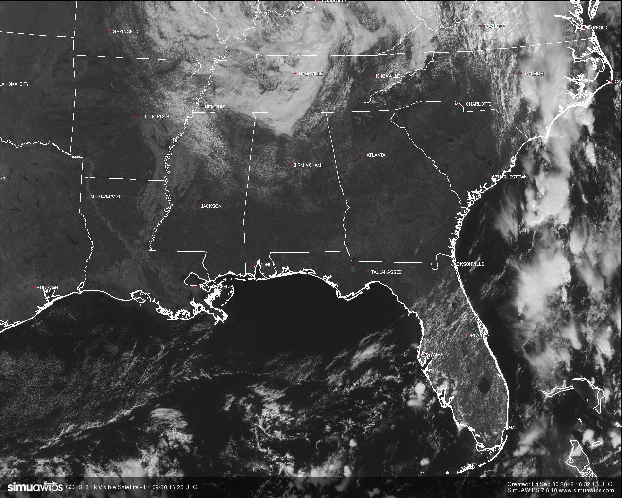
A mostly sunny day out there for the area, with most communities still reading at 70 degrees or lower at 11:30AM. With these conditions, the radar is completely clear of any precipitation, not only for our area, but for the whole state as well. Here is a list of temperatures across the area:
Birmingham: 70
Tuscaloosa: 70
Haleyville: 64
Gadsden: 70
Anniston: 68
Alabaster: 70
Alexander City: 70
Auburn: 70
Montgomery: 70
Selma: 70
REST OF TODAY:
Skies will remain mostly clear and may become completely clear by the late afternoon and early evening hours. Afternoon highs will be in the mid to upper 70s, and with dewpoints in the low 50s across the area, it will feel really good out there. For high school football games tonight, skies will be mostly clear with temperatures starting off at or just over 70 degrees at kickoff, and falling through the 60s throughout the games. At 10PM, temperatures will be at or just over 60 degrees.
DROUGHT CONDITIONS TO WORSEN:
The GFS model is suggesting basically no significant rain for Alabama over the next 10 days. Be extremely careful if you are doing any outdoor burning; the wildfire danger will remain high for the foreseeable future. And, pay attention to messages from your local water works authorities, water conservation is certainly in order.
NO AIR QUALITY ALERT:
Ozone and Particulate Matter 2.5 levels will be below criteria to raise an Air Quality Alert for the Birmingham metropolitan area today.
NORMS AND RECS FOR TODAY IN BIRMINGHAM:
The normal high for September 30th is 80, while the normal low is 58. The record high for today was set back in 1904 at 95. The record low was set back in 1967 at 37.
THE WEEKEND THROUGH THE WEEK AHEAD:
Mostly sunny days and fair nights can be expected from Saturday all the way through Friday. Afternoon highs will be in the 80s, with overnight lows in the upper 50 to the low 60s range. We will continue to be in a very dry pattern, especially with Hurricane Matthew passing well to the east.
HEADED TO THE BEACH:
Mostly sunny days and fair nights will continue through the weekend and early next week with highs in the 80s from Panama City Beach to Gulf Shores. Only isolated storms are expected from Sunday through Wednesday. See a very detailed Gulf Coast forecast here.
BARBER VINTAGE MOTORCYCLE FESTIVAL: This event runs from Friday October 7 through Sunday October 9 at the Barber Motorsports Park. No real skill in a specific forecast this far out, but October is our driest month of the year, and for now we see nothing to suggest any significant chance of rain event on these three days. Get ticket information right here.
TROPICS:
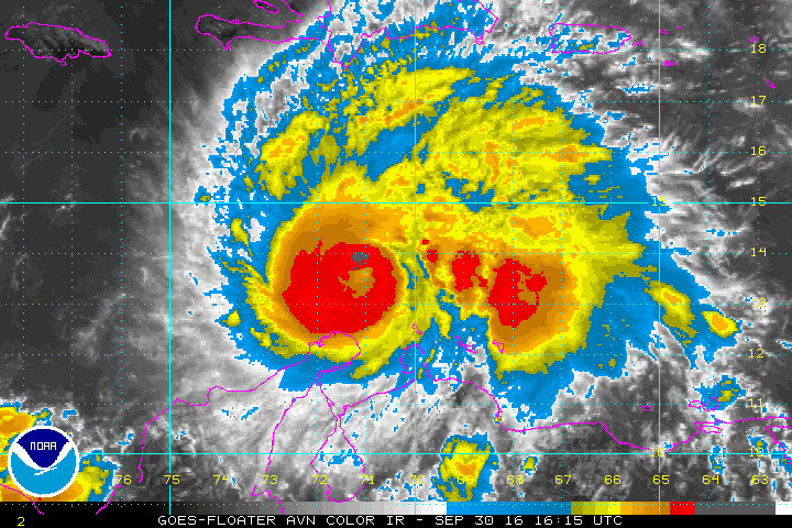
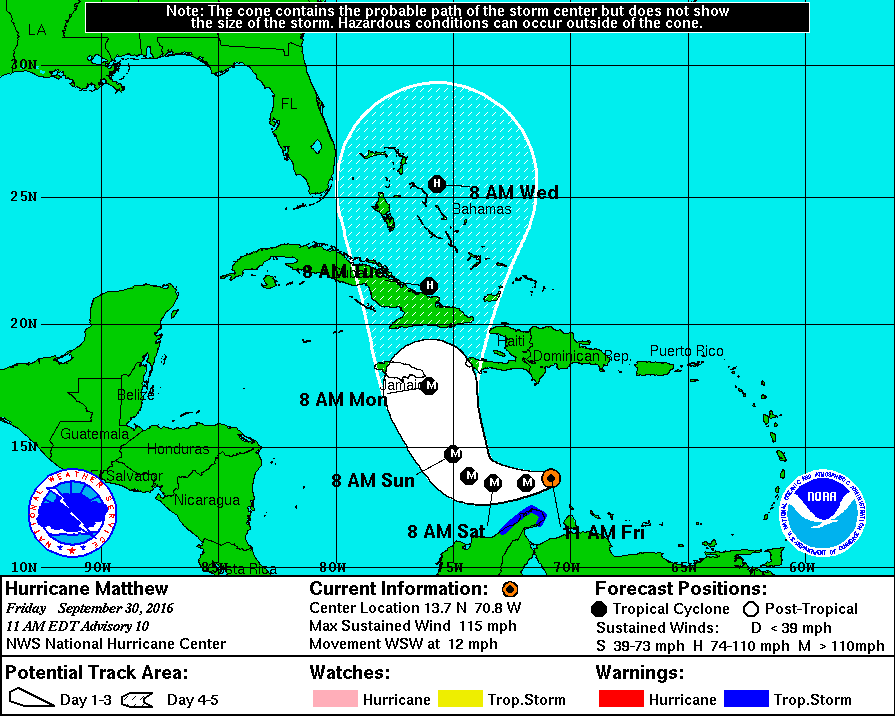
Hurricane Matthew now has become the first September major hurricane in the Caribbean since 2007 (the last was Felix), and the first in the Caribbean since 2012 (Sandy). Maximum sustained winds have increased to 115 MPH, making Matthew a category 3 on the Saffir-Simpson Scale, and gusts up to 140 MPH. Movement is to the west-southwest at 12 MPH, and was located about 100 miles northeast of Punta Gallinas, Columbia, and about 495 miles southeast of Kingston, Jamaica. The forecast track from the National Hurricane Center continues to have Matthew turning to the north sometime between tomorrow night and Sunday night. The latest minimum central pressure is 968 mb (28.59 inches), and there should be little change, if any, in strength over the next two days. Not expected to be a Gulf of Mexico storm, but could affect the southeastern Atlantic Coast before curving back out to sea.
ON THIS DAY IN 1987:
Afternoon thunderstorms in Michigan produced hail an inch in diameter at Pinckney, and wind gusts to 68 mph at Wyandotte. A thunderstorm in northern Indiana produced wet snow at South Bend. Seven cities in the northwestern U.S. reported record high temperatures for the date, including readings of 98 degrees at Medford OR and 101 degrees at downtown Sacramento CA.
THE BLOG IS ON TWITTER:
Be sure to follow the Alabama Wx Weather Blog on Twitter. Just click here to start following our feed.
WEATHERBRAINS:
This is the weekly netcast that’s all about weather featuring many familiar voices, including our meteorologists at ABC 33/40. You can listen anytime on the web, or on iTunes. You can find it here.
ADVERTISE WITH US:
Deliver your message to a highly engaged audience by advertising on the AlabamaWX.com website. The site enjoyed 10.2 MILLION pageviews in the past 12 months. Don’t miss out! We can customize a creative, flexible and affordable package that will suit your organization’s needs. Contact Bill Murray at (205) 687-0782.
Category: Alabama's Weather
About the Author (Author Profile)
Scott Martin is an operational meteorologist, professional graphic artist, musician, husband, and father. Not only is Scott a member of the National Weather Association, but he is also the Central Alabama Chapter of the NWA president. Scott is also the co-founder of Racecast Weather, which provides forecasts for many racing series across the USA. He also supplies forecasts for the BassMaster Elite Series events including the BassMaster Classic.Subscribe
If you enjoyed this article, subscribe to receive more just like it.


