Record Warmth Continues
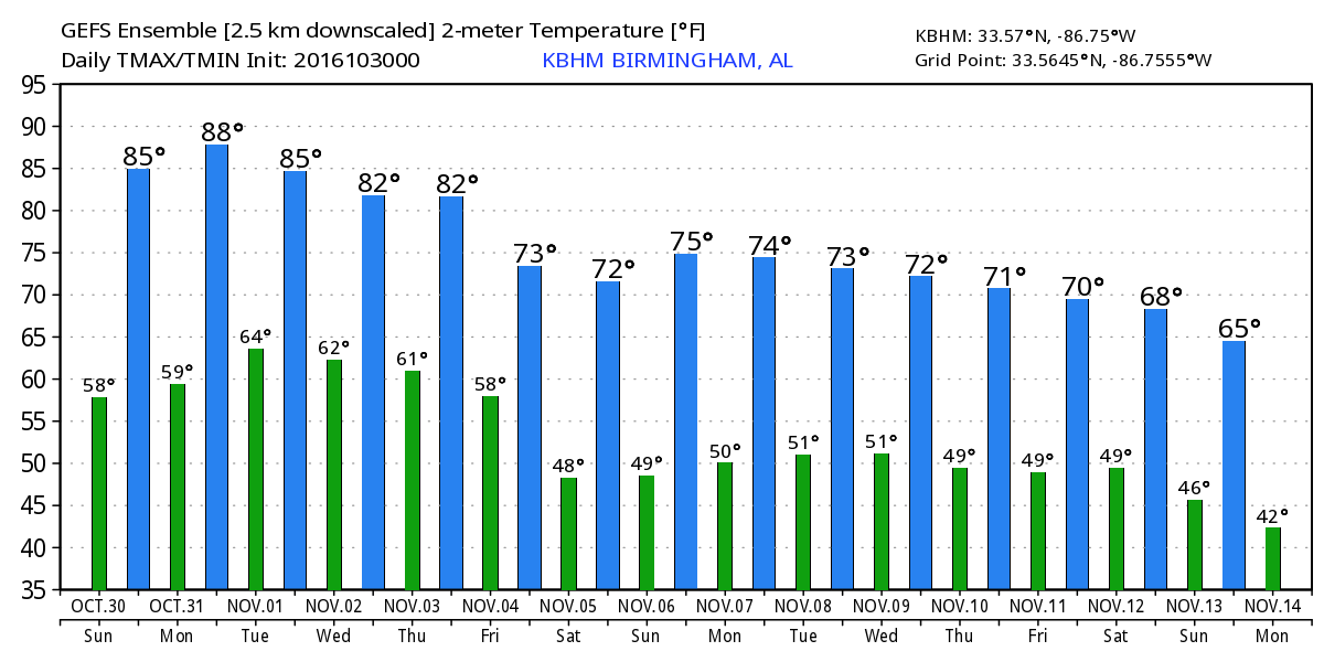
Saturday was a warm day for Alabama with new record highs set at Birmingham (87), Anniston (88), Tuscaloosa (87)m Montgomery (89) and Huntsville (88). Muscle Shoals tied their record high (88). Record warmth is going to continue today, too. The records look like this:
Location     Oct 30    Oct 31    Nov 1
Birmingham   86/1984   87/1984   85/2000
Anniston     86/1961   85/1961   85/1982
Tuscaloosa   87/1961   88/1950   86/1950
Montgomery   88/1984   90/1984   87/2004
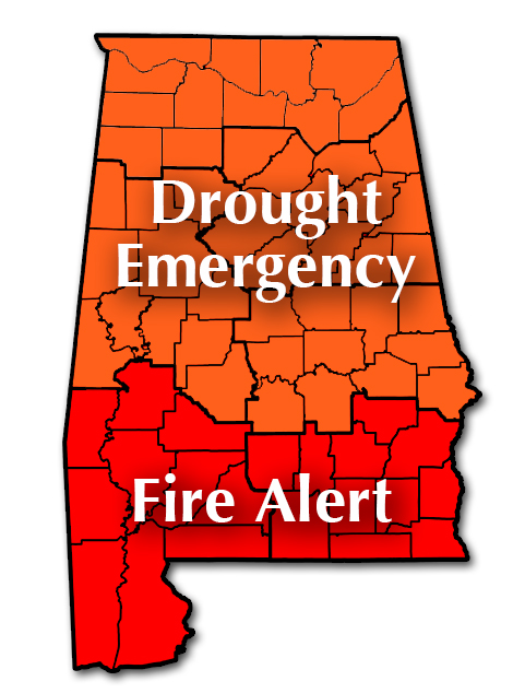
And drought conditions continue across all of Alabama. The State of Alabama continues the Drought Emergency for the northern two-thirds of the state which includes a No Burn Ban. A Fire Alert continues across the southern third of the state where burning is discouraged.
For beachgoers, gorgeous weather continues at the beach today and into the week ahead. You can expect mostly sunny days and fair nights with high temperatures in the lower 80s and low temperatures in the 60s. The water temperatures are still in the upper 70s along the Coast. See the complete Gulf Coast 7 Day Planner here.
SPC has a small marginal risk area centered primarily on eastern Idaho for Day 1 while Days 2 and 3 are free of any anticipated severe weather risk area. And the tropics remain quiet for both the Atlantic and Pacific basins.
The ridge is being beaten down by a trough moving through the eastern US. The trough is fairly weak, so other than a few clouds, we’re not really expecting to see much of an impact on our weather. nYou just can’t produce a shower when the moisture levels remain low.
Monday, Tuesday, and Wednesday will see the upper ridge migrate back over the eastern third of the country, so the heat will continue with highs mainly in the middle and upper 80s.
A trough coming across the North Central US on Wednesday will shear out across the eastern portion of the US Thursday and Friday. The shearing of this trough will begin the process of a pattern change as a trough becomes established over the eastern part of the US by Friday and Saturday. The upper flow becomes northwesterly for us, so this is expected to bring an end to the record warmth we’ve been experiencing and drop temperatures back pretty close to values that are much more seasonal with lows in the 40s and highs in the 70s. The northwesterly flow pattern will continue through next weekend and into voodoo country.
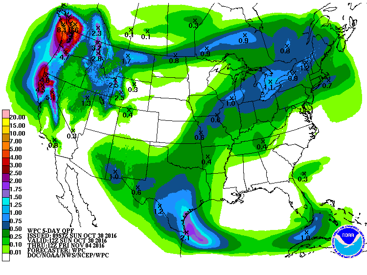
Voodoo country is interesting with the potential for a system that could bring some much needed rain to the Southeast US. The GFS maintains the troughiness across the eastern US through the 10th of November, and then develops an upper closed low along the Gulf Coast by the 13th. If this pattern develops as the GFS suggests, we could see a period of wet weather around the middle of November. But we all know how fickle the model output can be this far out. I’m cautiously optimistic for now.
I had a great time at the Alabama Wildlife Center at Oak Mountain State Park yesterday. I was surprised to get an invitation from the director there, Doug Adair, to assist with the release of one of their horned owls. It was such a thrilling experience to hold the owl who had been nursed back to good health and then to be able to release him back into the wild where he should be. That exhilarating experience will be with me for a long time to come. James Spann will be back with the next edition of the Weather Xtreme Video by 7 am on Monday. Enjoy your warm day and Godspeed.
-Brian-
Category: Alabama's Weather
About the Author (Author Profile)
Brian Peters is one of the television meteorologists at ABC3340 in Birmingham and a retired NWS Warning Coordination Meteorologist. He handles the weekend Weather Xtreme Videos and forecast discussion and is the Webmaster for the popular WeatherBrains podcast.Subscribe
If you enjoyed this article, subscribe to receive more just like it.


