Not as Warm But Still Dry
Drought conditions continue to worsen as shown in the U.S. Drought Monitor. Nearly all of the northern half of Alabama is now in an extreme drought classification, and today will mark the 48th day without measurable precipitation in Birmingham.
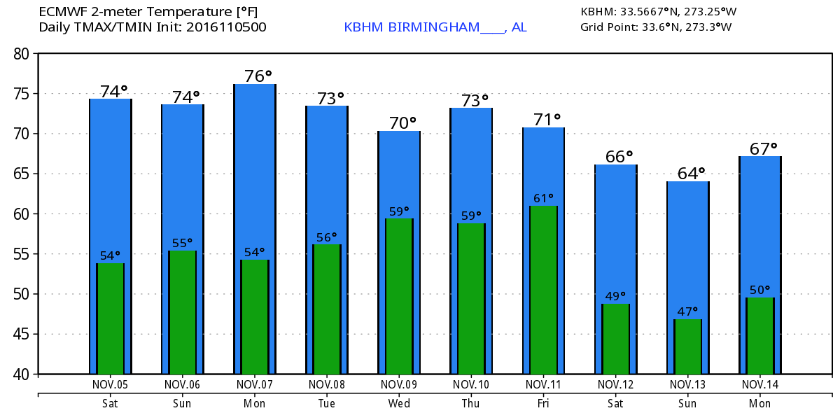
Alabama was waking up to clear skies but the satellite image indicated some high cirrus clouds west of us that will be pushing across the Alabama sky today. The upper air pattern is already transitioning out of the trough and into an upper ridge again, so we will continue to stay above average for our afternoon highs even though they are down a bit from the records earlier in the week. Looks for highs in the middle and upper 70s across Central Alabama today and Sunday with the morning lows Sunday morning dipping into the 40s.
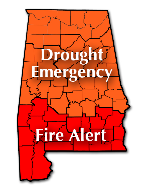
Remember, a Drought Emergency continued in effect for the northern two-thirds of Alabama with a ban on any outdoor burning. A Fire Alert remained in effect for the southern third of the state (see map below).
Some great weather is expected today for football games. Auburn will be hosting the Vanderbilt Commodores at Jordan-Hare at 11 am. Sunny skies throughout the game with temperatures around 70 at kickoff. Temperatures will drop to near 60 the final whistle. Alabama Crimson Tide visits the LSU Tigers in Baton Rouge. There will be some high clouds at kickoff at 7 pm with temperatures in the lower 70s. The temperatures will be falling into the 60s during the game.
For those headed to the beach, you’ll find sunny days and fair nights on the Gulf Coast through Monday with highs in the 70s. Rain chances along the beach will increase Monday and into the middle of the week. See a very detailed Gulf Coast forecast here.
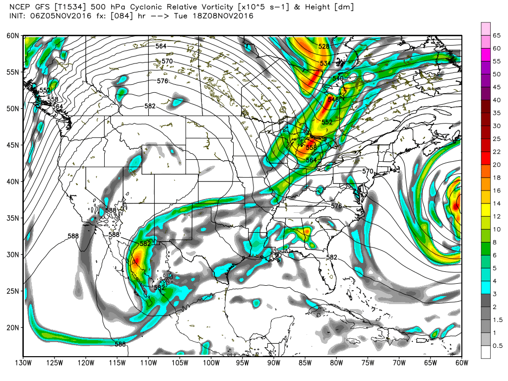
The upper air pattern will be sticking with a upper ridge for the next several days. A strong trough moving through the Great Lakes region on Tuesday will drag an upper trough through the Lower Mississippi River Valley and the Southeast US on Tuesday and Wednesday. While we would normally be looking for a decent chance at rain, it appears that rain chances for North and Central Alabama will be nearly nonexistent since moisture remains severely limited.
As the trough moves off late Wednesday and Thursday, we cool down once again as the upper flow goes northwesterly for a couple of days. A second reinforcing shot with another trough well to our north will keep the flow northwesterly into next weekend. So we should continue to see temperatures moderate somewhat with highs in the upper 60s by Thursday, Friday, and into Saturday. Morning lows are expected to be in the 40s.
The GFS projections for week 2 or voodoo country are not particularly encouraging. By Tuesday, the 15th of November, the GFS maintains the idea of the trough in the eastern US, but it also cuts off a big piece of it over the Southwest US. While this would usually be encouraging allowing us to tap into some Pacific moisture, the GFS takes that trough into the western Gulf of Mexico which would keep us dry. But it’s voodoo, so we’ll just see what tomorrow’s run foretells.
I’ll be heading out shortly in the ABC 3340 Storm Chaser for a visit to the Fall Festival in Sawyerville in Hale County. If you are in the area be sure to stop by and say hello. I’ll have the next Weather Xtreme Video posted here by 7:30 or so on Sunday morning. Remember, we set the clocks back an hour tonight as we go from daylight saving time to standard time. I always try to set mine back before I go to bed. Have a great day and Godspeed.
-Brian-
Category: Alabama's Weather
About the Author (Author Profile)
Brian Peters is one of the television meteorologists at ABC3340 in Birmingham and a retired NWS Warning Coordination Meteorologist. He handles the weekend Weather Xtreme Videos and forecast discussion and is the Webmaster for the popular WeatherBrains podcast.Subscribe
If you enjoyed this article, subscribe to receive more just like it.


