Unseasonable Warm Under Clear Skies at Midday
TODAY MAY BE THE END TO THE STREAK
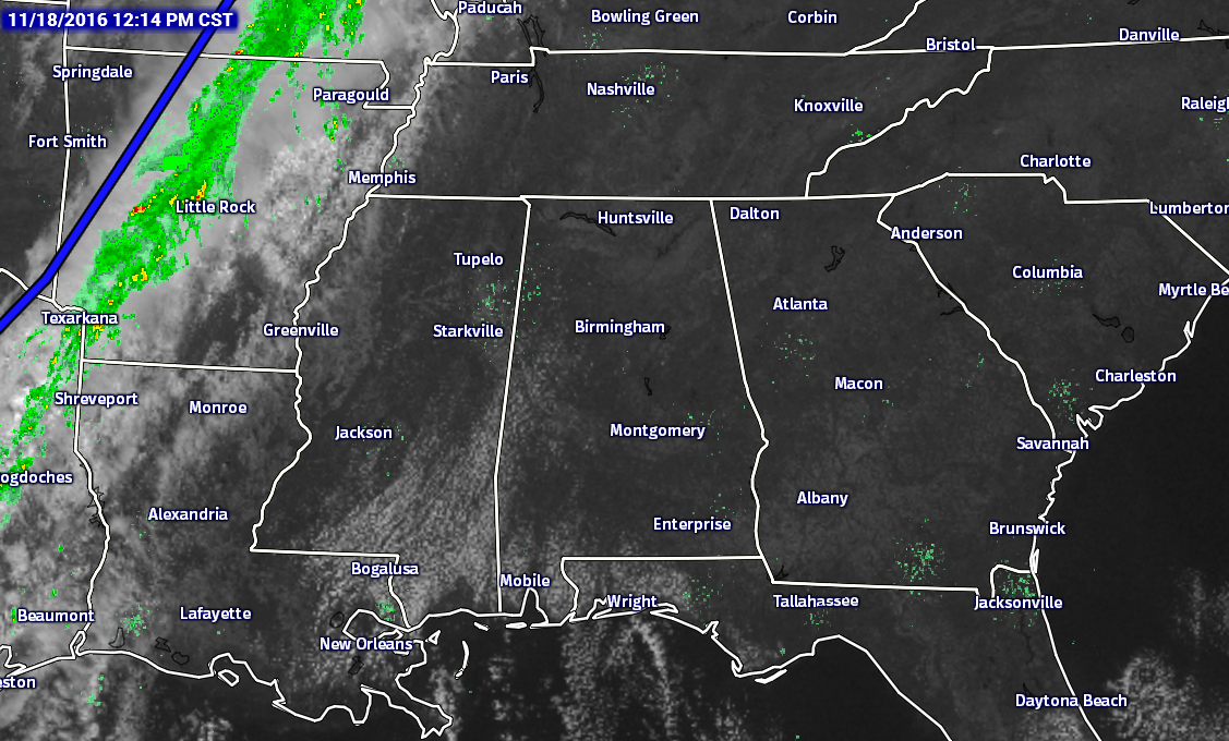
Could it possibly happen that day 61 will be the last day in the rain-free streak for the Birmingham area? The answer is “Could be.” At this moment in Central Alabama, skies are clear for the most part, with the exception for a few clouds over the extreme west and southwestern parts of the area.
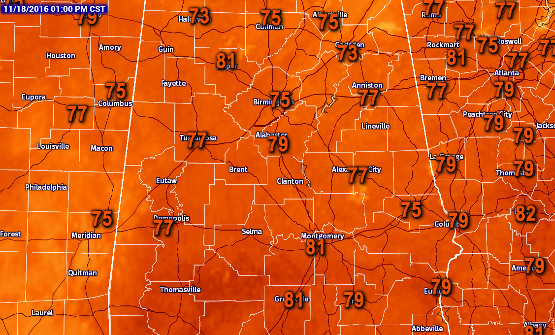
Here are the temperatures across the area at 1PM today.
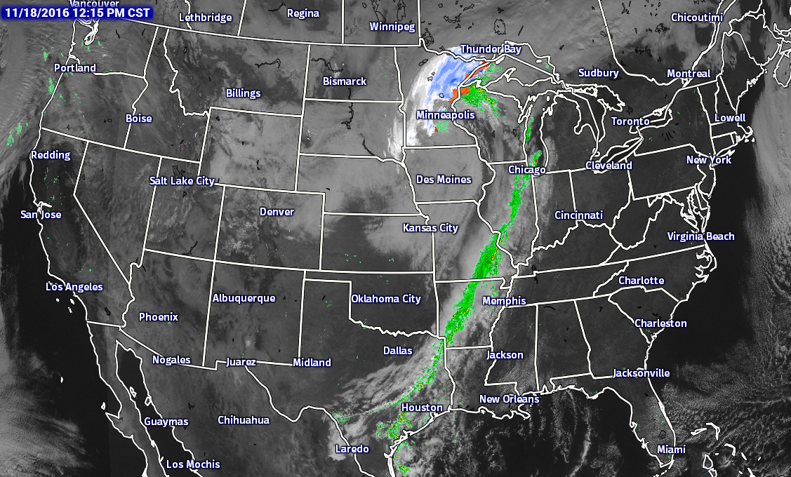
Looking at the Sat/Rad image for the nation, the cold front that will be bringing us our rain chances for the overnight period tonight is currently situated back in Central Missouri, Western Arkansas, and East-Central Texas. There is not that much moisture associated ahead of the front, so rainfall amounts are not that impressive.
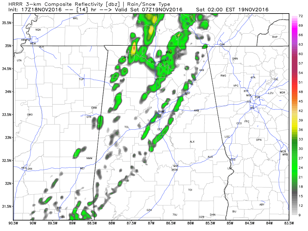
Looking at the latest run of the HRRR (17z run), this image is valid at 1AM. As you can see, this model run has the rain really starting to lessen and there really won’t be much out there.
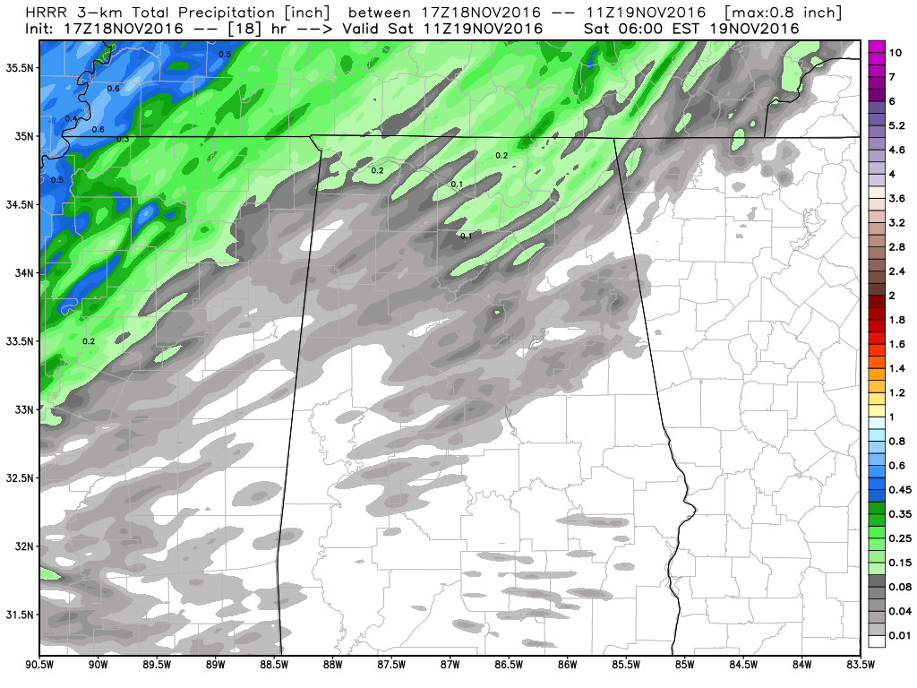
Latest estimates off of this run has much of the area north of I-20 only receiving 1/10th of an inch of rain or less, with locations south of that receiving even less to none at all. Amounts of over 1/10th of an inch will probably happen closer to the Alabama/Tennessee state line.
BIRMINGHAM’S CLIMATOLOGY AND RECORDS
The normal high for November 18th is 64, while the normal low is 41. The record high for today was set back in 1930 at 82. The record low was set back in 1959 at 20.
LATEST DATA FROM THE U.S. DROUGHT MONITOR
The latest data from the U.S. Drought Monitor for the state of Alabama now shows that over 65% of the state is now classified under “extreme” or “exceptional” drought conditions. That is an increase of over 13% from last week. A Drought Emergency continues in effect, banning any outdoor burning for all counties in the state. Click here for more information. Be sure to conserve water as well, as the Birmingham Water Works remains in a “Stage 4 Drought Emergency.”
THE REST OF YOUR FRIDAY
Mostly clear to sunny skies for the rest of your afternoon across Central Alabama. Temperatures will once again be unseasonably warm, with afternoon highs in the 77 to 82 degree range across the area. Birmingham should top out at 78 degrees. For this evening, clouds will start to increase from the northwest as the cold front starts to approach the state, and fill in as the front moves across during the overnight hours. Rain chances will be best for the north and northwestern parts (areas west of I-59 and I-20/59), and decrease sharply as you move east of there. Rainfall amounts should be less than 1/10th of an inch, if you receive any rain at all. Overnight lows will drop quickly after passage of the front, and range throughout the 40s west of I-59 and I-20/59, and the low to mid 50s east of that.
SATURDAY’S FORECAST
Once the front pushes through, skies will start to clear out quickly and should be mostly clear for the whole area by 10AM. It will be quite a brisk and breezy day out there, as winds will be averaging 10 to 15 MPH out of the northwest. Afternoon highs will only reach the mid 50s to the low 60s for much of Central Alabama, with temperatures being warmer in the extreme southeastern corner of the area due to the later passage of the front. Winds will be out of the north averaging around 10 MPH at 6PM tomorrow night, and skies will be clear for the start of both the Alabama and Auburn home games. Temperatures will start off at 50 at kickoff, and fall into the low 40s by the final whistle in Tuscaloosa. Pretty much the same story in Auburn, near 50 at kickoff, and falling into the mid 40s by the end of the game. Overnight lows for the area will drop off into 30s across the area, with the colder spots easily down in the 20s. I really wouldn’t be surprised if one or two of those spots make it down into the upper teens. We’ll see.
GULF COAST FORECAST
Sunny days, fair nights through the weekend from Gulf Shores to Panama City Beach. Highs in the 70s today, and in the 60s over the weekend. See a very detailed Gulf Coast forecast here.
UPDATE ON THE TROPICS
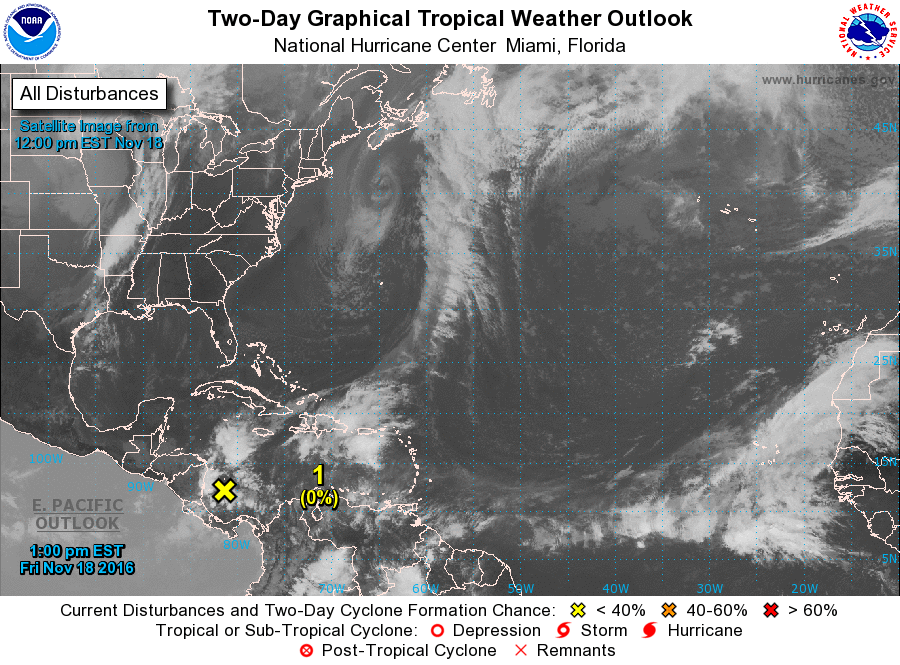
A broad low is located over the Southwestern Caribbean Sea has really become disorganized, and environmental conditions will not be conducive development during the next few days. Not much movement is to be expected, and it will not be a threat to the United States at all.
ON THIS DAY IN 1957
A tornado, 100 yards in width, travelled a nearly straight as an arrow 27-mile path from near Rosa AL to near Albertville AL, killing three persons. A home in the Susan Moore community in Blount County was picked up and dropped 500 feet away killing one person.
NUMBER OF THE DAY: -13
The coolest low temperature recorded in the United States for this morning was -13 degrees at West Yellowstone, Montana. The warmest high temperature recorded for yesterday was 90 degrees in Cotulla, Texas.
FOLLOW THE BLOG ON TWITTER
Be sure to follow the Alabama Wx Weather Blog on Twitter. Just click here to start following our feed.
WEATHERBRAINS
This is the weekly netcast that’s all about weather featuring many familiar voices, including our meteorologists at ABC 33/40. You can listen anytime on the web, or on iTunes. You can find it here.
Forecaster: Scott Martin (Twitter: @scottmartinwx)
Category: Alabama's Weather
About the Author (Author Profile)
Scott Martin is an operational meteorologist, professional graphic artist, musician, husband, and father. Not only is Scott a member of the National Weather Association, but he is also the Central Alabama Chapter of the NWA president. Scott is also the co-founder of Racecast Weather, which provides forecasts for many racing series across the USA. He also supplies forecasts for the BassMaster Elite Series events including the BassMaster Classic.Subscribe
If you enjoyed this article, subscribe to receive more just like it.


