Breezy, Colder and Still Dry
What a difference a day makes! The cold front has moved through much of Central Alabama this morning, and pretty much as expected the rain we saw to our west diminished as it moved into Alabama. Only the northern third of the state saw measurable rain, but the Birmingham-Shuttlesworth International Airport recorded a hundredth of an inch at 4:25 am, so the streak of days with no rain appears to have ended at 61! This breaks the record set back in 1924.
There were clouds across the eastern half of Alabama this morning just before daybreak, but those should move quickly out of the state as the front continued to move eastward. Temperatures ranged from near 40 on the Alabama-Mississippi line to near 60 on the Alabama-Georgia line. The highs today will be about 20 degrees colder than those on Friday as readings are expected to reach only the middle and upper 50s with a brisk northwest wind of 10 to 20 mph with occasional gusts to near 30 mph.
The tropics are quiet with one area of disturbed weather in the southwest Caribbean. That area may see some development in a couple of days as the conditions become more favorable for development. Movement of this system over the next several days will be slow and erratic. The Eastern North Pacific area was quiet with no areas of concern.
Severe weather will be at a minimum for the country over the next several days.
Heading to football game today? Alabama will be hosting Chattanooga at Bryant-Denny tonight at 6 pm. The sky will be clear and the wind will be out of the north around 10 mph. Temperatures will start off near 50 degrees at kickoff and drop into the mid 40s by the final whistle, so a jacket is probably a good idea. Auburn will be hosting Alabama A&M at Jordan-Hare at 6:30 pm. A clear sky is expected with temperatures starting off near 47 at kickoff and dropping to near 40 by the end of the game. The wind will be out of the north at 10 mph.
Heading to the beach? Sunny days and fair nights on the coast from Gulf Shores to Panama City Beach through Tuesday. Highs will be in the 60s for today and Sunday, rising back up into the 70s for Monday and Tuesday. See a very detailed Gulf Coast forecast here.
The drought conditions continue to be bad and the whole state of Alabama is under a drought emergency declaration which includes a ban on any outdoor burning.
The surface high will settled into the Middle Mississippi River Valley tonight and Sunday, so freezing temperatures are expected over the northern half of Alabama as seen in the map below. There is a freeze warning for tonight and Sunday morning with lows in the range of 28 to 32.
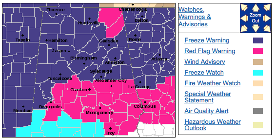
A freeze watch is also in effect for about the northern two-thirds of Alabama for Sunday evening into Monday morning. The surface high will be situated right over Alabama leading to excellent radiational cooling conditions. Those conditions and the cold northerly flow aloft will lead to morning lows across the watch area in the range of 24 to 30. This will be the first widespread freeze for our area for the Fall season.
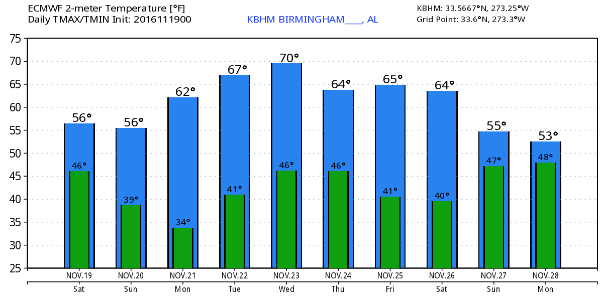
Temperatures will moderate by Tuesday as the upper ridge moves back into place across the eastern third of the country. But a stout trough moving out of the Rockies Tuesday will impact us with another shot at rain primarily on Wednesday. Just like the last couple of systems, the ridge is holding strong so the bulk of the dynamics will be to our north, so rainfall is not expected to be significant and not widespread. The trough and the frontal system producing the rain chances will zip by pretty quickly with the trough becoming re-established over the area by Friday and Saturday. So the cool down will be fairly short lived as highs dip back into the 60s for the Thursday and Friday, but warm back up toward 70 by Saturday.
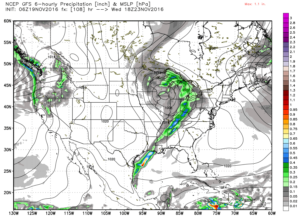
Looking further afield, the GFS keeps the pattern rather progressive with another strong trough around the 29th. But the GFS takes us back to a pattern with a strong upper ridge by the 4th of December.
I expect to have the next Weather Xtreme Video posted here by 7:30 or so on Sunday morning. You can catch the latest forecast this evening on ABC 3340 with the news at 6 and 10 pm as I fill in for Meaghan Thomas. Have a great day and Godspeed.
-Brian-
Category: Alabama's Weather
About the Author (Author Profile)
Brian Peters is one of the television meteorologists at ABC3340 in Birmingham and a retired NWS Warning Coordination Meteorologist. He handles the weekend Weather Xtreme Videos and forecast discussion and is the Webmaster for the popular WeatherBrains podcast.Subscribe
If you enjoyed this article, subscribe to receive more just like it.


