

An Earlier Than Midday Nowcast For Your Thanksgiving Day
A MIX OF SUN AND CLOUDS FOR THANKSGIVING
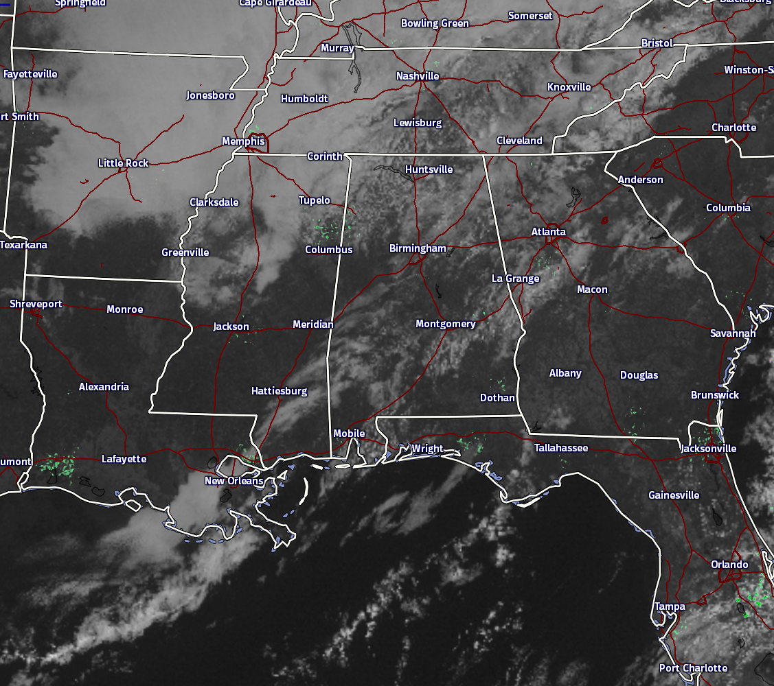
Happy Thanksgiving! Currently across Central Alabama, skies are partly cloudy for most, and no rain is showing up on radar at this moment. This should pretty much be the story for the rest of the day, as temperatures will be above normal under a partly cloudy to mostly clear skies.
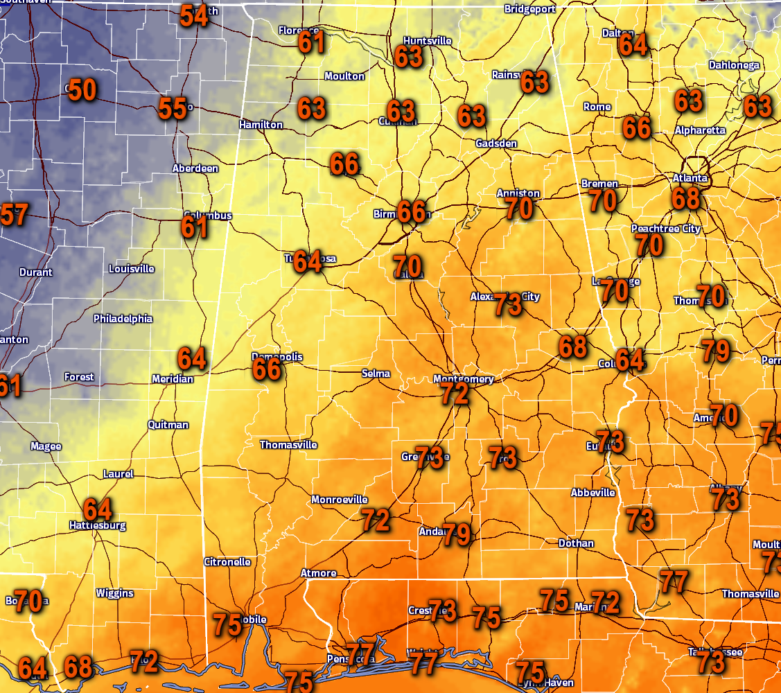
Temperatures at the 10 o’clock hour are in the 60s and 70s across the state. Warmer temperatures are located in the southeastern parts of the state, while cooler temperatures are found in the northwestern parts. The warm spots for Central Alabama are Alexander City, Eufaula, and Troy, all at 73 degrees. The cool spots in the area are Cullman and Haleyville at 63 degrees.
BIRMINGHAM’S CLIMATOLOGY AND RECORDS
The normal high for November 24th is 62, while the normal low is 41. The record high for today was set back in 1921 at 79. The record low was set back in 1970 at 13.
LATEST DATA FROM THE U.S. DROUGHT MONITOR
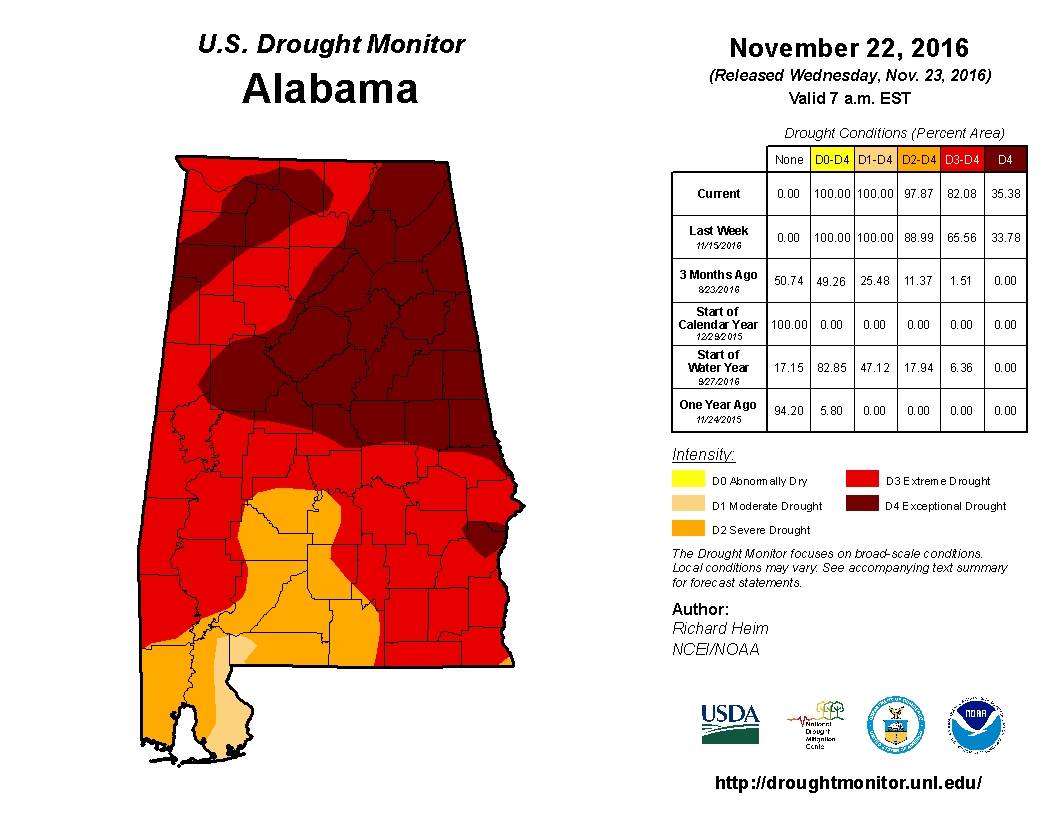
The latest data from the U.S. Drought Monitor for the state of Alabama now shows that over 97% of the state is now classified under “severe” drought conditions, with 82% of the state under “extreme” drought conditions, and over 35% of the state under “exceptional” drought conditions. A Drought Emergency continues in effect, banning any outdoor burning for all counties in the state. Click here for more information. Be sure to conserve water as well, as the Birmingham Water Works remains in a “Stage 4 Drought Emergency.”
FOR THE REST OF YOUR THANKSGIVING
A mix of sun and clouds in the skies across Central Alabama for the remainder of this afternoon and into the early evening hours. Afternoon highs will be in the 70s for most, with mid to upper 60s in the northwestern part of the area. Skies will remain partly cloudy tonight and during the overnight hours, with lows dropping into the 40s across the area. A few locations in the southeastern part of the area will stay in the 50s for lows.
WHAT TO EXPECT FOR “BLACK FRIDAY”
For the pre-dawn shoppers, skies will be partly cloudy and temperatures will mostly be in the 40s as you head out to the malls and super stores. Once the sun comes up, skies will become mostly clear by the late afternoon and temperatures will warm nicely into the upper 60s to the mid 70s across the area. Skies will continue to be mostly clear for the evening and overnight hours, with lows dropping into the 30s and 40s.
THE SHOWDOWN IN T-TOWN
The game that has separated friends, family, and marriages… The Iron Bowl. Kickoff is set for 2:30PM CST in Tuscaloosa, and I do not believe that the weather could be any better. Temperatures will be near 64 degrees with a northerly wind around 5 MPH at kickoff, and falling into the 52 to 55 degree range for the final whistle.
FOR THOSE WHO ARE BEACHBOUND
Mostly sunny days, fair nights on the Gulf Coast through the weekend with highs mostly in the 70s from Gulf Shores over to Panama City Beach. See a very detailed Gulf Coast forecast here.

UPDATE ON THE TROPICS
Our late season hurricane is moving into the Central America coast this morning near the border of Costa Rico and Nicaragua. It will emerge into the eastern Pacific tonight, and will keep its name unless it completely dissipates into a tropical disturbance (which is not forecasted to happen). The rest of the Atlantic Basin is quiet.
ON THIS DAY IN 1987
Showers and thunderstorms produced heavy rain in southern Missouri, southeast Kansas and northeastern Oklahoma. Flooding was reported in Greene County of southwestern Missouri. Springfield MO was drenched with more than six inches of rain. Thunderstorms over southern Texas produced more than eight inches of rain in Caldwell County and Hayes County, and thunderstorms over south central Oklahoma produced one inch hail at Temple twice within an hour.
NUMBER OF THE DAY: 88
The warmest high temperature that occurred in the United States for yesterday was recorded in Edinburg and McAllen, Texas, both at 88 degrees. The coolest low for the overnight period was recorded in Ely, Nevada, and in Mammoth Lakes, California, both at 6 degrees.
FOLLOW THE BLOG ON TWITTER
Be sure to follow the Alabama Wx Weather Blog on Twitter. Just click here to start following our feed.
WEATHERBRAINS
This is the weekly netcast that’s all about weather featuring many familiar voices, including our meteorologists at ABC 33/40. You can listen anytime on the web, or on iTunes. You can find it here.
Forecaster: Scott Martin (Twitter: @scottmartinwx)
Category: Alabama's Weather
About the Author (Author Profile)
Scott Martin is an operational meteorologist, professional graphic artist, musician, husband, and father. Not only is Scott a member of the National Weather Association, but he is also the Central Alabama Chapter of the NWA president. Scott is also the co-founder of Racecast Weather, which provides forecasts for many racing series across the USA. He also supplies forecasts for the BassMaster Elite Series events including the BassMaster Classic.Subscribe
If you enjoyed this article, subscribe to receive more just like it.


