Strong Storms Pushing Into Lamar and Marion Counties
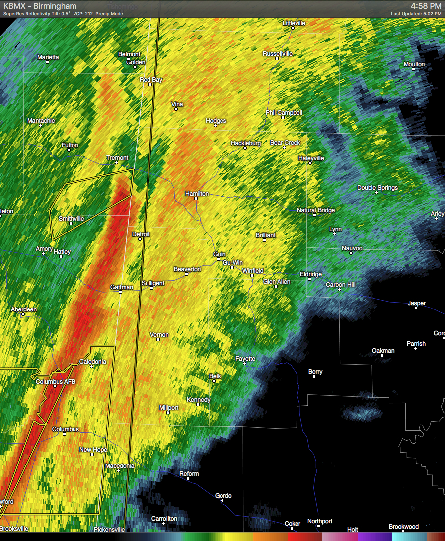
Strong thunderstorms are currently located near Fulton and stretching to 10 miles southeast of Amory. These storms are moving to the east at 45 MPH. Wind gusts of up to 55 MPH can be expected with these storms, and therefore the National Weather Service has issued a Significant Weather Advisory for Northern Lamar and Marion Counties until 5:45 PM CST. Torrential rainfall is also occurring with these storms, and may lead to localized flooding. Areas in the path are listed below:
HAMILTON, WINFIELD, HALEYVILLE, SULLIGENT, GUIN, HACKLEBURG, BRILLIANT, GLEN ALLEN, DETROIT, BEAVERTON, GU-WIN, CREWS, LAMAR COUNTY AIRPORT, BRINN, LAKE BUTTAHATCHEE, WESTON, BEAR CREEK, TWIN, PINEY GROVE AND TESSNER.
Category: Alabama's Weather, Severe Weather
About the Author (Author Profile)
Scott Martin is an operational meteorologist, professional graphic artist, musician, husband, and father. Not only is Scott a member of the National Weather Association, but he is also the Central Alabama Chapter of the NWA president. Scott is also the co-founder of Racecast Weather, which provides forecasts for many racing series across the USA. He also supplies forecasts for the BassMaster Elite Series events including the BassMaster Classic.Subscribe
If you enjoyed this article, subscribe to receive more just like it.


